Category:Clayton Brook
Jump to navigation
Jump to search
English: Clayton Brook is a large residential estate in Lancashire, between the city of Preston and the town of Chorley. It forms part of the Clayton-le-Woods civil parish, and is in the Clayton-le-Woods North ward of the borough of Chorley. Lying next to the industrial estate of Walton Summit, one-time terminus of a branch of the Lancaster Canal, it also neighbours Clayton-le-Woods, Clayton Green, Hoghton and Brindle, and is not far from the small town of Bamber Bridge. Clayton Brook Village as it is often termed, is bounded by the A6 road and the M61 and M65 motorways, and is conveniently near the M6 motorway.
Assets Based approach Breeding ground..
village in United Kingdom  | |||||
| Upload media | |||||
| Instance of | |||||
|---|---|---|---|---|---|
| Location | Clayton-le-Woods, Chorley, Lancashire, North West England, England | ||||
 | |||||
Media in category "Clayton Brook"
The following 12 files are in this category, out of 12 total.
-
 Clayton Brook Bus Stop.jpg 500 × 323; 72 KB
-
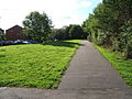
 Clayton Brook New Village Green.jpg 3,640 × 2,736; 1.55 MB
-
 Clayton Brook village green - geograph.org.uk - 225075.jpg 640 × 480; 116 KB
-
 Community BBQ & Disco 30th June 2013.JPG 3,072 × 1,728; 1.45 MB
-
 Footbridge and subway, Clayton Brook - geograph.org.uk - 1222455.jpg 640 × 480; 213 KB
-
 Gough lane - geograph.org.uk - 225079.jpg 640 × 480; 125 KB
-
 Hawksclough - geograph.org.uk - 76371.jpg 640 × 480; 265 KB
-
 Lancaster Canal, Clayton Brook - geograph.org.uk - 1222441.jpg 640 × 480; 207 KB
-

-
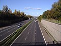 Motorway - geograph.org.uk - 273896.jpg 640 × 480; 76 KB
-
 Reedfield Place, Walton Summit - geograph.org.uk - 1805255.jpg 640 × 480; 153 KB
-
 Walton summit remains.jpg 640 × 480; 120 KB


