Category:Coal mines in Falkirk council area
Jump to navigation
Jump to search

Media in category "Coal mines in Falkirk council area"
The following 14 files are in this category, out of 14 total.
-
 Bankrigg opencast. - geograph.org.uk - 85237.jpg 640 × 460; 60 KB
-
 Bing, Candie. - geograph.org.uk - 85209.jpg 638 × 460; 84 KB
-
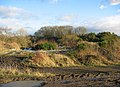
 Coal mining evidence near Linlithgow - geograph.org.uk - 1092372.jpg 640 × 480; 75 KB
-
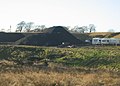
 Colliery waste, near Hill. - geograph.org.uk - 85205.jpg 640 × 480; 75 KB
-
 Darnrig Opencast Works - geograph.org.uk - 403199.jpg 640 × 480; 101 KB
-
 Derelict Weighbridge - geograph.org.uk - 416237.jpg 640 × 480; 94 KB
-
 Former open cast coal mine - geograph.org.uk - 1330253.jpg 640 × 480; 106 KB
-
 Former Opencast Coal Mine - geograph.org.uk - 147313.jpg 640 × 480; 158 KB
-
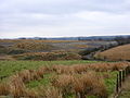
 Former opencast workings - geograph.org.uk - 179893.jpg 640 × 480; 121 KB
-
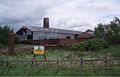 Old colliery buildings. - geograph.org.uk - 189608.jpg 640 × 413; 60 KB
-
 Open cast coal mine site - geograph.org.uk - 1534870.jpg 640 × 480; 114 KB
-

-
 Redding Colliery Memorial - geograph.org.uk - 1233344.jpg 480 × 640; 114 KB
-
 Replanted opencast workings - geograph.org.uk - 184193.jpg 640 × 480; 115 KB


