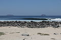
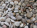
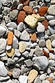
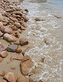
Category:Cobble beaches
Jump to navigation
Jump to search
Deutsch: Kieselsteinküste, auch Geröllküste, Schotterküste
English: Cobble beaches
English: Spiagge di ciottoli
especially in Europe, a beach composed of pebbles and cobbles  | |||||
| Upload media | |||||
| Subclass of | |||||
|---|---|---|---|---|---|
| Made from material |
| ||||
| |||||
Media in category "Cobble beaches"
The following 141 files are in this category, out of 141 total.
-
 Arena en Bahia de Plata.JPG 1,600 × 1,200; 2.37 MB
-
 Avala 3.JPG 2,592 × 1,944; 2.52 MB
-
 Camp celtique de la Bure - galets.jpg 3,456 × 2,304; 5.9 MB
-
 Cobble beach in New South Wales.jpg 2,236 × 1,677; 1.81 MB
-
 Cobbles Nash Point.jpg 3,872 × 2,592; 6.93 MB
-
 Driftwood(byPJrvs).jpg 2,500 × 1,667; 1.79 MB
-
 Driftwood.jpg 2,384 × 1,731; 657 KB
-
 Encourtiech - Passerelle sur le Salat à La Borye - 20110118 (3).jpg 4,000 × 3,000; 4.63 MB
-
 Eryngium maritimum, Vic-la-Gardiole 01.jpg 4,016 × 4,697; 11.66 MB
-
 Fehmarn Strand Steine.JPG 2,560 × 1,704; 932 KB
-
 Feuerstein Geröll.jpg 800 × 600; 473 KB
-
 Findling und Geröll.jpg 2,576 × 1,932; 1.53 MB
-
 Flyitchet, Saint Martîn, Jèrri 4.jpg 1,138 × 1,340; 1.11 MB
-
 Flyitchet, Saint Martîn, Jèrri 5.jpg 1,573 × 1,113; 1.43 MB
-
 Galets.jpg 2,272 × 1,704; 1.1 MB
-
 Golfo de Patras 11.jpg 4,288 × 2,848; 9.88 MB
-
 Hope river cobbles.jpg 2,048 × 1,536; 793 KB
-
 Intertidal shingle flats - geograph.org.uk - 227190.jpg 640 × 480; 83 KB
-
 Isla Seymour Norte-IMG 0584.JPG 5,055 × 3,370; 15.25 MB
-
 Isla Seymour Norte-IMG 0595.JPG 5,079 × 3,386; 14.62 MB
-
 Islandia, Austurland (1981) 21.jpg 1,036 × 678; 935 KB
-
 Iso-Pässilän pirunpelto.jpg 5,184 × 3,888; 10.13 MB
-
 KJAERSGAARDSTRAND 2012 (ubt)-002.JPG 4,272 × 2,848; 8.63 MB
-
 Lake Constance Low water 01.jpg 2,560 × 1,920; 2.37 MB
-
 Lakeshore stones.jpg 3,264 × 2,448; 2.63 MB
-
 Le Havre (France), bonhomme de neige face à la mer.JPG 4,288 × 2,848; 2.98 MB
-
 Le Havre vue de la plage.JPG 2,000 × 1,500; 2.03 MB
-
 Les Dithouïl'yes du Bouôlay Jèrri b.jpg 1,219 × 1,136; 927 KB
-
 Lopud 13.jpg 1,360 × 2,048; 1.47 MB
-
 Lyme Regis beach 04.JPG 2,592 × 1,944; 1.63 MB
-
 Lyme Regis harbour 11.JPG 2,592 × 1,944; 1.63 MB
-
 Lé Bieau Port, Jèrri 3.jpg 1,350 × 1,120; 1.46 MB
-
 Lé Bieau Port, Jèrri 4.jpg 1,303 × 1,090; 1.43 MB
-
 Lé Bieau Port, Jèrri 5.jpg 1,526 × 1,182; 1.73 MB
-
 Lé Bieau Port, Jèrri 6.jpg 1,061 × 1,166; 1.32 MB
-
 Lé Bieau Port, Jèrri 7.jpg 1,048 × 1,402; 1.6 MB
-
 Lé Bieau Port, Jèrri 8.jpg 1,149 × 1,503; 1.75 MB
-
 Lé Bieau Port, Jèrri 9.jpg 1,068 × 1,426; 1.71 MB
-
 Lé Hâvre Giffard Jèrri Mai 2009.jpg 1,600 × 1,200; 1.55 MB
-
 Lé Hâvre Giffard La Trinneté Jèrri.jpg 1,584 × 1,046; 1.62 MB
-
 Matthiola sinuata, Vic-la-Gardiole 01.jpg 5,923 × 3,954; 16.79 MB
-
 MERS (3).JPG 1,600 × 1,200; 581 KB
-
 Mersmaréehaute.JPG 2,048 × 1,536; 2.23 MB
-
 My personal windows wallpaper (2059825351).jpg 1,900 × 1,272; 2.8 MB
-
 Nizhne-Imeretinskaya Bukhta.jpg 4,272 × 2,359; 4.72 MB
-
 Normandie -Beach of Le Havre- 2001 by-RaBoe 01.jpg 800 × 640; 451 KB
-
 Normandie -Beach of Le Havre- 2001 by-RaBoe 02.jpg 800 × 497; 385 KB
-
 Nostalgy (11620819306).jpg 3,840 × 2,396; 4.15 MB
-
 NYK Oceanus ship, Le Havre.jpg 4,288 × 2,848; 4.42 MB
-
 Oregon coast trail north cape falcon P2529.jpeg 2,767 × 2,083; 1.58 MB
-
 Pebble Beach (70510361).jpeg 1,920 × 1,080; 746 KB
-
 PebbleBeach-DoF(byKundanRamisetti).jpg 2,448 × 2,448; 2.28 MB
-
 Pirunpelto Arppe Memorial Forest.jpg 3,648 × 2,736; 4.06 MB
-
 Plage du Tilleul, 2012.JPG 4,288 × 2,848; 6.56 MB
-
 Pollen washing ashore at Mica Bay 1.JPG 3,264 × 2,448; 3.76 MB
-
 Pollen washing ashore at Mica Bay 2.JPG 2,448 × 3,264; 2.56 MB
-
 Rainbow In The Waves.jpg 4,783 × 3,156; 7.22 MB
-
 Rocky beach, Gruinard Bay - geograph.org.uk - 210888.jpg 640 × 480; 230 KB
-
 Rust on the beach.jpg 3,872 × 2,592; 6.05 MB
-
 Sainte-Adresse (France), closed beach huts.JPG 4,288 × 2,848; 6.34 MB
-
 Santa Cruz - Madeira, 2012-10-24 (11).jpg 1,280 × 960; 263 KB
-
 Santorini 95.jpg 4,288 × 2,848; 11.29 MB
-
 Santorini 96.jpg 3,068 × 2,064; 6 MB
-
 Shingle and shell beach - geograph.org.uk - 77290.jpg 640 × 480; 164 KB
-
 Shingle bank - geograph.org.uk - 73215.jpg 640 × 427; 136 KB
-
 Shingle Bank nr. Norton Priory. - geograph.org.uk - 58560.jpg 640 × 480; 149 KB
-
 Shingle Beach - geograph.org.uk - 126654.jpg 640 × 479; 109 KB
-
 Shingle beach - geograph.org.uk - 1280309.jpg 640 × 457; 338 KB
-
 Shingle Beach - geograph.org.uk - 544594.jpg 640 × 427; 94 KB
-
 Shingle beach - geograph.org.uk - 55057.jpg 640 × 480; 107 KB
-
 Shingle beach - geograph.org.uk - 626679.jpg 640 × 480; 75 KB
-
 Shingle Beach - geograph.org.uk - 850296.jpg 438 × 640; 294 KB
-
 Shingle Beach and Groyne at Worthing.JPG 2,592 × 1,944; 1.41 MB
-
 Shingle beach and sandbanks - geograph.org.uk - 255175.jpg 640 × 480; 82 KB
-
 Shingle beach at Aberlleiniog - geograph.org.uk - 435070.jpg 640 × 480; 57 KB
-
 Shingle beach at Allonby - geograph.org.uk - 572573.jpg 640 × 480; 220 KB
-
 Shingle beach at Bawdsey, Suffolk. - geograph.org.uk - 163586.jpg 640 × 480; 84 KB
-

-
 Shingle beach at Mawbray - geograph.org.uk - 572462.jpg 640 × 480; 168 KB
-
 Shingle beach at Porth y Nant - geograph.org.uk - 468193.jpg 640 × 480; 138 KB
-
 Shingle Beach at Southsea. - geograph.org.uk - 178182.jpg 640 × 429; 131 KB
-
 Shingle Beach East of Dwyfor River Mouth - geograph.org.uk - 463071.jpg 640 × 480; 143 KB
-
 Shingle beach north of Dunwich - geograph.org.uk - 192544.jpg 640 × 474; 443 KB
-

-
 Shingle Beach West of Criccieth - geograph.org.uk - 463065.jpg 640 × 480; 147 KB
-
 Shingle Beach, Sandwick - geograph.org.uk - 206253.jpg 640 × 480; 71 KB
-
 Shingle Beach, Skateraw - geograph.org.uk - 170809.jpg 640 × 480; 105 KB
-
 Shingle ridges at Orford Ness - geograph.org.uk - 62114.jpg 640 × 480; 124 KB
-
 Slate formation at Mica Bay 1.JPG 3,264 × 2,448; 3.77 MB
-
 Slate formation at Mica Bay 2.JPG 3,264 × 2,448; 3.81 MB
-
 Slate formation at Mica Bay 3.JPG 3,264 × 2,448; 3.32 MB
-
 Slate formation at Mica Bay 4.JPG 3,264 × 2,448; 3.54 MB
-
 Slate formation at Mica Bay 5.JPG 3,264 × 2,448; 3.83 MB
-
 Slate formation at Mica Bay 6.JPG 3,264 × 2,448; 3.74 MB
-
 Steep shingle beach - geograph.org.uk - 42327.jpg 640 × 480; 226 KB
-
 Stone IMAG1020.JPG 640 × 480; 117 KB
-
 Stone IMAG1028.JPG 640 × 480; 74 KB
-
 Stone IMAG1030.JPG 640 × 480; 95 KB
-
 Stone IMAG1031.JPG 640 × 480; 90 KB
-
 Stone IMAG1032.JPG 640 × 480; 111 KB
-
 Storm Beach on Shapinsay.jpg 640 × 411; 121 KB
-
 Superior waves 4.JPG 2,560 × 1,920; 818 KB
-
 Talustre Ouaisné Saint Brélade Jèrri.jpg 951 × 1,323; 990 KB
-
 Tamarix gallica, Vic-la-Gardiole 01.jpg 5,994 × 3,746; 20.41 MB
-
 Texel - De Hors - View NE on De Mok.jpg 5,946 × 3,964; 21.17 MB
-
 Texel - De Hors - View NNE on De Mok.jpg 5,932 × 3,954; 20.48 MB
-
 The beach in Storviken in Trysunda (7741822268).jpg 3,648 × 2,736; 3.27 MB
-

-
 The shingle beach, St Leonards on sea - geograph.org.uk - 138798.jpg 480 × 640; 104 KB
-
 Torrisdalebay.jpg 640 × 483; 183 KB
-
 Trunk aground, Vic-la-Gardiole 02.jpg 5,926 × 3,956; 22.47 MB
-
 Trunk aground, Vic-la-Gardiole.jpg 6,001 × 3,751; 17.15 MB
-
 Water&Shingle.jpg 2,048 × 1,536; 2.46 MB
-
 Westcoasttrail.jpg 588 × 405; 88 KB
-
 Wet pebbles.JPG 3,072 × 2,304; 4.38 MB
-
 Atherington Beach - geograph.org.uk - 13306.jpg 640 × 480; 87 KB
-
 Balmeanach Beach - geograph.org.uk - 124071.jpg 640 × 480; 139 KB
-
 Barton on Sea, Hampshire - geograph.org.uk - 109245.jpg 640 × 481; 135 KB
-
 Beach - geograph.org.uk - 147899.jpg 640 × 480; 94 KB
-

-
 Bunlough Strand - geograph.org.uk - 237445.jpg 640 × 480; 98 KB
-
 Calshot Beach - geograph.org.uk - 20995.jpg 640 × 481; 100 KB
-
 East Preston Dinghy Club - geograph.org.uk - 12076.jpg 640 × 480; 114 KB
-
 Flint shingle on Kingsdown beach - geograph.org.uk - 236772.jpg 640 × 480; 75 KB
-
 Harbour Heights - geograph.org.uk - 23944.jpg 640 × 480; 98 KB
-
 Hayling Island Beach (west) - geograph.org.uk - 206606.jpg 640 × 480; 97 KB
-
 Hayling Island, Eastoke Beach - geograph.org.uk - 148165.jpg 640 × 480; 104 KB
-
 Limpert Bay - geograph.org.uk - 89687.jpg 640 × 480; 122 KB
-
 Milldown Point and Beach, Coldingham - geograph.org.uk - 191515.jpg 640 × 480; 102 KB
-
 Nanny Point Scar, Walney Island - geograph.org.uk - 224074.jpg 640 × 480; 179 KB
-
 Out to Sea From Dubmill Scar - geograph.org.uk - 102765.jpg 640 × 480; 103 KB
-
 Pebbles - geograph.org.uk - 144083.jpg 640 × 594; 127 KB
-
 Shingle Bank - geograph.org.uk - 151407.jpg 640 × 480; 75 KB
-

-
 Spey Bay - geograph.org.uk - 73220.jpg 640 × 427; 132 KB
-
 Spey Bay - geograph.org.uk - 73239.jpg 640 × 427; 118 KB
-
 The stony shore line - geograph.org.uk - 98361.jpg 640 × 405; 90 KB
-
 Île de Ré 2011 (2).jpg 2,048 × 1,536; 354 KB
-
 Дрібна галька.JPG 3,984 × 2,656; 2.55 MB
-
 Каменный пляж (52258806588).jpg 1,600 × 1,063; 1.19 MB
-
 Кемпинг - panoramio (3).jpg 5,616 × 3,744; 9.89 MB


.jpg)

.jpg)


_21.jpg)

-002.JPG)


,_bonhomme_de_neige_face_%C3%A0_la_mer.JPG)


.JPG)

.jpg)


.jpg)


.jpeg)
.jpg)


,_closed_beach_huts.JPG)
.jpg)


.jpg)


_-_geograph.org.uk_-_206606.jpg)


.jpg)

.jpg)
.jpg)