Category:Cobham, Kent
Jump to navigation
Jump to search
English: Cobham is a village and civil parish in the Gravesham District of Kent, England. It is located south of Watling Street, the old road from Dover to London, six miles south-east of Gravesend. The hamlet of Sole Street lies within the parish, which covers an area of 1,240 ha and has a population of 1,328. (2001 census).
Nederlands: Cobham is een plaats en civil parish in het bestuurlijke gebied Gravesham, in het Engelse graafschap Kent. De plaats telt 1328 (2001) inwoners.
village in Kent, England, UK  | |||||
| Upload media | |||||
| Instance of | |||||
|---|---|---|---|---|---|
| Location | Gravesham, Kent, South East England, England | ||||
| Said to be the same as | Cobham (Wikimedia duplicated page, civil parish) | ||||
 | |||||
Subcategories
This category has the following 10 subcategories, out of 10 total.
C
- Cobham College (6 F)
- Cobham War Memorial, Kent (1 F)
H
L
O
- Oasts in Cobham, Kent (14 F)
- Owletts (3 F)
S
- Ship Inn, Cobham, Kent (8 F)
- St Mary's Room, Sole Street (3 F)
Media in category "Cobham, Kent"
The following 200 files are in this category, out of 622 total.
(previous page) (next page)-
 43, The Street - geograph.org.uk - 3508783.jpg 640 × 430; 50 KB
-
 A bend in the road - geograph.org.uk - 2476506.jpg 4,000 × 3,000; 4.49 MB
-

-
 A horse and hay - geograph.org.uk - 2362500.jpg 640 × 480; 111 KB
-
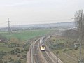
 A Javelin approaches Ashenbank Wood - geograph.org.uk - 2868705.jpg 4,000 × 3,000; 4.09 MB
-
 A Javelin near Ashenbank Wood - geograph.org.uk - 1844243.jpg 2,560 × 1,920; 2.02 MB
-
 A Javelin passes Ashenbank Wood - geograph.org.uk - 1874083.jpg 2,560 × 1,920; 2.34 MB
-
 A Jeskin's Gate - geograph.org.uk - 4598311.jpg 640 × 424; 79 KB
-
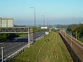
 A2 (dual carriageway) to Medway - geograph.org.uk - 3164548.jpg 4,288 × 3,216; 3.63 MB
-
 A2 (dual-carriageway) to London - geograph.org.uk - 3164542.jpg 4,288 × 3,216; 3.72 MB
-
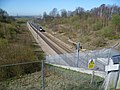
 A2 crossing M2 - geograph.org.uk - 5969765.jpg 1,024 × 576; 83 KB
-
 A2 Watling Street, near Cobham - geograph.org.uk - 3631071.jpg 640 × 480; 207 KB
-
 Apple orchard, Cobham - geograph.org.uk - 2362534.jpg 640 × 480; 170 KB
-
 Approach road to Ifield Court - geograph.org.uk - 2476519.jpg 4,000 × 3,000; 4.21 MB
-
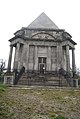
 Approach to the Darnley Mausoleum in Cobham Park - geograph.org.uk - 3869407.jpg 4,000 × 3,000; 4.11 MB
-
 Approach to the Darnley Mausoleum in Cobham Park - geograph.org.uk - 3869412.jpg 4,000 × 3,000; 4.28 MB
-
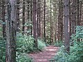
 Ashenbank Wood - geograph.org.uk - 2523047.jpg 640 × 480; 212 KB
-
 Ashenbank Wood - geograph.org.uk - 2523257.jpg 640 × 480; 209 KB
-
 Ashenbank Wood - geograph.org.uk - 2605208.jpg 4,000 × 3,000; 4.14 MB
-
 Ashenbank Wood - geograph.org.uk - 2605260.jpg 4,000 × 3,000; 4.07 MB
-
 Ashenbank Wood - geograph.org.uk - 3498259.jpg 640 × 430; 129 KB
-
 Ashenbank Wood - geograph.org.uk - 3498270.jpg 640 × 430; 144 KB
-
 Ashenbank Wood - geograph.org.uk - 3498271.jpg 640 × 430; 115 KB
-
 Ashenbank Wood - geograph.org.uk - 3498284.jpg 640 × 430; 124 KB
-
 Ashenbank Wood - geograph.org.uk - 3498313.jpg 640 × 430; 138 KB
-
 Ashenbank Wood - geograph.org.uk - 3498316.jpg 640 × 430; 139 KB
-
 Ashenbank Wood - geograph.org.uk - 3498318.jpg 640 × 430; 139 KB
-
 Ashenbank Wood - geograph.org.uk - 3498319.jpg 640 × 430; 131 KB
-
 Ashenbank Wood - geograph.org.uk - 3498322.jpg 640 × 430; 135 KB
-
 Ashenbank Wood - geograph.org.uk - 4598301.jpg 424 × 640; 97 KB
-
 Barn, Lodge Farm - geograph.org.uk - 3517180.jpg 640 × 430; 65 KB
-
 Barns, Lodge Farm - geograph.org.uk - 3517177.jpg 640 × 430; 68 KB
-
 Barnside, Lodge Lane - geograph.org.uk - 3517170.jpg 640 × 430; 96 KB
-
 Batt's Road Bridge over Railway - geograph.org.uk - 1118187.jpg 481 × 640; 90 KB
-
 Battle Street, Cobham - geograph.org.uk - 5079648.jpg 3,264 × 2,448; 1.98 MB
-
 Batts Road looking towards Cobhambury Hill - geograph.org.uk - 2605293.jpg 4,000 × 3,000; 4.13 MB
-
 Batts Road near Cobhambury Wood - geograph.org.uk - 2605287.jpg 4,000 × 3,000; 3.94 MB
-
 Batts Road, Cobham - geograph.org.uk - 2362566.jpg 4,000 × 3,000; 2.93 MB
-
 Black Horse Cottage - geograph.org.uk - 1227550.jpg 640 × 480; 108 KB
-
 Blossom either side of the path - geograph.org.uk - 3541069.jpg 640 × 430; 96 KB
-
 Blossom, Jeskyn Country Park - geograph.org.uk - 3498344.jpg 640 × 430; 98 KB
-
 Blossom, Scotland Lane - geograph.org.uk - 3498350.jpg 430 × 640; 88 KB
-
 Bluebells at Ashenbank Wood - panoramio.jpg 4,288 × 2,848; 9.31 MB
-
 Brewers Road crossing the A2 - geograph.org.uk - 5176857.jpg 2,304 × 1,728; 969 KB
-
 Bridge across HS1 - geograph.org.uk - 3534738.jpg 640 × 430; 61 KB
-
 Bridge on the HS1 - geograph.org.uk - 3541087.jpg 430 × 640; 81 KB
-
 Bridleway entrance to Jeskyns - geograph.org.uk - 1112228.jpg 640 × 481; 49 KB
-
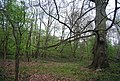
 Broad Oak Wood - geograph.org.uk - 3525640.jpg 640 × 430; 135 KB
-
 Broad Oak Wood - geograph.org.uk - 3525642.jpg 640 × 430; 88 KB
-
 Broad Oak Wood - geograph.org.uk - 3525803.jpg 640 × 430; 133 KB
-
 Broad Oak Wood - geograph.org.uk - 3525813.jpg 640 × 430; 81 KB
-
 Broad Oak Wood - geograph.org.uk - 3525819.jpg 640 × 430; 130 KB
-
 Broad Oak Wood - geograph.org.uk - 3525822.jpg 640 × 430; 136 KB
-
 Bronze Age Barrow, Ashenbank Wood - geograph.org.uk - 3498306.jpg 640 × 430; 100 KB
-
 Bronze Age Barrow, Ashenbank Wood - geograph.org.uk - 3498310.jpg 640 × 430; 84 KB
-
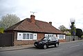
 Bungalow on The Street, Cobham - geograph.org.uk - 4652544.jpg 2,304 × 1,728; 859 KB
-
 Bungalow, The Street - geograph.org.uk - 3508846.jpg 640 × 430; 63 KB
-
 Bunny on the bridge - geograph.org.uk - 3164501.jpg 4,288 × 3,216; 5.45 MB
-
 Byway leading to Lodge farm, near Cobham - geograph.org.uk - 1961387.jpg 3,488 × 2,616; 2.13 MB
-
 Byway through Jeskins - geograph.org.uk - 4598316.jpg 424 × 640; 71 KB
-
 Byway to Cobhan - geograph.org.uk - 4598319.jpg 424 × 640; 59 KB
-
 Byway ^ Owletts Cottage - geograph.org.uk - 4598334.jpg 640 × 424; 85 KB
-
 Byway, Ashenbank Wood - geograph.org.uk - 3498323.jpg 640 × 430; 127 KB
-
 Car park, Ashenbank Wood - geograph.org.uk - 3541115.jpg 640 × 430; 119 KB
-
 Cattle grid, Cobham Park - geograph.org.uk - 2362361.jpg 640 × 480; 166 KB
-
 Channel Tunnel Rail Link from Henhurst Road - geograph.org.uk - 2604882.jpg 4,000 × 3,000; 4.2 MB
-
 Channel Tunnel Rail Link Maintenance Works - geograph.org.uk - 2604896.jpg 4,000 × 3,000; 4.04 MB
-
 Cherry Sculpture in Jeskyns - geograph.org.uk - 1227579.jpg 640 × 480; 65 KB
-
 Church path to St Mary Magdalene, Cobham - geograph.org.uk - 2558391.jpg 4,000 × 3,000; 4.07 MB
-
 Church Road - geograph.org.uk - 2871165.jpg 640 × 427; 80 KB
-
 Church Road footbridge over the A2 - geograph.org.uk - 3164496.jpg 4,288 × 3,216; 4.97 MB
-

-
 Church Road, Ifield - geograph.org.uk - 5079694.jpg 3,264 × 2,448; 1.7 MB
-
 Church Road, Ifield - geograph.org.uk - 5079698.jpg 3,264 × 2,448; 1.76 MB
-
 Church Road, Ifield - geograph.org.uk - 5079700.jpg 3,264 × 2,448; 2.02 MB
-
 Church Road, Ifield - geograph.org.uk - 6239940.jpg 1,024 × 685; 225 KB
-
 Church Road, Ifield - geograph.org.uk - 6239947.jpg 1,024 × 685; 251 KB
-
 Church Road, Ifield - geograph.org.uk - 6240204.jpg 1,024 × 685; 292 KB
-
 Church Road, Ifield - geograph.org.uk - 6240209.jpg 1,024 × 685; 421 KB
-
 Cleared woodland - geograph.org.uk - 3525646.jpg 640 × 430; 85 KB
-
-
 Cobham - The Stone House (geograph 7419457).jpg 1,354 × 1,000; 1,015 KB
-
 Cobham Bowls Club - geograph.org.uk - 2051325.jpg 1,496 × 1,122; 482 KB
-
 Cobham churchyard - geograph.org.uk - 2362527.jpg 640 × 480; 107 KB
-
 Cobham Cottages - geograph.org.uk - 4598339.jpg 424 × 640; 81 KB
-
 Cobham Hall in the trees - geograph.org.uk - 3541094.jpg 640 × 430; 49 KB
-
 Cobham Hall Lodge - geograph.org.uk - 1728719.jpg 3,488 × 2,616; 2.13 MB
-
 Cobham Hall Lodge - geograph.org.uk - 323190.jpg 640 × 480; 51 KB
-
 Cobham Hall School - geograph.org.uk - 1053986.jpg 640 × 481; 72 KB
-
 Cobham Manor Equestrian Centre - geograph.org.uk - 18056.jpg 640 × 480; 79 KB
-
 Cobham Park - geograph.org.uk - 3517237.jpg 640 × 430; 53 KB
-
 Cobham Park - geograph.org.uk - 3517241.jpg 640 × 430; 64 KB
-
 Cobham Park - geograph.org.uk - 3517247.jpg 640 × 430; 53 KB
-
 Cobham Park - geograph.org.uk - 3517274.jpg 640 × 430; 143 KB
-
 Cobham Park - geograph.org.uk - 3525515.jpg 640 × 430; 72 KB
-
 Cobham Park - geograph.org.uk - 3525518.jpg 640 × 430; 52 KB
-
 Cobham Park - geograph.org.uk - 3525526.jpg 640 × 430; 96 KB
-
 Cobham Park - geograph.org.uk - 3525528.jpg 640 × 430; 99 KB
-
 Cobham Park - geograph.org.uk - 3535546.jpg 640 × 430; 112 KB
-
 Cobham Park - geograph.org.uk - 3541088.jpg 640 × 430; 43 KB
-
 Cobham Park - geograph.org.uk - 3541089.jpg 640 × 430; 49 KB
-
 Cobham Park - geograph.org.uk - 3541091.jpg 640 × 430; 48 KB
-
 Cobham Park - geograph.org.uk - 3541092.jpg 640 × 430; 55 KB
-
 Cobham Park - geograph.org.uk - 3541093.jpg 640 × 430; 57 KB
-
 Cobham Park - geograph.org.uk - 3541096.jpg 640 × 430; 47 KB
-
 Cobham Park - geograph.org.uk - 3541101.jpg 640 × 430; 75 KB
-
 Cobham Park - geograph.org.uk - 3541102.jpg 640 × 430; 57 KB
-
 Cobham Park - geograph.org.uk - 3541103.jpg 640 × 430; 65 KB
-
 Cobham Park - geograph.org.uk - 3541105.jpg 640 × 430; 58 KB
-
 Cobham Park - geograph.org.uk - 3541110.jpg 640 × 430; 47 KB
-
 Cobham Park on Christmas Day 2010 - geograph.org.uk - 2249046.jpg 1,280 × 960; 641 KB
-
 Cobham Park on Christmas Day, 2010 - geograph.org.uk - 2235940.jpg 1,280 × 960; 652 KB
-
 Cobham Park wood - geograph.org.uk - 2523194.jpg 640 × 480; 154 KB
-
 Cobham Park wood - geograph.org.uk - 2523197.jpg 640 × 480; 142 KB
-
 Cobham Park wood - geograph.org.uk - 2523200.jpg 640 × 480; 143 KB
-
 Cobham Primary School - geograph.org.uk - 1589570.jpg 640 × 453; 62 KB
-
 Cobham Pump - geograph.org.uk - 4598345.jpg 640 × 424; 92 KB
-
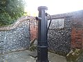 Cobham pump - geograph.org.uk - 4650426.jpg 2,304 × 1,728; 846 KB
-
 Cobham Pylons - geograph.org.uk - 5513944.jpg 5,825 × 3,883; 2.24 MB
-
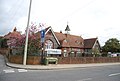 Cobham Village School - geograph.org.uk - 3508797.jpg 640 × 430; 67 KB
-
 Cobham Village School - geograph.org.uk - 3508801.jpg 640 × 430; 75 KB
-
 Cobham Village Sign - geograph.org.uk - 5079658.jpg 3,264 × 2,448; 2.89 MB
-
 Cobham War Memorial - geograph.org.uk - 2488429.jpg 3,000 × 4,000; 3.99 MB
-
 Cobham War Memorial - geograph.org.uk - 3508854.jpg 430 × 640; 64 KB
-
 Cobham War Memorial - geograph.org.uk - 5079160.jpg 2,448 × 3,264; 1.33 MB
-
 Cobham Wood - geograph.org.uk - 3525633.jpg 640 × 430; 98 KB
-
 Cobham Wood - geograph.org.uk - 3525634.jpg 640 × 430; 102 KB
-
 Cobham Wood - geograph.org.uk - 3535685.jpg 640 × 430; 141 KB
-
 Cobham Wood - geograph.org.uk - 3535686.jpg 640 × 430; 135 KB
-
 Cobham Wood - geograph.org.uk - 3535690.jpg 640 × 430; 135 KB
-
 Cobham Wood - geograph.org.uk - 3535797.jpg 640 × 430; 145 KB
-
 Cobham Wood - geograph.org.uk - 3535801.jpg 640 × 430; 133 KB
-
 Cobham Wood - geograph.org.uk - 3535806.jpg 640 × 430; 138 KB
-
 Cobham Wood - geograph.org.uk - 3535811.jpg 640 × 430; 139 KB
-
 Cobham Wood - geograph.org.uk - 3535814.jpg 640 × 430; 147 KB
-
 Cobham Wood - geograph.org.uk - 3535818.jpg 640 × 430; 137 KB
-
 Cobham Wood - geograph.org.uk - 3535838.jpg 640 × 430; 121 KB
-
 Cobham Wood Footpaths Sign - geograph.org.uk - 1137905.jpg 640 × 435; 70 KB
-
 Cobham, from churchyard.JPG 1,785 × 1,380; 975 KB
-
 Cobhambury Hilltop, Looking North towards Cobham - geograph.org.uk - 2209133.jpg 1,159 × 783; 514 KB
-

-
 Cobhambury Rd - geograph.org.uk - 3493676.jpg 640 × 430; 52 KB
-
 Cobhambury Rd - geograph.org.uk - 3493681.jpg 640 × 430; 88 KB
-
 Cobhambury Rd - geograph.org.uk - 3493684.jpg 640 × 415; 54 KB
-
 Cobhambury Rd - geograph.org.uk - 3493686.jpg 640 × 430; 74 KB
-
 Cobhambury Wood from Batts Road - geograph.org.uk - 2605301.jpg 4,000 × 3,000; 3.92 MB
-
 Colyer-Fergusson family plot at Ifield - geograph.org.uk - 2476574.jpg 4,000 × 3,000; 4.05 MB
-

-
 Comhambury Road - geograph.org.uk - 2522968.jpg 640 × 480; 141 KB
-
 Converted barn at Lodge Farm - geograph.org.uk - 2640939.jpg 1,024 × 759; 167 KB
-
 Coppiced trees - geograph.org.uk - 3535523.jpg 640 × 430; 128 KB
-
 Coppicing, Ashenbank Wood - geograph.org.uk - 3498326.jpg 640 × 430; 139 KB
-
 Coppicing, Broad Oak Wood - geograph.org.uk - 3525643.jpg 640 × 430; 128 KB
-
 Cottage in Ashenden Woods (now demolished) - geograph.org.uk - 2209159.jpg 1,110 × 739; 673 KB
-
 Cottage in Ashenden Woods (now demolished) - geograph.org.uk - 2209166.jpg 1,071 × 710; 400 KB
-
 Cottage, The Street - geograph.org.uk - 3508786.jpg 640 × 430; 82 KB
-
 Cottages, The Street - geograph.org.uk - 3508767.jpg 640 × 430; 67 KB
-
 Crocker's Place - geograph.org.uk - 3508707.jpg 640 × 430; 89 KB
-
 Crocker's Place - geograph.org.uk - 3508713.jpg 640 × 430; 93 KB
-
 Crossing Cobham Park - geograph.org.uk - 3517236.jpg 640 × 430; 60 KB
-
 Crossing HS1 - geograph.org.uk - 3534732.jpg 640 × 405; 49 KB
-
 CTRL and half of the A2 - geograph.org.uk - 2362220.jpg 640 × 480; 93 KB
-
 CTRL emergency access gate - geograph.org.uk - 2617126.jpg 640 × 480; 102 KB
-
 CTRL railbridge over road - geograph.org.uk - 1054015.jpg 640 × 481; 74 KB
-
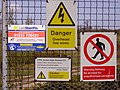 CTRL signs near Ashenbank Wood - geograph.org.uk - 1874115.jpg 2,560 × 1,920; 2.29 MB
-
 CTRL to Ashford - geograph.org.uk - 3164477.jpg 4,288 × 3,216; 3.72 MB
-
 Cul de Sac off Battle St - geograph.org.uk - 3508692.jpg 640 × 430; 85 KB
-
 Daffodils, The Avenue - geograph.org.uk - 3508862.jpg 640 × 430; 108 KB
-
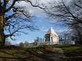
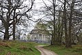 Darnley Mausoleum - geograph.org.uk - 3525513.jpg 640 × 430; 125 KB
-
 Darnley Mausoleum - geograph.org.uk - 3525514.jpg 640 × 430; 57 KB
-
 Darnley Mausoleum - geograph.org.uk - 3525517.jpg 430 × 640; 70 KB
-
 Darnley Mausoleum - geograph.org.uk - 3525521.jpg 640 × 403; 57 KB
-
 Darnley Mausoleum in Cobham Park - geograph.org.uk - 2249074.jpg 960 × 1,280; 654 KB
-
 Darnley Mausoleum, Cobham Park - geograph.org.uk - 2362402.jpg 640 × 480; 100 KB
-
 Dovecot, Knights Place - geograph.org.uk - 3535532.jpg 640 × 430; 95 KB
-
 Dovecot, Lodge Farm - geograph.org.uk - 3517187.jpg 640 × 430; 50 KB
-
 Dovecot, Lodge Farm - geograph.org.uk - 3517194.jpg 640 × 502; 83 KB
-
 Dried up pond - geograph.org.uk - 3498358.jpg 640 × 430; 146 KB
-
 Driveway to Cobham Hall - geograph.org.uk - 3541098.jpg 640 × 430; 76 KB
-
 Driveway, Cobham Hall - geograph.org.uk - 3541099.jpg 640 × 430; 52 KB
-
 Eden Cottage - geograph.org.uk - 1227553.jpg 640 × 480; 91 KB
-
 Electricity Pylons Near Cobham - geograph.org.uk - 2362564.jpg 4,000 × 3,000; 2.87 MB
-
 Electricity Pylons, Cobhambury - geograph.org.uk - 323244.jpg 640 × 480; 53 KB
-
 Entering Ranscombe Farm Reserve - geograph.org.uk - 3525814.jpg 640 × 430; 111 KB
-
 Entering Sole Street on Sole Street - geograph.org.uk - 3545249.jpg 640 × 430; 57 KB
-
 Entrance into Ashenbank Wood - geograph.org.uk - 1109572.jpg 640 × 481; 105 KB
-
 Entrance Lodge to Cobham Park - geograph.org.uk - 3517205.jpg 640 × 430; 54 KB
-
 Entrance Lodge to Cobham Park - geograph.org.uk - 3517217.jpg 640 × 423; 59 KB
-
 Entrance Lodge to Cobham Park - geograph.org.uk - 3517231.jpg 640 × 430; 55 KB
-
 Entrance lodge, Cobham Park, a 'cottage orné' - geograph.org.uk - 2640968.jpg 1,024 × 1,024; 215 KB
-
 Entrance to Cobham Park - geograph.org.uk - 3517215.jpg 640 × 430; 71 KB
-
 Entrance to Ranscombe Farm Reserve - geograph.org.uk - 3525540.jpg 640 × 430; 113 KB
-

-
 Entrance to Temple Wood - geograph.org.uk - 3331393.jpg 4,000 × 3,000; 4.34 MB
-
 Entrance to woodland, Cobham Park - geograph.org.uk - 3517253.jpg 640 × 430; 107 KB
-
 Eurostar at Cobham - geograph.org.uk - 323181.jpg 640 × 480; 25 KB
-
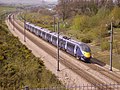
 Eurostar near Ashenbank Wood - geograph.org.uk - 1874046.jpg 2,560 × 1,920; 2.17 MB
-
 Eurostar train, HS1 - geograph.org.uk - 3541073.jpg 640 × 430; 78 KB
-
 Fallen tree, Cobham Park - geograph.org.uk - 3525530.jpg 640 × 430; 130 KB
-
 Farmland by Gold St - geograph.org.uk - 3545265.jpg 640 × 442; 62 KB


_to_Medway_-_geograph.org.uk_-_3164548.jpg)
_to_London_-_geograph.org.uk_-_3164542.jpg)


.jpg)


_-_geograph.org.uk_-_2209159.jpg)
_-_geograph.org.uk_-_2209166.jpg)


