Category:Borough of Gravesham
Jump to navigation
Jump to search
local government district and borough in North West Kent, England  | |||||
| Upload media | |||||
| Instance of | |||||
|---|---|---|---|---|---|
| Location | Kent, South East England, England | ||||
| Capital | |||||
| Legislative body |
| ||||
| Population |
| ||||
| Area |
| ||||
| official website | |||||
 | |||||
English: Gravesham is a district in the county of Kent, England.
Subcategories
This category has the following 10 subcategories, out of 10 total.
C
G
H
L
M
N
S
V
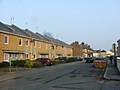
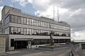
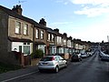
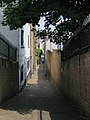
Media in category "Borough of Gravesham"
The following 200 files are in this category, out of 1,454 total.
(previous page) (next page)-

-
 'Morgenster' passes Tilbury International Cruise Terminal - geograph.org.uk - 4156414.jpg 3,270 × 2,180; 5.03 MB
-
 'Symphorine' heads downriver - geograph.org.uk - 4150992.jpg 640 × 480; 74 KB
-
 1 Berkley Crescent - geograph.org.uk - 5457631.jpg 4,000 × 3,000; 3.56 MB
-

-
 109, Windmill Street - geograph.org.uk - 5072450.jpg 2,448 × 3,264; 2.38 MB
-
 14-31 Heritage Quay - geograph.org.uk - 5457022.jpg 4,000 × 3,000; 3.06 MB
-
 14-31 Heritage Quay - geograph.org.uk - 5457023.jpg 4,000 × 3,000; 4.3 MB
-
 20-24 Stone Street, Gravesend - geograph.org.uk - 3164785.jpg 4,288 × 3,216; 3.28 MB
-
 A 'Javelin' train comes off the CTRL - geograph.org.uk - 2503530.jpg 640 × 480; 128 KB
-
 A Bench With a View, Northfleet - geograph.org.uk - 4136694.jpg 4,608 × 3,456; 3.43 MB
-
 A bend in the road - geograph.org.uk - 2476506.jpg 4,000 × 3,000; 4.49 MB
-
 A corner of Gravesend cemetery - geograph.org.uk - 2480011.jpg 640 × 480; 166 KB
-
 A down Eurostar on HS1 - geograph.org.uk - 5265483.jpg 4,000 × 3,000; 4.68 MB
-
 A motley tribe of horses - geograph.org.uk - 2480251.jpg 640 × 480; 104 KB
-
 A small green in Gravesend - geograph.org.uk - 1942442.jpg 1,280 × 960; 634 KB
-
 A Zig-Zag Footbridge, Northfleet - geograph.org.uk - 4147423.jpg 4,608 × 3,456; 3.64 MB
-
 A2 at A337 junction - geograph.org.uk - 3667422.jpg 2,320 × 998; 401 KB
-
 A2 Watling Street - geograph.org.uk - 4280709.jpg 3,264 × 2,448; 1.34 MB
-
 A2 Watling Street - geograph.org.uk - 4280715.jpg 3,264 × 2,448; 1.33 MB
-
 A2, Pepper Hill - geograph.org.uk - 3631374.jpg 640 × 480; 249 KB
-
 Abbey Road, Gravesend - geograph.org.uk - 4146815.jpg 3,488 × 2,616; 2.75 MB
-
 Access Gate 156, High Speed Line, near Ebbsfleet - geograph.org.uk - 4147437.jpg 4,608 × 3,456; 3.45 MB
-

-

-
 Alanbrooke, Gravesend - geograph.org.uk - 5267419.jpg 3,264 × 2,448; 1.58 MB
-
 Alanbrooke, Gravesend - geograph.org.uk - 5267421.jpg 3,264 × 2,448; 1.8 MB
-
 Albion Parade, Gravesend - geograph.org.uk - 4146834.jpg 3,488 × 2,616; 3.34 MB
-
 Albion Parade, Gravesend - geograph.org.uk - 4189678.jpg 3,128 × 2,346; 1.62 MB
-
 Albion Parade, Gravesend - geograph.org.uk - 4189679.jpg 3,128 × 2,346; 2.51 MB
-
 Albion Road, Milton - geograph.org.uk - 3666146.jpg 3,488 × 2,616; 2.22 MB
-
 Albion Road, Milton - geograph.org.uk - 4388643.jpg 2,272 × 1,704; 737 KB
-
 Albion Road, Milton - geograph.org.uk - 5267424.jpg 3,264 × 2,448; 1.85 MB
-
 Albion Terrace, Milton - geograph.org.uk - 4388638.jpg 2,272 × 1,704; 751 KB
-
 Albion Terrace, Milton - geograph.org.uk - 4388652.jpg 2,272 × 1,704; 651 KB
-
 Alex House - geograph.org.uk - 4598206.jpg 640 × 424; 59 KB
-
 Alexandra Road, Gravesend - geograph.org.uk - 3666050.jpg 3,488 × 2,616; 2.22 MB
-
 Alfred Road, Gravesend - geograph.org.uk - 4129203.jpg 3,488 × 2,616; 2.62 MB
-
 All Saints Road, Northfleet - geograph.org.uk - 3677777.jpg 3,488 × 2,616; 2.23 MB
-
 All Saints Road, Northfleet - geograph.org.uk - 5318197.jpg 3,264 × 2,448; 1.75 MB
-
 All Saints Road, Northfleet - geograph.org.uk - 5318201.jpg 3,264 × 2,448; 2.1 MB
-
 All Saints', Perry Street, Northfleet - geograph.org.uk - 3677781.jpg 3,488 × 2,616; 2.21 MB
-
 Alleyway from Guru Nanak Marg - geograph.org.uk - 5456325.jpg 3,000 × 4,000; 3.63 MB
-

-
 AMF Bowling Alley, Gravesend - geograph.org.uk - 3182514.jpg 4,288 × 3,216; 4.74 MB
-
 Anchor Cove - geograph.org.uk - 4597999.jpg 424 × 640; 58 KB
-
 Appleshaw Close, Gravesend - geograph.org.uk - 4561755.jpg 2,272 × 1,704; 725 KB
-
 Approach to Market Hall, Gravesend - geograph.org.uk - 4697933.jpg 480 × 640; 113 KB
-
 Arcadia Avenue, Istead Rise - geograph.org.uk - 4562196.jpg 2,272 × 1,704; 712 KB
-
 Arcadia Avenue, Istead Rise - geograph.org.uk - 4562206.jpg 2,272 × 1,704; 730 KB
-
 Arcadia Road, Istead Rise - geograph.org.uk - 3567343.jpg 3,201 × 2,480; 1.51 MB
-
 Ariel Close, Riverview Park - geograph.org.uk - 3899118.jpg 3,488 × 2,616; 2 MB
-
 Armoury Drive, Gravesend - geograph.org.uk - 5267416.jpg 2,879 × 2,159; 1.27 MB
-
 Arnold Road, Gravesend - geograph.org.uk - 4146766.jpg 3,488 × 2,616; 3.25 MB
-
 Arriva Bus Garage, Northfleet - geograph.org.uk - 5486415.jpg 2,592 × 1,944; 1.38 MB
-
 Arthur Street West, Gravesend - geograph.org.uk - 5318236.jpg 3,264 × 2,448; 1.68 MB
-
 Arthur Street, Gravesend - geograph.org.uk - 4129104.jpg 3,488 × 2,616; 2.88 MB
-
 Arthur Street, Gravesend - geograph.org.uk - 4408975.jpg 2,272 × 1,704; 739 KB
-
 Arthur Street, Gravesend - geograph.org.uk - 5267356.jpg 3,264 × 2,448; 1.55 MB
-
 Arthur Street, Gravesend - geograph.org.uk - 5318242.jpg 3,264 × 2,448; 1.75 MB
-
 Ascot Arms, Gravesend - geograph.org.uk - 4129291.jpg 3,488 × 2,616; 2.85 MB
-
 Ascot Road, Gravesend - geograph.org.uk - 4129281.jpg 3,488 × 2,616; 2.85 MB
-
 Ash Road, Gravesend - geograph.org.uk - 4129324.jpg 3,488 × 2,616; 2.43 MB
-
 Ashlen Down Nursing Home, Parrock Street - geograph.org.uk - 5070152.jpg 2,448 × 3,264; 2.31 MB
-
 Aspdin Road, Northfleet - geograph.org.uk - 4138957.jpg 3,488 × 2,616; 2.94 MB
-
 Aspdin Wharf - geograph.org.uk - 5525196.jpg 3,264 × 2,448; 3.81 MB
-
 Astra Drive, Riverview Park - geograph.org.uk - 3899012.jpg 3,488 × 2,616; 2.29 MB
-
 Augustine Road, Milton - geograph.org.uk - 4388648.jpg 2,272 × 1,704; 659 KB
-
 Austin Road, Northfleet - geograph.org.uk - 4129125.jpg 3,488 × 2,616; 3.39 MB
-
 Baltimore Terrace, Gravesend - geograph.org.uk - 3665974.jpg 3,488 × 2,616; 2.28 MB
-
 Bandstand - Fort Gardens, Gravesend - geograph.org.uk - 2863206.jpg 1,280 × 856; 146 KB
-
 Bandstand, Fort Gardens, Gravesend - geograph.org.uk - 4146846.jpg 3,488 × 2,616; 3.46 MB
-
 Bank Street, Gravesend - geograph.org.uk - 3942358.jpg 2,616 × 3,488; 2.06 MB
-
 Bankside, Northfleet - geograph.org.uk - 4297400.jpg 2,272 × 1,704; 1.06 MB
-
 Barr Road, Westcourt - geograph.org.uk - 3899209.jpg 3,488 × 2,616; 2.18 MB
-
 Barrack Row, Gravesend - geograph.org.uk - 4702899.jpg 3,264 × 2,448; 1.54 MB
-
 Bartlett Road, Gravesend - geograph.org.uk - 3677645.jpg 3,488 × 2,616; 2.27 MB
-
 Bat ^ Ball, Gravesend - geograph.org.uk - 5319205.jpg 2,545 × 1,711; 887 KB
-
 Battle of Britain Pub Sign (2) - geograph.org.uk - 3164744.jpg 3,216 × 4,288; 3.38 MB
-
 Battle of Britain Pub Sign, Gravesend - geograph.org.uk - 3164740.jpg 3,216 × 4,288; 3.58 MB
-
 Battle of Britain, Northfleet - geograph.org.uk - 1996123.jpg 3,198 × 2,398; 1.64 MB
-
 Beatrice Gardens, Northfleet - geograph.org.uk - 4561730.jpg 2,272 × 1,704; 852 KB
-
 Bedford Road, Northfleet - geograph.org.uk - 4129135.jpg 3,488 × 2,616; 2.76 MB
-
 Bellman Avenue, Gravesend - geograph.org.uk - 4146816.jpg 3,488 × 2,616; 2.63 MB
-
 Bentley Street, Gravesend - geograph.org.uk - 4146851.jpg 3,488 × 2,616; 2.43 MB
-
 Bentley Street, Gravesend - geograph.org.uk - 5267438.jpg 3,264 × 2,448; 1.69 MB
-
 Beresford Road, Northfleet - geograph.org.uk - 3677895.jpg 3,488 × 2,616; 2.17 MB
-
 Beresford Road, Northfleet - geograph.org.uk - 5318101.jpg 3,264 × 2,448; 2 MB
-
 Berkley Road, Gravesend - geograph.org.uk - 3665949.jpg 3,488 × 2,616; 2.25 MB
-
 Berkley Road, Gravesend - geograph.org.uk - 4388752.jpg 2,272 × 1,704; 754 KB
-
 Berkley Street, Gravesend - geograph.org.uk - 5267463.jpg 3,264 × 2,448; 1.68 MB
-
 Bernard Street, Gravesend - geograph.org.uk - 3665952.jpg 3,488 × 2,616; 2.25 MB
-
 Bernard Street, Gravesend - geograph.org.uk - 4388746.jpg 2,272 × 1,704; 739 KB
-
 Berries on the Wealdway - geograph.org.uk - 5099124.jpg 4,608 × 3,456; 3.38 MB
-
 Bevans 42 - geograph.org.uk - 4426106.jpg 2,592 × 1,944; 226 KB
-
 Bevans Wharf - geograph.org.uk - 4426050.jpg 640 × 480; 60 KB
-
 Black Rose, Gravesend - geograph.org.uk - 1927242.jpg 3,146 × 2,485; 2.63 MB
-
 Blackberries on the Wealdway - geograph.org.uk - 5099117.jpg 4,608 × 3,456; 3.39 MB
-
 Blossom alongside the new A2 - geograph.org.uk - 5352741.jpg 4,000 × 3,000; 4.91 MB
-
 BMX Racetrack, Cyclopark - geograph.org.uk - 3164715.jpg 4,288 × 3,216; 3.52 MB
-
 Bonaventure Court, Riverview Park - geograph.org.uk - 3899078.jpg 3,488 × 2,616; 1.83 MB
-
 Botany Marsh - geograph.org.uk - 3748323.jpg 3,488 × 2,616; 2.31 MB
-
 Botany Marshes - geograph.org.uk - 2863828.jpg 4,000 × 3,000; 3.98 MB
-
 Botany Marshes - geograph.org.uk - 3748319.jpg 3,488 × 2,616; 1.85 MB
-
 Botany Road, Northfleet - geograph.org.uk - 3748348.jpg 3,488 × 2,616; 934 KB
-
 Botany Road, Northfleet - geograph.org.uk - 3748349.jpg 3,488 × 2,616; 2.19 MB
-
 Botany Road, Northfleet - geograph.org.uk - 3748352.jpg 3,488 × 2,616; 1.56 MB
-
 Botany Road, Northfleet - geograph.org.uk - 3748356.jpg 3,488 × 2,616; 1.48 MB
-
 Botany Road, Northfleet - geograph.org.uk - 4181767.jpg 3,488 × 2,616; 2.18 MB
-
 Bowater Scott - Water Tower and former offices - geograph.org.uk - 3037836.jpg 2,791 × 4,203; 5.49 MB
-
 Bowling green at Clarence Place, Gravesend - geograph.org.uk - 1945078.jpg 1,280 × 960; 651 KB
-
 Brandon Street, Gravesend - geograph.org.uk - 4129107.jpg 3,488 × 2,616; 3.06 MB
-
 Brandon Street, Gravesend - geograph.org.uk - 4408974.jpg 2,272 × 1,704; 719 KB
-
 Brandon Street, Gravesend - geograph.org.uk - 5267354.jpg 3,264 × 2,448; 1.58 MB
-
 Brenchley Avenue, Gravesend - geograph.org.uk - 4562114.jpg 2,272 × 1,704; 740 KB
-
 Brenchley Avenue, Gravesend - geograph.org.uk - 4562147.jpg 2,272 × 1,704; 708 KB
-
 Brewhouse Yard, Gravesend - geograph.org.uk - 3677277.jpg 3,488 × 2,616; 2.28 MB
-
 Bridge leading over to Gordon Promenade East, Gravesend - geograph.org.uk - 4146835.jpg 3,488 × 2,616; 3.14 MB
-
 Bridge over entrance lock to Thames ^ Medway Canal Basin - geograph.org.uk - 5067702.jpg 3,264 × 2,448; 2.37 MB
-

-
 Britannia Drive, Riverview Park - geograph.org.uk - 3899014.jpg 3,488 × 2,616; 2.17 MB
-
 Britannia Refined Metals Plant, Botany Road, Northfleet (2) - geograph.org.uk - 4146553.jpg 4,608 × 3,456; 3.37 MB
-
 Britannia Refined Metals Plant, Botany Road, Northfleet - geograph.org.uk - 4146548.jpg 4,608 × 3,456; 3.42 MB
-
 Britannia Refined Metals, Northfleet - geograph.org.uk - 4181772.jpg 3,488 × 2,616; 2.21 MB
-
 Brook Road, Northfleet - geograph.org.uk - 3677778.jpg 3,488 × 2,616; 2.27 MB
-
 Brookside Road, Istead Rise - geograph.org.uk - 4562554.jpg 2,272 × 1,704; 808 KB
-
 Brown Road, Gravesend - geograph.org.uk - 4146819.jpg 3,488 × 2,616; 2.54 MB
-
 Bucks Cross Road, Northfleet - geograph.org.uk - 1996133.jpg 3,488 × 2,616; 2.16 MB
-
 Buddleia above the raised pavement in Cross Lane East - geograph.org.uk - 2475918.jpg 4,000 × 3,000; 4.4 MB
-
 Burch Road, Gravesend - geograph.org.uk - 3646847.jpg 640 × 360; 64 KB
-
 Burch Road, Rosherville - geograph.org.uk - 3677977.jpg 3,488 × 2,616; 2.21 MB
-
 Burch Road, Rosherville - geograph.org.uk - 3677981.jpg 3,488 × 2,616; 1.64 MB
-
 Burch Road, Rosherville - geograph.org.uk - 4136801.jpg 4,608 × 3,456; 3.63 MB
-
 Burnaby Road, Northfleet - geograph.org.uk - 3677916.jpg 3,488 × 2,616; 1.49 MB
-
 Burnaby Road, Northfleet - geograph.org.uk - 5318109.jpg 3,264 × 2,448; 2.63 MB
-
 Bycliffe Terrace, Northfleet - geograph.org.uk - 3677749.jpg 3,488 × 2,616; 2.23 MB
-
 B^M Home Store, 2-4, New Road - geograph.org.uk - 5527455.jpg 2,391 × 3,120; 1.81 MB
-
 Cambria Crescent, Riverview Park - geograph.org.uk - 3899107.jpg 3,488 × 2,616; 2.15 MB
-
 Cambrian Grove, Gravesend - geograph.org.uk - 4129092.jpg 3,488 × 2,616; 3.08 MB
-
 Cambrian Grove, Gravesend - geograph.org.uk - 5318245.jpg 3,041 × 2,281; 1.14 MB
-
 Campbell Road, Northfleet - geograph.org.uk - 3677757.jpg 3,488 × 2,616; 2.23 MB
-
 Canal footbridge near Gravesend - geograph.org.uk - 3645543.jpg 640 × 360; 105 KB
-
 Canterbury Road, Gravesend - geograph.org.uk - 3677597.jpg 3,488 × 2,616; 2.27 MB
-
 Cap George, Container Ship - geograph.org.uk - 2090061.jpg 2,560 × 1,920; 1.54 MB
-
 Cap George, Monrovia - geograph.org.uk - 2090068.jpg 2,560 × 1,920; 1.59 MB
-
 Captain Cabin of Princess Pocahontas at Gravesend Pier - geograph.org.uk - 3182549.jpg 4,288 × 3,216; 4.37 MB
-
 Caravan site at Denton - geograph.org.uk - 2375942.jpg 1,280 × 960; 613 KB
-
 Castlefields, Istead Rise - geograph.org.uk - 3427441.jpg 4,000 × 3,000; 4.3 MB
-
 Castlefields, Istead Rise - geograph.org.uk - 4562204.jpg 2,272 × 1,704; 738 KB
-
 Castlefields, Istead Rise - geograph.org.uk - 4562547.jpg 2,272 × 1,704; 809 KB
-
 Cecil Road, Northfleet - geograph.org.uk - 4129127.jpg 3,488 × 2,616; 2.74 MB
-
 Cedar Avenue, Gravesend - geograph.org.uk - 4129317.jpg 3,488 × 2,616; 2.47 MB
-
 Celebrating the Queen's 90th birthday - geograph.org.uk - 5007513.jpg 4,608 × 3,456; 3.9 MB
-
 Celebrating the Queen's 90th birthday - geograph.org.uk - 5007514.jpg 4,608 × 3,456; 3.89 MB
-
 Cement lorries at Northfleet - geograph.org.uk - 2073909.jpg 1,280 × 960; 577 KB
-
 Central Avenue, Gravesend - geograph.org.uk - 4129294.jpg 3,488 × 2,616; 3.14 MB
-
 Ceramic tiles, Gravesend High Street - geograph.org.uk - 3552290.jpg 473 × 1,000; 344 KB
-

-
 Chalk Quarry, Northfleet - geograph.org.uk - 4147515.jpg 2,712 × 2,034; 2.52 MB
-
 Chalk Road, Chalk - geograph.org.uk - 3899218.jpg 3,488 × 2,616; 1.34 MB
-
 Chalky Bank, Gravesend - geograph.org.uk - 4561750.jpg 2,272 × 1,704; 752 KB
-
 Chalky Bank, Gravesend - geograph.org.uk - 4561752.jpg 2,272 × 1,704; 791 KB
-
 Channel Tunnel Rail Link - geograph.org.uk - 2617258.jpg 640 × 480; 119 KB
-
 Channel Tunnel Rail Link from the Wealdway - geograph.org.uk - 2476368.jpg 4,000 × 3,000; 4.27 MB
-
 Chapels, Northfleet Cemetery - geograph.org.uk - 2503576.jpg 640 × 480; 114 KB
-
 Chaucer Road, Northfleet - geograph.org.uk - 4138906.jpg 3,488 × 2,616; 3.91 MB
-
 Cherry blossom in Milton Churchyard - geograph.org.uk - 3900279.jpg 4,000 × 3,000; 4.28 MB
-
 Chiltern Road, Northfleet - geograph.org.uk - 4138945.jpg 3,488 × 2,616; 3.41 MB
-
 Chopped up telegraph poles - geograph.org.uk - 3138522.jpg 640 × 480; 136 KB
-
 Christ Church Crescent, Gravesend - geograph.org.uk - 4129433.jpg 3,488 × 2,616; 5.15 MB
-
 Christ Church Road, Gravesend - geograph.org.uk - 4129419.jpg 3,488 × 2,616; 3.37 MB
-
 Christ Church Road, Gravesend - geograph.org.uk - 5319229.jpg 3,264 × 2,448; 1.81 MB
-
 Christian Fields Avenue, Gravesend - geograph.org.uk - 4129326.jpg 3,488 × 2,616; 2.37 MB
-
 Christmas Shopping - geograph.org.uk - 4427343.jpg 2,592 × 3,872; 1.02 MB
-
 Church Lane, Chalk - geograph.org.uk - 3899240.jpg 3,488 × 2,616; 1.22 MB
-
 Church Lane, Chalk - geograph.org.uk - 3899241.jpg 3,488 × 2,616; 1.45 MB
-
 Church Lane, Chalk - geograph.org.uk - 3899245.jpg 3,488 × 2,616; 2.91 MB
-
 Church Lane, Chalk - geograph.org.uk - 3899252.jpg 3,488 × 2,616; 2.25 MB
-
 Church Path, Northfleet - geograph.org.uk - 3666210.jpg 3,488 × 2,616; 2.23 MB
-
 Church Road - geograph.org.uk - 3127615.jpg 640 × 480; 62 KB
-
 Church Walk, Gravesend - geograph.org.uk - 3677373.jpg 3,488 × 2,616; 2.23 MB
-
 Church Walk, Gravesend - geograph.org.uk - 3677425.jpg 3,488 × 2,616; 2.22 MB
-
 Churchill Road, Northfleet - geograph.org.uk - 5318226.jpg 3,121 × 2,341; 1.48 MB
-
 Churchill Road, Northfleet - geograph.org.uk - 5318227.jpg 3,125 × 2,345; 1.34 MB
-
 Cimba Wood, Riverview Park - geograph.org.uk - 4146793.jpg 3,488 × 2,616; 2.95 MB
-
 Cirrus Crescent, Riverview Park - geograph.org.uk - 3899069.jpg 3,488 × 2,616; 1.82 MB
-
 Clarence Place, Gravesend - geograph.org.uk - 1945384.jpg 1,280 × 960; 638 KB
-
 Clarence Place, Gravesend - geograph.org.uk - 4129415.jpg 3,488 × 2,616; 2.94 MB
-
 Clarence Place, Gravesend - geograph.org.uk - 4138791.jpg 3,488 × 2,616; 2.9 MB
-
 Clarence Place, Gravesend - geograph.org.uk - 5319220.jpg 3,264 × 2,448; 2.37 MB
-
 Clarence Place, Gravesend - geograph.org.uk - 5319223.jpg 3,264 × 2,448; 1.76 MB
-
 Clarence Row, Gravesend - geograph.org.uk - 4138789.jpg 3,488 × 2,616; 3.06 MB
-
 Clarence Row, Gravesend - geograph.org.uk - 5319242.jpg 3,264 × 2,448; 1.44 MB
-
 Clarendon Road, Gravesend - geograph.org.uk - 4388730.jpg 2,272 × 1,704; 783 KB
-
 Clarendon Road, Gravesend - geograph.org.uk - 5267453.jpg 3,264 × 2,448; 2.06 MB
-
 Clifton Marine Parade - geograph.org.uk - 5527382.jpg 3,264 × 2,448; 3.81 MB
-
 Clifton Marine Parade, Gravesend - geograph.org.uk - 1965222.jpg 3,488 × 2,616; 2.13 MB
-
 Clifton Marine Parade, Gravesend - geograph.org.uk - 4138810.jpg 3,488 × 2,616; 2.34 MB
-
 Clive Road, Gravesend - geograph.org.uk - 5092848.jpg 3,264 × 2,448; 2.17 MB
-
 Clock tower, Gravesend - geograph.org.uk - 2974098.jpg 2,112 × 2,816; 1.15 MB


_-_geograph.org.uk_-_5602729.jpg)
_-_geograph.org.uk_-_5602736.jpg)


_-_geograph.org.uk_-_3164744.jpg)


_-_geograph.org.uk_-_4146553.jpg)


