Category:Coco Islands
Jump to navigation
Jump to search
territory of Myanmar in the Bay of Bengal  | |||||
| Upload media | |||||
| Instance of |
| ||||
|---|---|---|---|---|---|
| Location | Yangon Region, Burma | ||||
| Located in or next to body of water | |||||
| Area |
| ||||
| Elevation above sea level |
| ||||
 | |||||
Media in category "Coco Islands"
The following 12 files are in this category, out of 12 total.
-
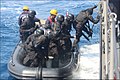
 6th Indo-Myanmar Coordinated Patrol concludes at Coco Islands (1).jpg 700 × 467; 130 KB
-
 6th Indo-Myanmar Coordinated Patrol concludes at Coco Islands (2).jpg 700 × 467; 164 KB
-
 6th Indo-Myanmar Coordinated Patrol concludes at Coco Islands (3).jpg 700 × 467; 183 KB
-
 6th Indo-Myanmar Coordinated Patrol concludes at Coco Islands (4).jpg 700 × 467; 172 KB
-
 6th Indo-Myanmar Coordinated Patrol concludes at Coco Islands (5).jpg 700 × 467; 153 KB
-
 6th Indo-Myanmar Coordinated Patrol concludes at Coco Islands (6).jpg 700 × 467; 145 KB
-
 6th Indo-Myanmar Coordinated Patrol concludes at Coco Islands (7).jpg 700 × 467; 135 KB
-
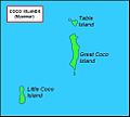
 Coco-situation-map.jpg 310 × 655; 55 KB
-
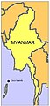
 Cocos-Islands-Myanmar-map.jpg 486 × 438; 24 KB
-
 Great-Coco-map.jpg 1,084 × 1,452; 73 KB
-
 Little-Coco-map.jpg 446 × 584; 53 KB
-
 Table-Island-map.jpg 490 × 424; 28 KB
.jpg)
.jpg)
.jpg)
.jpg)
.jpg)
.jpg)
.jpg)


