Category:Col du Moulin à Vent (stele)
Jump to navigation
Jump to search
| Object location | | View all coordinates using: OpenStreetMap |
|---|
|
Col du Moulin à Vent (stele) has an entry on OpenStreetMap (show). |
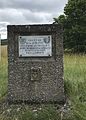
| FFI |
|
C'est ici que |
Media in category "Col du Moulin à Vent (stele)"
The following 3 files are in this category, out of 3 total.
-
 Col du Moulin à Vent (Lyas) Plaque de la formation de l'Armée secrète en 1944.jpg 2,772 × 1,750; 3.26 MB
-
 Col du Moulin à Vent - Lyas (3).JPG 2,768 × 3,816; 8.35 MB
-
 Col du Moulin à Vent - Lyas (4).JPG 2,312 × 3,232; 6.7 MB
_Plaque_de_la_formation_de_l%27Arm%C3%A9e_secr%C3%A8te_en_1944.jpg)
.JPG)
.JPG)