Category:Cold Newton
Jump to navigation
Jump to search
village in the United Kingdom | |||||
| Upload media | |||||
| Instance of | |||||
|---|---|---|---|---|---|
| Location | Harborough, Leicestershire, East Midlands, England | ||||
| Population |
| ||||
 | |||||
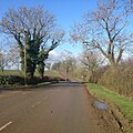
English: Cold Newton is a small hamlet and civil parish in the Harborough district of Leicestershire. It is situated about two miles from Tilton on the Hill and two miles north of Billesdon. Some above sea level, it overlooks the Wreake valley. For administrative purposes the village is linked with Lowesby parish. It has no church, public house or shop. A village green was created in 1977 to mark Queen Elizabeth II's Silver Jubilee on land gifted to the parish by the Quenby estate.
Media in category "Cold Newton"
The following 57 files are in this category, out of 57 total.
-
Approaching the entrance to Cold Newton Lodge - geograph.org.uk - 6418552.jpg 3,776 × 2,520; 4.11 MB
-
Bale stack - geograph.org.uk - 3277288.jpg 640 × 464; 52 KB
-
Cattle grid on Park Road at White's Barn - geograph.org.uk - 4284138.jpg 1,600 × 1,140; 377 KB
-
Cattle near Lord Morton's Covert - geograph.org.uk - 4165227.jpg 1,600 × 1,167; 589 KB
-
Cold Newton - geograph.org.uk - 172488.jpg 640 × 480; 67 KB
-
Cold Newton - geograph.org.uk - 3277289.jpg 640 × 462; 51 KB
-
Cold Newton DMV remains.jpg 3,872 × 2,592; 1.38 MB
-
Cold Newton Lodge - geograph.org.uk - 5099334.jpg 640 × 480; 130 KB
-
Cold Newton ridge and furrow.jpg 3,900 × 2,613; 4.42 MB
-
Cold Newton, Leicestershire.jpg 640 × 434; 101 KB
-
Communications mast near Tilton Lane - geograph.org.uk - 6174409.jpg 632 × 800; 178 KB
-
Enderbys Lane near Sludge Hall Farm - geograph.org.uk - 1812612.jpg 640 × 480; 80 KB
-
Enderbys Lane towards Cold Newton - geograph.org.uk - 3277284.jpg 640 × 461; 56 KB
-
Enderbys Lane towards Life Hill - geograph.org.uk - 3277285.jpg 640 × 448; 60 KB
-
Entering Cold Newton on Skeg Hill Road - geograph.org.uk - 6221218.jpg 3,776 × 2,520; 4.03 MB
-
Entrance to field off Enderbys Lane - geograph.org.uk - 3277286.jpg 640 × 458; 49 KB
-
Fields near Cold Newton Lodge - geograph.org.uk - 697072.jpg 640 × 484; 82 KB
-
Footpath towards Tilton on the Hill - geograph.org.uk - 6363533.jpg 3,776 × 2,520; 3.08 MB
-
Gate on Skeg Hill Road - geograph.org.uk - 6012500.jpg 640 × 426; 56 KB
-
Hamner's Lodge Farm - geograph.org.uk - 4165346.jpg 1,600 × 1,182; 475 KB
-
Highfield Farm - geograph.org.uk - 519779.jpg 511 × 640; 174 KB
-
Hungarton Road near Cold Newton - geograph.org.uk - 519777.jpg 640 × 551; 122 KB
-
Hungarton Road towards Hungarton - geograph.org.uk - 3277290.jpg 640 × 481; 58 KB
-
Inquisitive cattle - geograph.org.uk - 6012533.jpg 640 × 449; 59 KB
-
Manor House - geograph.org.uk - 5609460.jpg 640 × 480; 37 KB
-
Midshires Way towards South Croxton - geograph.org.uk - 3277291.jpg 640 × 463; 47 KB
-
Nearing the eastern edge of Quenby Park - geograph.org.uk - 519774.jpg 640 × 480; 108 KB
-
On Hungarton Road - geograph.org.uk - 6827803.jpg 768 × 1,024; 130 KB
-
Overgrown pond in summer - geograph.org.uk - 964861.jpg 640 × 401; 64 KB
-
Park Road - geograph.org.uk - 2607512.jpg 640 × 603; 100 KB
-
Park Road crossing Queniborough Brook - geograph.org.uk - 6221208.jpg 3,776 × 2,520; 4.18 MB
-
Park Road in Lowesby Park - geograph.org.uk - 4284562.jpg 1,600 × 1,100; 397 KB
-
Park Road towards Lowesby Park - geograph.org.uk - 6221206.jpg 3,776 × 2,520; 3.21 MB
-
Public footpath to Cold Newton - geograph.org.uk - 4165393.jpg 1,600 × 1,155; 433 KB
-
Road to Hammer Lodge Farm - geograph.org.uk - 6012535.jpg 640 × 497; 107 KB
-
Sheep next to Park Road - geograph.org.uk - 4284153.jpg 1,600 × 1,375; 689 KB
-
Skeg Hill - geograph.org.uk - 3277293.jpg 640 × 486; 62 KB
-
Skeg Hill - geograph.org.uk - 6012501.jpg 640 × 469; 64 KB
-
Skeg Hill Road towards Cold Newton - geograph.org.uk - 6012502.jpg 640 × 428; 56 KB
-
Skeg Hill Road, Cold Newton - geograph.org.uk - 519787.jpg 640 × 507; 119 KB
-
Soggy field by Hungarton Road - geograph.org.uk - 3277292.jpg 640 × 475; 51 KB
-
The grounds of Quenby Hall - geograph.org.uk - 519767.jpg 640 × 535; 119 KB
-
The Manor House at Cold Newton - geograph.org.uk - 519788.jpg 640 × 465; 140 KB
-
The Manor House at Cold Newton - geograph.org.uk - 519789.jpg 506 × 640; 151 KB
-
The Midshires Way - geograph.org.uk - 5609459.jpg 640 × 480; 27 KB
-
The Midshires Way leading to Hamner's Lodge Farm - geograph.org.uk - 6221229.jpg 3,776 × 2,520; 3.41 MB
-
Tilton Lane - geograph.org.uk - 4877628.jpg 640 × 640; 135 KB
-
Towards Cold Newton Grange - geograph.org.uk - 3277287.jpg 640 × 449; 47 KB
-
Towards Hammer's Lodge Farm - geograph.org.uk - 6012534.jpg 640 × 445; 61 KB
-
Towards Hamner's Lodge Farm - geograph.org.uk - 3277294.jpg 640 × 479; 36 KB
-
Towards junction with Skeg Hill - geograph.org.uk - 3277295.jpg 640 × 484; 37 KB
-
View towards Tilton on the Hill - geograph.org.uk - 6012536.jpg 640 × 385; 60 KB
-
White's Barn along Park Road - geograph.org.uk - 4284120.jpg 1,600 × 1,145; 599 KB


