Category:Coldblow
Aller à la navigation
Aller à la recherche
English: Coldblow is a settlement in the unparished area of Bexley, in the London borough of Bexley, in the county of Greater London, England.
établissement humain du district londonien de Bexley, Angleterre, Royaume-Uni  | |||||
| Téléverser des médias | |||||
| Nature de l’élément | |||||
|---|---|---|---|---|---|
| Lieu | Borough londonien de Bexley, Grand Londres, Londres, Angleterre | ||||
 | |||||
Sous-catégories
Cette catégorie comprend seulement la sous-catégorie ci-dessous.
Média dans la catégorie « Coldblow »
Cette catégorie comprend 14 fichiers, dont les 14 ci-dessous.
-
 1 and 3 Hill Crescent, Coldblow.jpg 4 278 × 2 958 ; 7,78 Mio
-
 107 Tile Kiln Lane, Coldblow.jpg 3 113 × 4 153 ; 10,5 Mio
-
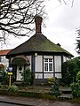
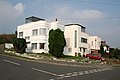 1930s Apartment Block, Hill Crescent, Bexley - geograph.org.uk - 242033.jpg 640 × 427 ; 69 kio
-
 2 Hill Crescent, Coldblow (01).jpg 3 650 × 3 009 ; 6,79 Mio
-
 2 Hill Crescent, Coldblow (02).jpg 4 083 × 3 087 ; 6,78 Mio
-
 Baldwyn's Park Baptist Church - geograph.org.uk - 1279325.jpg 640 × 480 ; 85 kio
-
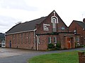 Baldwyns Park Baptist Church, Coldblow.jpg 4 592 × 3 448 ; 11,85 Mio
-
 Coal Duty Tax Post and Bollard along Tile Kiln Lane (01).jpg 3 448 × 4 592 ; 14,3 Mio
-
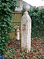 Coal Duty Tax Post and Bollard along Tile Kiln Lane (02).jpg 3 448 × 4 592 ; 13,77 Mio
-
 Coal Duty Tax Post and Bollard along Tile Kiln Lane (03).jpg 4 051 × 3 259 ; 14,03 Mio
-
 Kent-London Border at Dartford Road (01).jpg 4 592 × 3 448 ; 17,44 Mio
-
 Kent-London Border at Dartford Road (02).jpg 4 592 × 3 448 ; 19,63 Mio
-
 Kent-London Border at Dartford Road (03).jpg 3 448 × 4 592 ; 15,28 Mio
-
 St Mary's Road, Coldblow - geograph.org.uk - 1424667.jpg 640 × 480 ; 69 kio


.jpg)
.jpg)


.jpg)
.jpg)
.jpg)
.jpg)
.jpg)
.jpg)