Category:Colgate, West Sussex
Jump to navigation
Jump to search
English: Colgate is a village in the civil parish of Colgate, in the Horsham District of West Sussex, about four miles north east of Horsham.
village in West Sussex, England, UK  | |||||
| Upload media | |||||
| Instance of | |||||
|---|---|---|---|---|---|
| Location | Horsham, West Sussex, South East England, England | ||||
| Area |
| ||||
 | |||||
Subcategories
This category has the following 7 subcategories, out of 7 total.
C
- St Saviours Church, Colgate (4 F)
D
- The Dragon, Colgate (7 F)
F
H
- Holmbush Farm (13 F)
K
- Kilnwood Vale (129 F)
S
- Sun Oak (5 F)
Media in category "Colgate, West Sussex"
The following 200 files are in this category, out of 792 total.
(previous page) (next page)-

-
 A Boundary Path St Leonards Forest - geograph.org.uk - 2994152.jpg 640 × 429; 100 KB
-
 A line of trees south of Colgate Hill - geograph.org.uk - 1288900.jpg 640 × 430; 102 KB
-
 A notable beech tree - geograph.org.uk - 3612257.jpg 640 × 480; 171 KB
-
 A shapely tree - geograph.org.uk - 1627062.jpg 428 × 640; 205 KB
-
 A snowy Wimlands Lane - geograph.org.uk - 4273825.jpg 640 × 428; 164 KB
-
 A tunnel of trees - geograph.org.uk - 2836847.jpg 640 × 430; 136 KB
-
 A2220 - geograph.org.uk - 2845362.jpg 640 × 430; 72 KB
-
 A2220 - geograph.org.uk - 2845366.jpg 640 × 430; 69 KB
-

-
 A2220 leaving Crawley - geograph.org.uk - 3615204.jpg 640 × 480; 87 KB
-
 A264 - geograph.org.uk - 2840628.jpg 640 × 430; 49 KB
-
 A264 - geograph.org.uk - 2840635.jpg 640 × 430; 60 KB
-
 A264 - geograph.org.uk - 2845382.jpg 640 × 430; 71 KB
-
 A264 - geograph.org.uk - 2845398.jpg 640 × 430; 56 KB
-
 A264 - geograph.org.uk - 4410860.jpg 640 × 426; 48 KB
-
 A264 - geograph.org.uk - 4410868.jpg 640 × 426; 34 KB
-
 A264 - geograph.org.uk - 4410872.jpg 640 × 426; 50 KB
-
 A264 - geograph.org.uk - 4410877.jpg 640 × 426; 47 KB
-

-
 A264 approaching Newhouse Farm - geograph.org.uk - 4840297.jpg 640 × 495; 74 KB
-
 A264 at Kilnwood Vale roundabout - geograph.org.uk - 5753105.jpg 640 × 480; 96 KB
-
 A264 Horsham to Crawley road - geograph.org.uk - 3043105.jpg 3,264 × 2,448; 4.33 MB
-
 A264 passing through Buchan Country Park - geograph.org.uk - 3043122.jpg 3,264 × 2,448; 3.33 MB
-
 A264 to Horsham - geograph.org.uk - 4410861.jpg 640 × 426; 37 KB
-

-
 A264 towards Horsham - geograph.org.uk - 5753063.jpg 640 × 428; 96 KB
-
 A264 towards Horsham - geograph.org.uk - 5753075.jpg 640 × 480; 137 KB
-
 A264 towards Horsham - geograph.org.uk - 5753081.jpg 640 × 480; 133 KB
-
 A264 towards Horsham - geograph.org.uk - 5753090.jpg 640 × 480; 115 KB
-
 A264 towards Horsham - geograph.org.uk - 5753100.jpg 640 × 480; 96 KB
-
 A264 towards Horsham - geograph.org.uk - 5753259.jpg 640 × 480; 105 KB
-
 A264 towards Horsham - geograph.org.uk - 5753322.jpg 640 × 480; 98 KB
-
 A264 towards Horsham - geograph.org.uk - 5753329.jpg 640 × 480; 106 KB
-
 A264 towards Horsham - geograph.org.uk - 5753335.jpg 640 × 480; 101 KB
-
 A264 towards Horsham - geograph.org.uk - 5753427.jpg 640 × 480; 105 KB
-
 A264 towards Horsham - geograph.org.uk - 5753435.jpg 640 × 480; 127 KB
-
 A264 towards Horsham - geograph.org.uk - 5753451.jpg 640 × 428; 105 KB
-
 A264 towards Horsham - geograph.org.uk - 5753462.jpg 640 × 428; 96 KB
-
 A264 towards Horsham - geograph.org.uk - 5753470.jpg 640 × 480; 96 KB
-
 A264 towards Horsham - geograph.org.uk - 5753491.jpg 640 × 428; 94 KB
-
 A264, Crawley Rd - geograph.org.uk - 2952071.jpg 640 × 430; 45 KB
-

-
 Access road to Kilnwood Vale - geograph.org.uk - 5753118.jpg 640 × 480; 106 KB
-
 Ant nest - geograph.org.uk - 3029663.jpg 1,600 × 1,200; 585 KB
-

-
 Attractive clump of trees - geograph.org.uk - 4841296.jpg 800 × 600; 137 KB
-
 Autumn leaves on the bridleway - geograph.org.uk - 2849568.jpg 640 × 430; 136 KB
-
 Bare ground by Douster Pond - geograph.org.uk - 3611271.jpg 640 × 480; 130 KB
-
-
 Barnsnap Wood - geograph.org.uk - 1288857.jpg 640 × 430; 148 KB
-

-
 Beech on the boundary bank - geograph.org.uk - 3576808.jpg 640 × 428; 191 KB
-
 Beech tree, St. Leonard's Forest - geograph.org.uk - 3581077.jpg 640 × 480; 177 KB
-
 Beech tree, St. Leonard's Forest - geograph.org.uk - 3581110.jpg 640 × 480; 183 KB
-
 Beeches, St. Leonard's Forest - geograph.org.uk - 3581030.jpg 640 × 480; 186 KB
-
 Beeches, St. Leonard's Forest - geograph.org.uk - 3581039.jpg 640 × 480; 190 KB
-
 Beeches, St. Leonard's Forest - geograph.org.uk - 3581191.jpg 640 × 480; 171 KB
-
 Bench in Buchan Country Park - geograph.org.uk - 6134117.jpg 3,648 × 2,736; 6.39 MB
-

-
 Bend on footpath - geograph.org.uk - 4902235.jpg 800 × 600; 137 KB
-
 Bewbush Brook - geograph.org.uk - 2849587.jpg 640 × 430; 143 KB
-
 Bewbush Brook - geograph.org.uk - 2849593.jpg 640 × 430; 139 KB
-
 Bewbush Manor Roundabout - geograph.org.uk - 3611918.jpg 640 × 428; 118 KB
-
 Bewbush Manor Roundabout - geograph.org.uk - 4920169.jpg 800 × 600; 118 KB
-
 Bewbush Manor Roundabout - geograph.org.uk - 5870059.jpg 1,960 × 1,412; 1.34 MB
-
 Birch and bracken, Buchan Country Park - geograph.org.uk - 3611330.jpg 640 × 480; 190 KB
-
 Boat House on Douster Pond - geograph.org.uk - 4893687.jpg 800 × 600; 179 KB
-
 Bracken, St Leonard's Forest - geograph.org.uk - 3300841.jpg 640 × 426; 84 KB
-
 Bracken, St Leonard's Forest - geograph.org.uk - 3308014.jpg 640 × 426; 95 KB
-
 Bridge over Frenchbridge Gill - geograph.org.uk - 2994202.jpg 435 × 640; 126 KB
-
 Bridge over Inholms Gill - geograph.org.uk - 407288.jpg 480 × 640; 128 KB
-
 Bridleway - geograph.org.uk - 2845409.jpg 640 × 430; 116 KB
-
 Bridleway 2822 - geograph.org.uk - 3021222.jpg 1,600 × 1,200; 381 KB
-
 Bridleway and Path to Mick's Cross - geograph.org.uk - 2994101.jpg 640 × 429; 113 KB
-
 Bridleway BW1550-1 - geograph.org.uk - 3211088.jpg 4,000 × 3,000; 5.23 MB
-
 Bridleway by paddock - geograph.org.uk - 4920232.jpg 800 × 600; 227 KB
-
 Bridleway changes direction - geograph.org.uk - 4878424.jpg 800 × 600; 192 KB
-
 Bridleway crosses Forest Rd - geograph.org.uk - 3298207.jpg 640 × 426; 86 KB
-
 Bridleway crossing Bewbush Brook - geograph.org.uk - 2849577.jpg 640 × 430; 139 KB
-

-
 Bridleway gate and pillars - geograph.org.uk - 411699.jpg 640 × 480; 104 KB
-
 Bridleway heading north - geograph.org.uk - 2833467.jpg 640 × 430; 101 KB
-
 Bridleway heading south - geograph.org.uk - 3312927.jpg 640 × 426; 79 KB
-
 Bridleway in St Leonards Forest - geograph.org.uk - 2994111.jpg 428 × 640; 123 KB
-
 Bridleway into St Leonard's Forest - geograph.org.uk - 3298225.jpg 640 × 426; 64 KB
-
 Bridleway Junction - geograph.org.uk - 2849610.jpg 640 × 430; 130 KB
-

-
 Bridleway junction with Hammerpond Road - geograph.org.uk - 4873971.jpg 800 × 600; 211 KB
-

-
 Bridleway off A264 - geograph.org.uk - 2845388.jpg 640 × 430; 72 KB
-
 Bridleway off Hammerpond Rd - geograph.org.uk - 1865251.jpg 640 × 430; 179 KB
-
 Bridleway on Silver Hill - geograph.org.uk - 403162.jpg 640 × 480; 146 KB
-
 Bridleway outside The Orchards - geograph.org.uk - 2833471.jpg 640 × 430; 96 KB
-
 Bridleway past Bewbush - geograph.org.uk - 2845413.jpg 640 × 430; 117 KB
-
 Bridleway reaches Grouse Road (geograph 4878421).jpg 800 × 600; 183 KB
-

-
 Bridleway through Bracken - geograph.org.uk - 2833477.jpg 640 × 430; 117 KB
-
 Bridleway through Cottesmore Golf Course - geograph.org.uk - 2829318.jpg 640 × 430; 113 KB
-

-
 Bridleway through woodland - geograph.org.uk - 2849572.jpg 640 × 430; 138 KB
-
 Bridleway to Bucks Head - geograph.org.uk - 415180.jpg 640 × 480; 121 KB
-
 Bridleway to The Heritage Trail - geograph.org.uk - 2994087.jpg 429 × 640; 109 KB
-
 Bridleway, Coombe Wood (geograph 3298211).jpg 640 × 426; 84 KB
-

-
 Bridleway, St Leonard's Forest - geograph.org.uk - 3300794.jpg 640 × 426; 75 KB
-
 Bridleway, St Leonard's Forest - geograph.org.uk - 3300812.jpg 640 × 426; 55 KB
-
 Bridleway, St Leonard's Forest - geograph.org.uk - 3300828.jpg 640 × 426; 83 KB
-
 Bridleway, St. Leonard's Forest - geograph.org.uk - 3579652.jpg 640 × 480; 198 KB
-
 Bridleway, St. Leonard's Forest - geograph.org.uk - 3579769.jpg 640 × 480; 184 KB
-
 Broadfield Kennels site - geograph.org.uk - 3612898.jpg 640 × 480; 138 KB
-
 Broadfield Kennels site - geograph.org.uk - 3612911.jpg 640 × 480; 138 KB
-
 Broken fence, Buchan Country Park - geograph.org.uk - 3611900.jpg 640 × 480; 190 KB
-
 Buchan Country Park (1) - geograph.org.uk - 4752491.jpg 3,872 × 2,592; 4.81 MB
-
 Buchan Country Park (10) - geograph.org.uk - 4758294.jpg 3,872 × 2,592; 4.62 MB
-
 Buchan Country Park (11) - geograph.org.uk - 4761390.jpg 3,872 × 2,592; 4.24 MB
-
 Buchan Country Park (12) - geograph.org.uk - 4761405.jpg 3,872 × 2,592; 4.77 MB
-
 Buchan Country Park (13) - geograph.org.uk - 4763672.jpg 3,872 × 2,592; 4.34 MB
-
 Buchan Country Park (14) - geograph.org.uk - 4763673.jpg 3,872 × 2,592; 4.53 MB
-
 Buchan Country Park (15) - geograph.org.uk - 4764295.jpg 3,872 × 2,592; 4.61 MB
-
 Buchan Country Park (16) - geograph.org.uk - 4764299.jpg 3,872 × 2,592; 4.65 MB
-
 Buchan Country Park (17) - geograph.org.uk - 4764304.jpg 3,872 × 2,592; 4.75 MB
-
 Buchan Country Park (18) - geograph.org.uk - 4764311.jpg 3,872 × 2,592; 4.35 MB
-
 Buchan Country Park (19) - geograph.org.uk - 4764314.jpg 3,872 × 2,592; 4.76 MB
-
 Buchan Country Park (2) - geograph.org.uk - 4752497.jpg 3,872 × 2,592; 4.77 MB
-
 Buchan Country Park (20) - geograph.org.uk - 4764322.jpg 3,872 × 2,592; 4.76 MB
-
 Buchan Country Park (3) - geograph.org.uk - 4752747.jpg 3,872 × 2,592; 4.6 MB
-
 Buchan Country Park (4) - geograph.org.uk - 4752757.jpg 3,872 × 2,592; 4.56 MB
-
 Buchan Country Park (5) - geograph.org.uk - 4752763.jpg 3,872 × 2,592; 4.86 MB
-
 Buchan Country Park (6) - geograph.org.uk - 4757720.jpg 3,872 × 2,592; 4.22 MB
-
 Buchan Country Park (7) - geograph.org.uk - 4757725.jpg 3,872 × 2,592; 4.86 MB
-
 Buchan Country Park (8) - geograph.org.uk - 4758286.jpg 3,872 × 2,592; 4.81 MB
-
 Buchan Country Park (9) - geograph.org.uk - 4758289.jpg 3,872 × 2,592; 4.74 MB
-
 Buchan Country Park - geograph.org.uk - 2840617.jpg 640 × 430; 124 KB
-
 Buchan Country Park - geograph.org.uk - 2840638.jpg 640 × 430; 142 KB
-
 Buchan Country Park - geograph.org.uk - 6134103.jpg 2,736 × 3,648; 4.52 MB
-
 Buchan Country Park - geograph.org.uk - 6134110.jpg 3,648 × 2,736; 5.89 MB
-
 Buchan Country Park - geograph.org.uk - 6134113.jpg 3,648 × 2,736; 6.82 MB
-
 Buchan Country Park - geograph.org.uk - 6134122.jpg 3,648 × 2,736; 6.9 MB
-
 Buchan Country Park - geograph.org.uk - 6134147.jpg 3,648 × 2,736; 4.12 MB
-
 Buildings at Old Springfield Farm - geograph.org.uk - 4902248.jpg 800 × 600; 208 KB
-
 Bus stop on the A264 - geograph.org.uk - 4920032.jpg 800 × 600; 98 KB
-
 Bus Stop, Forest Rd - geograph.org.uk - 1289396.jpg 640 × 430; 126 KB
-
 Business premises on Grouse Road - geograph.org.uk - 4877874.jpg 800 × 600; 141 KB
-
 By the HWLT - geograph.org.uk - 3312923.jpg 640 × 426; 44 KB
-
 By the path, St. Leonard's Forest - geograph.org.uk - 3579855.jpg 640 × 480; 169 KB
-
 Calvert Link, Kilnwood Vale - geograph.org.uk - 5753257.jpg 640 × 480; 119 KB
-
 Car park, Buchan Country Park - geograph.org.uk - 2845344.jpg 640 × 430; 102 KB
-
 Chalybeate Spring - geograph.org.uk - 3308011.jpg 640 × 426; 83 KB
-

-
 Cleared area, St. Leonard's Forest - geograph.org.uk - 3580196.jpg 640 × 480; 157 KB
-
 Cleared area, St. Leonard's Forest - geograph.org.uk - 3580211.jpg 640 × 480; 186 KB
-
 Cleared area, St. Leonard's Forest - geograph.org.uk - 3582642.jpg 640 × 480; 174 KB
-
 Cleared area, St. Leonard's Forest - geograph.org.uk - 3582772.jpg 640 × 480; 179 KB
-
 Cleared forest - geograph.org.uk - 3308033.jpg 640 × 426; 80 KB
-

-

-
 Colgate, Barnsnap - geograph.org.uk - 646910.jpg 640 × 480; 127 KB
-
 Colgate, Blindman's wood - geograph.org.uk - 646880.jpg 640 × 480; 137 KB
-
 Colgate, Blindman's wood - geograph.org.uk - 646888.jpg 640 × 480; 127 KB
-
 Colgate, Blindman's wood - geograph.org.uk - 646900.jpg 640 × 480; 132 KB
-
 Colgate, Frenchbridge Gill - geograph.org.uk - 646917.jpg 640 × 480; 120 KB
-
 Colgate, UK - panoramio (1).jpg 2,592 × 1,944; 2.53 MB
-
 Colgate, UK - panoramio (2).jpg 2,592 × 1,944; 2.07 MB
-
 Colgate, UK - panoramio.jpg 2,592 × 1,944; 2.78 MB
-
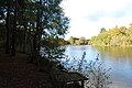
 Colgate, woodland pond - geograph.org.uk - 646867.jpg 640 × 480; 128 KB
-
 Colourful driveway at Benson's House - geograph.org.uk - 4841132.jpg 800 × 600; 190 KB
-
 Conifer Plantation St Leonards Forest - geograph.org.uk - 2994118.jpg 429 × 640; 117 KB
-

-
 Conifers, Race Hill, St Leonards Forest - geograph.org.uk - 1288514.jpg 640 × 430; 147 KB
-
 Conifers, St Leonard's Forest - geograph.org.uk - 3306099.jpg 640 × 426; 80 KB
-
 Conifers, St Leonard's Forest - geograph.org.uk - 3307998.jpg 640 × 426; 88 KB
-
 Conifers, St Leonard's Forest - geograph.org.uk - 3308020.jpg 640 × 426; 94 KB
-
 Conifers, St Leonards Forest (2) - geograph.org.uk - 1288430.jpg 640 × 430; 133 KB
-
 Conifers, St Leonards Forest (geograph 3300819).jpg 640 × 426; 92 KB
-
 Conifers, St Leonards Forest - geograph.org.uk - 1288412.jpg 640 × 430; 116 KB
-
 Control station and covered reservoir - geograph.org.uk - 2959744.jpg 3,264 × 2,448; 4.04 MB
-
 Coolhurst Wood (2) - geograph.org.uk - 1865222.jpg 640 × 430; 178 KB
-
 Coolhurst Wood (3) - geograph.org.uk - 1865233.jpg 640 × 430; 202 KB
-
 Coolhurst Wood - geograph.org.uk - 1865220.jpg 640 × 430; 192 KB
-
 Coolhurst Wood - geograph.org.uk - 2849774.jpg 1,600 × 1,200; 865 KB
-
 Coolhurst Wood off Hammerpond Rd - geograph.org.uk - 1865281.jpg 640 × 430; 175 KB
-
 Coombe Wood - geograph.org.uk - 3298200.jpg 640 × 426; 99 KB
-
 Coombe Wood - geograph.org.uk - 3298203.jpg 640 × 426; 118 KB
-
 Coombe Wood - geograph.org.uk - 3298204.jpg 640 × 426; 106 KB
-
 Coppicing, Coombe Wood - geograph.org.uk - 3298215.jpg 640 × 426; 99 KB
-
 Cottage on Wimland Road, Faygate - geograph.org.uk - 5215506.jpg 1,693 × 1,535; 663 KB
-
 Cottage, Buchan Country Park - geograph.org.uk - 2845345.jpg 640 × 430; 106 KB
-
 Cottages on Faygate Lane - geograph.org.uk - 5870147.jpg 2,048 × 1,536; 1.5 MB
-
 Cottages, Cottesmore School - geograph.org.uk - 2833445.jpg 640 × 430; 67 KB
-
 Cottesmore Golf Course - geograph.org.uk - 2829321.jpg 640 × 430; 101 KB
-
 Cottesmore golf Course - geograph.org.uk - 2829333.jpg 640 × 430; 132 KB
-
 Cottesmore Golf Course - geograph.org.uk - 2829336.jpg 640 × 430; 72 KB
-
 Cottesmore Golf Course - geograph.org.uk - 2836843.jpg 640 × 430; 101 KB
-

-
 Cottesmore Hotel Golf Course - geograph.org.uk - 2833478.jpg 640 × 430; 79 KB
-
 Cottesmore School - geograph.org.uk - 2833452.jpg 640 × 430; 73 KB
-
 Cottesmore School - geograph.org.uk - 2833455.jpg 640 × 430; 76 KB
-
 Cottesmore School - geograph.org.uk - 2833458.jpg 640 × 430; 72 KB
-
 Cottesmore School - geograph.org.uk - 2833463.jpg 640 × 430; 84 KB


.jpg)


.jpg)


_-_geograph.org.uk_-_4752491.jpg)
_-_geograph.org.uk_-_4758294.jpg)
_-_geograph.org.uk_-_4761390.jpg)
_-_geograph.org.uk_-_4761405.jpg)
_-_geograph.org.uk_-_4763672.jpg)
_-_geograph.org.uk_-_4763673.jpg)
_-_geograph.org.uk_-_4764295.jpg)
_-_geograph.org.uk_-_4764299.jpg)
_-_geograph.org.uk_-_4764304.jpg)
_-_geograph.org.uk_-_4764311.jpg)
_-_geograph.org.uk_-_4764314.jpg)
_-_geograph.org.uk_-_4752497.jpg)
_-_geograph.org.uk_-_4764322.jpg)
_-_geograph.org.uk_-_4752747.jpg)
_-_geograph.org.uk_-_4752757.jpg)
_-_geograph.org.uk_-_4752763.jpg)
_-_geograph.org.uk_-_4757720.jpg)
_-_geograph.org.uk_-_4757725.jpg)
_-_geograph.org.uk_-_4758286.jpg)
_-_geograph.org.uk_-_4758289.jpg)


.jpg)
.jpg)


_-_geograph.org.uk_-_1288430.jpg)
.jpg)


_-_geograph.org.uk_-_1865222.jpg)
_-_geograph.org.uk_-_1865233.jpg)


