Category:Colorado State Highway 9
Jump to navigation
Jump to search
 | number: | (nine) |
|---|---|---|
| State highways in Colorado: | 1 · 2 · 3 · 5 · 7 · 8 · 9 · 10 · 11 · 12 · 13 · 14 · 15 · 16 · 17 · 21 · 22 · 23 · 26 |
state highway in Colorado, Untied States .JPG)  | |||||
| Upload media | |||||
| Instance of | |||||
|---|---|---|---|---|---|
| Location |
| ||||
| Transport network | |||||
| Owned by | |||||
| Maintained by | |||||
| Length |
| ||||
| Terminus | |||||
| Partially coincident with | |||||
| |||||
English: Media related to Colorado State Highway 9, a 138.92-mile (223.57 km) state highway in Colorado, United States, that connects U.S. Route 50 (northeast of Parkdale in Fremont County) with U.S. Route 40 in Kremmling in Grand County.
Subcategories
This category has only the following subcategory.
Media in category "Colorado State Highway 9"
The following 13 files are in this category, out of 13 total.
-
 Alma Junction, Colorado.JPG 4,834 × 3,630; 13.16 MB
-
 Colorado 9.svg 601 × 601; 5 KB
-
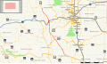 Colorado State Highway 9 Map.svg 1,028 × 609; 2.16 MB
-
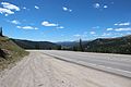 Colorado State Highway 9 near Hoosier Pass, July 2016.jpg 3,456 × 2,304; 4.21 MB
-
 Fairplay 1481.jpg 4,608 × 3,072; 3.43 MB
-
 Hartsel CO US24 2007 09 14.jpg 3,504 × 2,336; 2.04 MB
-
 Middle Fork South Platte River above Alma.JPG 3,796 × 2,889; 7.11 MB
-
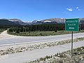
 Silverthorne, Colorado.JPG 5,184 × 3,456; 12.54 MB
-
 South Park - panoramio (18).jpg 3,264 × 2,448; 2.75 MB
-
 South Park - panoramio (19).jpg 3,264 × 2,448; 2.73 MB
-
 South Park National Heritage Area.JPG 5,765 × 3,788; 16.34 MB
-
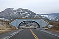
 Wildlife overpass (Colorado State Highway 9).JPG 5,454 × 3,429; 12.9 MB
-
 Wildlife overpass (Colorado State Highway 9)—2.JPG 4,781 × 3,155; 7.16 MB


.jpg)
.jpg)

%E2%80%942.JPG)