Category:Commonwealth War Graves, Den Burg, Texel, the Netherlands
Jump to navigation
Jump to search
| Object location | | View all coordinates using: OpenStreetMap |
|---|
war memorial in Den Burg, the Netherlands  | |||||
| Upload media | |||||
| Instance of | |||||
|---|---|---|---|---|---|
| Commemorates | |||||
| Location | Den Burg, Texel, North Holland, Netherlands | ||||
| Street address |
| ||||
| Creator | |||||
| Inception |
| ||||
| Date of official opening |
| ||||
 | |||||
|
This is a category about a war memorial in the Netherlands, number: 1019
|
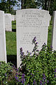
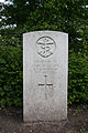
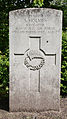
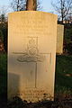
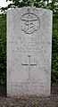
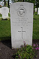
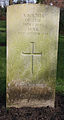
English: Description CWGC: Texel is one of the West Frisian islands and Den Burg is its main town. Follow the signs to Den Helder and then take the ferry to Texel. Coming off the ferry follow the main road towards Den Burg. At the first roundabout turn right, then turn first left into Beatrixlaan. Continue along here and turn left into Kogerstraat which is opposite Boogerd, and the cemetery is at the end of this road. Texel (Den Berg) General Cemetery contains a plot of 167 Commonwealth burials of the Second World War, most of them airmen. 44 of the burials are unidentified.
Nederlands: Oorlogsgraven van het Gemenebest, Erehof Texel
| Address |
|
Media in category "Commonwealth War Graves, Den Burg, Texel, the Netherlands"
The following 95 files are in this category, out of 95 total.
-
 17-Den Burg - Cemetery - A.MG.G Sandars - D.Telfer - W.I. Wheeler - 26-06-1943.JPG 2,592 × 3,888; 3.84 MB
-
 19-Den Burg - Cemetery - J.C. Evans - G.S. Hodges - 26-06-1943.JPG 2,592 × 3,888; 3.78 MB
-
 Den Burg - cemetery- A.Abrahams - Air Bomber - 22-01-1944.JPG 2,592 × 3,888; 4.31 MB
-
 Den Burg - cemetery- K.L. Atkins - Air Bomber - RAF - 15-02-1944.JPG 2,592 × 3,888; 4.41 MB
-
 Den Burg - cemetery- T.A. Austin - Royal Engineers - 27-07-1944.JPG 2,592 × 3,888; 4.1 MB
-
 Den Burg - cemetery-R. Barnes - 11-04-1945. Barnes - 08-04-1945.JPG 2,592 × 3,888; 3.84 MB
-
 22-Den Burg cemetery - H. Beck - R.A.F. - 27-04-1943.JPG 2,592 × 3,888; 2.91 MB
-
 08-Den Burg cemetery - G. Beckett - R.A.F. -17-12-1942.JPG 1,649 × 2,988; 1.86 MB
-
 07-Den Burg cemetery -Lieutenant J.L.M. Bel RN - H.M.S. Peregrine - 02-06-1940.JPG 2,592 × 3,888; 2.88 MB
-
 Den Burg - cemetery- K.H. Berry DFM - piloot - RAF - 15-02-1944.JPG 2,592 × 3,888; 3.48 MB
-
 10-Den Burg - Cemetery - S.F.O. Blackmore - 24-07-1942.JPG 2,592 × 3,888; 3.62 MB
-
 24-Den Burg cemetery -R.B. Broadhurst - R.A.F. - 2-9-1940.JPG 2,592 × 3,888; 5.39 MB
-
 Texel - Den Burg - begraafplaats -68.jpg 1,734 × 2,600; 2.09 MB
-
 05-Den Burg - Cemetery - S.F. Clarke -23-09-1943.JPG 2,592 × 3,888; 3.28 MB
-
 04-Den Burg cemetery - R.N. MC Cleery - 17-12-1942 - Royal Canadian Air Force.JPG 2,592 × 3,888; 3.31 MB
-
 03-Den Burg - Cemetery - A.S. Corlett -23-09-1943.JPG 2,592 × 3,888; 3.47 MB
-
 Den Burg - cemetery- T.R. Court DFC - Air bomber - RAF - 09-09-1944.JPG 1,894 × 3,051; 2.39 MB
-
 20-Den Burg - Cemetery - H. Dalton - H.M.S. Tunisian - 9-7-1942.JPG 2,592 × 3,888; 5.52 MB
-
 Texel - Den Burg - begraafplaats -74.jpg 1,807 × 2,710; 2.23 MB
-
 05-Den Burg cemetery - Sub Lieutenant V.J. Dyke RN. h.m.s. Peregrine - 21-06-1940.JPG 1,906 × 3,165; 2.06 MB
-
 02-Den Burg cemetery - G.G. Ellis - R.A.F. - 27-01-1943.jpg 2,592 × 3,888; 3.69 MB
-
 09-Den Burg - Cemetery - A.J. Ellis-04-10-1943.JPG 2,592 × 3,888; 3.75 MB
-
 Den Burg - cemetery-G.H. Fletcher - 05-04-1945.JPG 1,768 × 3,328; 2.14 MB
-
 23-Den Burg cemetery - W. Foley - R.A.F. - 27-04-1943.JPG 1,849 × 3,228; 2.83 MB
-
 35-Den Burg cemetery - J. Forrest - R.A.F. -23-11-1943.JPG 1,843 × 3,115; 2.04 MB
-
 03-Den Burg cemetery - T. Foster - Royal Artillery - 25-06-1940.JPG 2,080 × 3,242; 2.28 MB
-
 Den Burg - cemetery- W.C. Gadsby - Radio-operator - RAF - 14-02-1944.JPG 2,592 × 3,888; 4.29 MB
-
 32-Den Burg cemetery - F.W. Harris - 23-11-1943 - R.A.F..JPG 2,086 × 3,442; 2.28 MB
-
 26-Den Burg cemetery - B. Hassal - R.A.F. - 17-07-1941.JPG 2,004 × 3,419; 2.75 MB
-
 13-Den Burg cemetery - F.W. Hayden - Able seaman - H.M.S. Wivern - 14-05-1940.JPG 2,592 × 3,888; 4.99 MB
-
 11-Den Burg - Cemetery - J.E.R. Hayter DFC - 4-10-1943.JPG 2,592 × 3,888; 3.59 MB
-
 34-Den Burg cemetery - C.H. Hollingsworth - RAF - 23-11-1943.JPG 1,825 × 3,121; 1.68 MB
-
 16-Den Burg cemetery - S. Holmes - NZ - 17-12-1942.JPG 1,581 × 2,819; 1.95 MB
-
 09-Den Burg cemetery -Sub-Lieutenant F.B. Hooks RN - H.M.S. Peregrine - 2-juni-1940.JPG 1,789 × 2,961; 1.85 MB
-
 Den Burg - cemetery- J. Hulme - Radio-operator - 09-09-1944 - RAF.JPG 2,592 × 3,888; 3.56 MB
-
 10-Den Burg cemetery -G.W. Jones - R.A.F. - 17-12-1942.JPG 1,682 × 2,889; 1.52 MB
-
 04-Den Burg - Cemetery - Zdenek Kothera - 27-04-1942.JPG 2,592 × 3,888; 3.16 MB
-
 Texel - Den Burg - begraafplaats -72.jpg 2,592 × 3,888; 3.2 MB
-
 Den Burg - cemetery- L.N.L. Laver - Air gunner - RAF - 14-01-1944.JPG 2,592 × 3,888; 4.55 MB
-
 12-Den Burg cemetery - J.W. Loree - R.C.A.F - 17-12-1942.JPG 1,706 × 3,202; 2.05 MB
-
 21-Den Burg - Cemetery - N.T. Mac Aulay - 22-06-1943.JPG 2,592 × 3,888; 3.67 MB
-
 06-Den Burg cemetery - K.R. Mac Leod - R.A.F. - 17-12-1942.JPG 2,592 × 3,888; 3.32 MB
-
 21-Den Burg cemetery - K.D. Mac Pherson - 19-07-1940 - R.A.F..JPG 2,592 × 3,888; 3.74 MB
-
 18-Den Burg cemetery - P.J.D. MC Geenhan DFM - NZ - 16-03-1943.JPG 2,024 × 3,669; 2.56 MB
-
 14-Den Burg cemetery - L.G.L. Mc Namara - pilot - 17-12-1942.JPG 1,789 × 3,175; 2.65 MB
-
 15-Den Burg cemetery - G.B. Mitchell - 9-11-1939 - R.A.F..JPG 1,581 × 2,883; 2.01 MB
-
 08-Den Burg - Cemetery - P.Morris -25-06-1942.JPG 2,592 × 3,888; 3.72 MB
-
 17-Den Burg cemetery R.C. Morris DFC - 16-03-1943 - R.A.F..JPG 1,647 × 2,983; 2.12 MB
-
 19-Den Burg cemetery - J.H. New - Maritime Regiment Royal Artillery - 9-02-1943.JPG 1,886 × 3,199; 2.09 MB
-
 Texel - Den Burg - begraafplaats -88.jpg 1,918 × 2,876; 1.75 MB
-
 25-Den Burg cemetery - K. Oatridge - R.A.F. - 27-04-1943.JPG 2,110 × 3,579; 2.44 MB
-
 18-Den Burg - Cemetery - E.H. Patrick - 26-06-1943.JPG 2,592 × 3,888; 3.8 MB
-
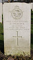 Den Burg - cemetery- J.J. Peacock - boordschutter - RAF -15-02-1944.JPG 1,546 × 2,829; 1.67 MB
-
 30-Den Burg cemetery - J.H.Pepper - 23-11-1943 - R.A.F..JPG 1,962 × 3,407; 2.11 MB
-
 11-Den Burg cemetery - R.G. Poole - H.M.S. Peregrine - 2-juni 1940.JPG 1,693 × 3,127; 1.8 MB
-
 07-Den Burg - Cemetery - J.K. Prudhoe - 4-10-1943.JPG 2,592 × 3,888; 3.23 MB
-
 16-Den Burg - Cemetery - G.J. Sharman - 09-06-1942.JPG 2,592 × 3,888; 3.77 MB
-
 14-Den Burg - Cemetery - F. Skelley - 27-07-1942.JPG 2,592 × 3,888; 3.59 MB
-
 Den Burg - cemetery- C.J. Skinner - Air gunner - RAF - 14-02-1944.JPG 2,592 × 3,888; 4.37 MB
-
 01-Den Burg cemetery -N.G. Smit - 27-01-1943 - Royal Australian Air Force.JPG 1,777 × 3,017; 2.04 MB
-
 12-Den Burg - Cemetery - R.J. Smith - 20-07-1942.JPG 2,592 × 3,888; 3.59 MB
-
 31-Den Burg cemetery G.W. Smith - R.A.F. - 23-11-1943.JPG 1,866 × 3,622; 2.26 MB
-
 Den Burg - cemetery- J,C. Southy - boordschutter - RAF - 15-02-1944.JPG 1,728 × 3,152; 2.53 MB
-
 Den Burg - cemetery- B.E. Stourton - Piloot - RAF - 20-04-1944.JPG 1,377 × 2,754; 1.53 MB
-
 Texel - Den Burg - begraafplaats -80.jpg 1,698 × 2,545; 1.98 MB
-
 22-Den Burg - Cemetery - N.C. Thirkell - 7-8-1941.JPG 2,592 × 3,888; 3.83 MB
-
 Texel - Den Burg - begraafplaats -76.jpg 1,734 × 2,601; 1.7 MB
-
 33-Den Burg cemetery - G.W. Tindle - pilot - 23-11-1943 - RNZAF.JPG 1,944 × 3,068; 1.5 MB
-
 27-Den Burg cemetery - W.H. Trotter - R.A.F. - 5-3-1943.JPG 1,909 × 3,255; 1.93 MB
-
 02-Den Burg - cemetery - Unknown Airman - 8-11-1943.JPG 2,592 × 3,888; 2.81 MB
-
 06-Den Burg - Cemetery - An unknown pilot officer - New Zealand - 29-06-1942.JPG 2,592 × 3,888; 3.62 MB
-
 13-Den Burg - Cemetery - Unknown airman - 29-09-1943.JPG 2,592 × 3,888; 3.82 MB
-
 15-Den Burg - Cemetery - An unknown Airman - 22-09-1943.JPG 2,592 × 3,888; 3.72 MB
-
 20-Den Burg cemetery - Airman - unknown - 3-4-1943.JPG 2,022 × 3,287; 3.03 MB
-
 23-Den Burg - Cemetery - Soldier Unknown - 10-05-1943.JPG 2,592 × 3,888; 6.31 MB
-
 24-Den Burg - Cemetery - Soldier unknown - 11-09-1941.JPG 2,592 × 3,888; 6.61 MB
-
 28-Den Burg cemetery - Pilot Officer - unknown - 7-8-1941.JPG 1,693 × 3,596; 2.07 MB
-
 Den Burg - cemetery- Unknown - Airman - 06-02-1944.JPG 2,592 × 3,888; 3.75 MB
-
 Den Burg - cemetery- Unknown - Airman - 17-04-1945.JPG 1,850 × 3,375; 2.75 MB
-
 Den Burg - cemetery- Unknown - Airman - RAF - 22-06-1944.JPG 2,592 × 3,888; 3.9 MB
-
 Den Burg - cemetery- Unknown - Airman - RAF - 27-05-1944.JPG 2,592 × 3,888; 4.45 MB
-
 Den Burg - cemetery- Unknown - Airman - Royal Airforce -28-09-1944.JPG 1,782 × 3,092; 1.9 MB
-
 Den Burg - cemetery- Unknown - Sergeant R.A.F. - 17 april 1945.JPG 1,822 × 3,220; 1.95 MB
-
 Den Burg - cemetery- Unknown Soldier - 17-04-1945.JPG 2,592 × 3,888; 5.37 MB
-
 Den Burg - cemetery-airman - Royal Airforce - 28-09-1944.JPG 1,701 × 3,010; 2.01 MB
-
 Den Burg - cemetery-Unknown - Airman - 08-07-1945.JPG 1,742 × 3,240; 1.59 MB
-
 Den Burg - cemetery-unknown soldier - 19-10-1944.JPG 1,715 × 3,213; 1.95 MB
-
 Den Burg - cemetery- W.G.E.F. Walton - boordschutter - RAF - 09-09-1944.JPG 2,592 × 3,888; 3.71 MB
-
 Den Burg - cemetery- W.B. Wardle - Navigator - 12-09-1944.JPG 1,789 × 3,044; 2.04 MB
-
 Den Burg - cemetery- R.J. Warren - Sergeant - Royal Australian Airforce - 17-06-1944.JPG 2,592 × 3,888; 3.34 MB
-
 29-Den Burg cemetery - A.D. West - R.A.F. - 23-11-1943.JPG 1,968 × 3,543; 3.13 MB
-
 Den Burg - cemetery- R.L. White -Navigator - RAF - 20-04-1944.JPG 1,498 × 2,956; 1.69 MB
-
 Texel - Den Burg - begraafplaats -69.jpg 2,592 × 3,888; 3.64 MB
-
 Den Burg - cemetery- K. Wilcock - Flight engineer - RAF - 15-02-1944.JPG 2,592 × 3,888; 3.69 MB
-
 01-Den Burg - Cemetery - A.E. Winn Dem - 3-10-1943.JPG 2,592 × 3,888; 2.88 MB


