Category:Congleton
Jump to navigation
Jump to search
town and civil parish in Cheshire East, Cheshire, England, UK   | |||||
| Upload media | |||||
| Instance of | |||||
|---|---|---|---|---|---|
| Location | Cheshire East, Cheshire, North West England, England | ||||
| Different from | |||||
| Said to be the same as | Congleton (Wikimedia duplicated page, civil parish) | ||||
 | |||||
Subcategories
This category has the following 16 subcategories, out of 16 total.
A
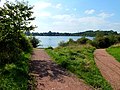
- Astbury Mere (51 F)
B
- Bears in Congleton (6 F)
- The Bridestones (37 F)
C
- Congleton Park (10 F)
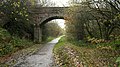
- Congleton Viaduct (6 F)
D
- Dane-in-Shaw Brook (5 F)
- Dane-In-Shaw Pasture (4 F)
- Durham Ox, Congleton (2 F)
H
M
N
- North Rode Viaduct (5 F)
P
T
W
- West Heath, Cheshire (2 F)
Media in category "Congleton"
The following 200 files are in this category, out of 351 total.
(previous page) (next page)-
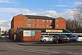
 "Exciting changes" to Tesco's - geograph.org.uk - 1880942.jpg 3,072 × 1,728; 939 KB
-
 14 Moody Street Congleton.jpg 4,032 × 3,024; 2.92 MB
-
 31-37 Chapel Street Congleton.jpg 4,032 × 3,024; 3.27 MB
-
 6 Moody Street Congleton.jpg 4,032 × 3,024; 2.52 MB
-
 8 Biddulph Road Congleton.jpg 4,032 × 3,024; 3.25 MB
-
 A chunky seat - geograph.org.uk - 2166665.jpg 2,040 × 1,530; 803 KB
-
 A lot of steps - geograph.org.uk - 4714646.jpg 6,000 × 4,000; 5.94 MB
-
 A shaft of sunlight in the pinewood - geograph.org.uk - 5224799.jpg 800 × 600; 209 KB
-
 A34 Clayton Bypass - geograph.org.uk - 4146237.jpg 640 × 480; 328 KB
-
 A34 West Road - geograph.org.uk - 2974465.jpg 640 × 480; 50 KB
-
 A34, Sandbach Road - geograph.org.uk - 4146286.jpg 640 × 480; 357 KB
-
 A534 Sandbach Road looking west - geograph.org.uk - 3904657.jpg 640 × 481; 98 KB
-
 A534, Sandbach Road - geograph.org.uk - 4146303.jpg 640 × 480; 236 KB
-
 A54 Buxton Road junction Crossley Lane - geograph.org.uk - 3314094.jpg 3,456 × 2,304; 2.87 MB
-
 A54 crosses the River Dane - geograph.org.uk - 3904656.jpg 640 × 481; 75 KB
-
 A54 entering Congleton - geograph.org.uk - 2877041.jpg 1,024 × 768; 217 KB
-
 A54 near Buglawton Hall - geograph.org.uk - 3904653.jpg 640 × 480; 48 KB
-
 Across the bridge - geograph.org.uk - 2571099.jpg 800 × 591; 97 KB
-
 After the aqueduct - geograph.org.uk - 2168469.jpg 2,008 × 1,430; 888 KB
-
 Along West Street - geograph.org.uk - 2202558.jpg 1,739 × 1,536; 417 KB
-
 An orange valley - geograph.org.uk - 2166714.jpg 2,048 × 1,536; 1.38 MB
-
 Astbury Lane Ends - geograph.org.uk - 2571088.jpg 800 × 672; 132 KB
-
 Autumn colours - geograph.org.uk - 2166681.jpg 2,048 × 1,536; 1.09 MB
-
 Back Park Street car park, Congleton - geograph.org.uk - 5336358.jpg 4,032 × 3,024; 3.12 MB
-
 Barn Road - geograph.org.uk - 1917142.jpg 2,048 × 1,536; 547 KB
-
 Bath-house in Congleton Physic Garden.jpg 4,000 × 3,000; 4.84 MB
-
 Beech trees at the crossroads - geograph.org.uk - 3312965.jpg 2,304 × 3,456; 2.76 MB
-
 Bench mark on Dane Bridge - geograph.org.uk - 2306277.jpg 1,531 × 1,183; 513 KB
-
 Bench mark on the bridge - geograph.org.uk - 2199327.jpg 1,334 × 1,364; 386 KB
-
 Bench mark on The Counting House - geograph.org.uk - 2201977.jpg 1,278 × 1,321; 420 KB
-
 Bench mark on the Lion and Swan - geograph.org.uk - 2175865.jpg 1,373 × 1,553; 493 KB
-
 Bench mark on ^10 West Street, Congleton - geograph.org.uk - 2202565.jpg 1,973 × 1,536; 641 KB
-
 Bench mark, Peover Lane Bridge - geograph.org.uk - 5666022.jpg 1,280 × 1,280; 593 KB
-
 Benchmark by the south gate - geograph.org.uk - 2169201.jpg 1,980 × 1,350; 771 KB
-
 Benchmark on Bridge 72 - geograph.org.uk - 2167209.jpg 2,048 × 1,401; 798 KB
-
 Benchmark on Congleton Edge Chapel - geograph.org.uk - 2160255.jpg 2,983 × 3,521; 2.14 MB
-
 Biddulph Brook - geograph.org.uk - 2166672.jpg 2,048 × 1,536; 800 KB
-
 Biddulph Brook - geograph.org.uk - 2224614.jpg 640 × 480; 144 KB
-
 Biddulph Valley Trail at Dane-in-Shaw - geograph.org.uk - 4297049.jpg 1,024 × 768; 443 KB
-
 Biddulph Valley Trail at Dane-in-Shaw - geograph.org.uk - 4297162.jpg 1,024 × 768; 462 KB
-
 Biddulph Valley Way - geograph.org.uk - 1867721.jpg 1,600 × 1,200; 691 KB
-
 Biddulph Valley Way - geograph.org.uk - 4297192.jpg 1,024 × 768; 509 KB
-
 BIG drainage - geograph.org.uk - 4713933.jpg 6,000 × 4,000; 3.2 MB
-
 Birch Road, West Heath - geograph.org.uk - 1083279.jpg 640 × 480; 59 KB
-
 Black Firs Primary School - geograph.org.uk - 2877013.jpg 1,280 × 960; 1.5 MB
-
 Blue plaque on Bradshaw House, Congleton - geograph.org.uk - 3610429.jpg 1,600 × 1,200; 662 KB
-
 Blue plaque to Elizabeth Wolstenholme Elmy.jpg 938 × 1,252; 96 KB
-
 Bluebells at Dane-in-Shaw,Congleton.jpg 1,024 × 771; 824 KB
-
 Borough of Congleton Roll of Honorary Alderman.jpg 3,024 × 4,032; 2.22 MB
-

-
 Bridestone Shopping Centre, Congleton - geograph.org.uk - 3608356.jpg 1,200 × 1,600; 669 KB
-
 Bridge on the Biddulph Valley Way - geograph.org.uk - 2224595.jpg 640 × 480; 144 KB
-
 Bridge over the Biddulph Valley Way - geograph.org.uk - 4297201.jpg 1,024 × 768; 355 KB
-
 Bridge over the footpath - geograph.org.uk - 2166739.jpg 2,048 × 1,536; 962 KB
-
 Bridge Street, Congleton - geograph.org.uk - 5506720.jpg 1,600 × 1,067; 433 KB
-
 Bromley Road bridge - geograph.org.uk - 2169127.jpg 1,772 × 1,296; 625 KB
-
 Buglawton Bear - geograph.org.uk - 5091201.jpg 1,500 × 1,000; 1.53 MB
-
-
 Bus shelter and housing, West Heath - geograph.org.uk - 2871844.jpg 1,280 × 960; 1.14 MB
-
 Buxton Road at Havannah Lane - geograph.org.uk - 3904654.jpg 640 × 480; 72 KB
-
 Buxton Road near King Street - geograph.org.uk - 3904655.jpg 640 × 480; 74 KB
-
 Camborne Close, Mossley - geograph.org.uk - 2662891.jpg 640 × 480; 66 KB
-
 Canal Road, Congleton - geograph.org.uk - 6207505.jpg 1,024 × 768; 156 KB
-
 Car body repair shop, Congleton - geograph.org.uk - 5336338.jpg 4,032 × 3,024; 4.11 MB
-
 Castle Farm - geograph.org.uk - 4249769.jpg 1,024 × 768; 241 KB
-
 Catkins and trolleys - geograph.org.uk - 1726515.jpg 2,048 × 1,536; 738 KB
-
 Cedar Court, Congleton - geograph.org.uk - 6198350.jpg 1,024 × 768; 111 KB
-
 Chairmen of Congleton Rural District Council (1894-1974).jpg 3,159 × 2,335; 1.18 MB
-
 Changing the light bulb - geograph.org.uk - 2581645.jpg 800 × 675; 270 KB
-
 Chapel at Nick i'th Hill near Biddulph - geograph.org.uk - 5279129.jpg 5,184 × 2,920; 5.01 MB
-
 Chapel House Congleton.jpg 4,032 × 3,024; 4.01 MB
-
 Cheshire farmland - geograph.org.uk - 5666018.jpg 1,280 × 960; 322 KB
-
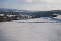 Cheshire in the snow - geograph.org.uk - 2205416.jpg 640 × 430; 116 KB
-
 Chestnut Drive, West Heath - geograph.org.uk - 2876365.jpg 1,280 × 960; 1.16 MB
-
 Clayton Bypass (A34) - geograph.org.uk - 4146241.jpg 640 × 480; 340 KB
-
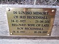 Close-up of the inscription (OpenBenches 4663).jpg 4,032 × 3,024; 2.64 MB
-
 Close-up of the inscription (OpenBenches 4668).jpg 4,032 × 3,024; 3.21 MB
-
 Close-up of the Our Elizabeth statue by Hazel Reeves.jpg 1,280 × 1,022; 1.33 MB
-
 Cockshuts, Congleton 01.jpg 3,000 × 4,000; 4.92 MB
-
 Cockshuts, Congleton 02.jpg 4,000 × 3,000; 5.08 MB
-
 Collecting for charity - geograph.org.uk - 1821692.jpg 2,048 × 1,536; 385 KB
-
 Colleymill Bridge 01.jpg 4,000 × 3,000; 4.81 MB
-
 Colleymill Bridge 02.jpg 4,000 × 3,000; 4.75 MB
-
 Colleymill Bridge 03.jpg 4,000 × 3,000; 4.84 MB
-
 Confluence of the Cow Brook and River Dane - geograph.org.uk - 3314084.jpg 3,456 × 2,304; 3.67 MB
-
 Congleton - a ghastly pastiche - geograph.org.uk - 6117310.jpg 640 × 427; 139 KB
-
 Congleton - Bosley Cloud.jpg 640 × 371; 65 KB
-
 Congleton - The R Dane beside Congleton Park - geograph.org.uk - 5237089.jpg 2,920 × 5,184; 4.89 MB
-
 Congleton 2438.JPG 3,264 × 2,448; 1.97 MB
-
 Congleton 2439.JPG 3,264 × 2,448; 1.98 MB
-
 Congleton Award plaques one.jpg 4,032 × 3,024; 5.68 MB
-
 Congleton Award plaques Two.jpg 4,032 × 3,024; 4.54 MB
-
 Congleton banner.jpg 2,047 × 292; 105 KB
-
 Congleton Bath Vale 2511.JPG 3,264 × 2,448; 2.02 MB
-
 Congleton Bath Vale 2513.JPG 3,264 × 2,448; 2.06 MB
-
 Congleton Bath Vale Footpath 2514.JPG 3,264 × 2,448; 2.06 MB
-
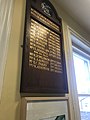
 Congleton Borough Council Mayors board.jpg 4,032 × 3,024; 3.49 MB
-
 Congleton Bromley Road 2516.JPG 3,264 × 2,448; 1.98 MB
-
 Congleton Bromley Road 2521.JPG 3,264 × 2,448; 1.98 MB
-
 Congleton Bromley Road 2526.JPG 3,264 × 2,448; 2.03 MB
-
 Congleton Bromley Road Co-operative2518.JPG 3,264 × 2,448; 1.98 MB
-
 Congleton Bromley Road Pulse 2519.JPG 3,264 × 2,448; 1.99 MB
-
 Congleton Brown Street 2523.JPG 3,264 × 2,448; 1.99 MB
-
 Congleton Business Park - geograph.org.uk - 1361376.jpg 640 × 480; 66 KB
-
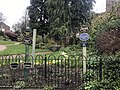
 Congleton Community Gardens - geograph.org.uk - 2202622.jpg 2,048 × 1,536; 630 KB
-
 Congleton Country Park - geograph.org.uk - 5707073.jpg 3,968 × 2,976; 2.41 MB
-
 Congleton Dane Mill 2585.JPG 3,264 × 2,448; 2.07 MB
-
 Congleton Dane Rope Walk 2573.JPG 3,264 × 2,448; 1.99 MB
-
 Congleton Dane Royle Street 2574.JPG 3,264 × 2,448; 2.02 MB
-
 Congleton Edge Methodist Chapel - geograph.org.uk - 2160242.jpg 4,000 × 2,645; 1.85 MB
-
 Congleton Edge War Memorial - geograph.org.uk - 2160342.jpg 2,543 × 3,503; 1.81 MB
-
 Congleton fire station - geograph.org.uk - 188185.jpg 640 × 426; 167 KB
-
 Congleton Golf Club - geograph.org.uk - 2224608.jpg 640 × 480; 112 KB
-
 Congleton High School - geograph.org.uk - 1081701.jpg 640 × 401; 103 KB
-
 Congleton in Bloom Community Garden - geograph.org.uk - 2634622.jpg 1,600 × 1,200; 681 KB
-
 Congleton Lawton Street 2535.JPG 3,264 × 2,448; 1.96 MB
-
 Congleton Lawton Street 2540.JPG 3,264 × 2,448; 1.98 MB
-
 Congleton Lawton Street 2543.JPG 3,264 × 2,448; 2 MB
-
 Congleton Mallard with Ducklings 2592.JPG 3,264 × 2,448; 1.96 MB
-
 Congleton Milestone 2599.jpg 3,264 × 2,448; 1.98 MB
-
 Congleton Old Mill Weir 2441.JPG 3,264 × 2,448; 2.04 MB
-
 Congleton Old Mill Weir 2442.JPG 3,264 × 2,448; 2.05 MB
-
 Congleton Recycling Centre - geograph.org.uk - 1933669.jpg 3,072 × 1,728; 1.15 MB
-
 Congleton Rural District, Cheshire (1970).svg 1,410 × 1,018; 385 KB
-
 Congleton town sign - geograph.org.uk - 5179574.jpg 800 × 600; 197 KB
-
 Congleton War Memorial Hospital - geograph.org.uk - 2200379.jpg 2,020 × 1,233; 562 KB
-
 Congleton Water Tower - geograph.org.uk - 2261426.jpg 1,200 × 797; 310 KB
-
 Congleton, Macclesfield Road (A34) - geograph.org.uk - 4146086.jpg 640 × 480; 272 KB
-
 Congleton, Rood Lane - geograph.org.uk - 4146234.jpg 640 × 480; 258 KB
-
 Congleton, Sandbach Road (A34) - geograph.org.uk - 4146294.jpg 640 × 480; 368 KB
-
 Congleton, West Road - geograph.org.uk - 4146246.jpg 640 × 480; 274 KB
-
 Connecting steps - geograph.org.uk - 4297219.jpg 1,024 × 768; 466 KB
-
 Corda Well Farm (geograph 6603352 by Bill Boaden).jpg 6,000 × 4,000; 3.31 MB
-
 County boundary wall - geograph.org.uk - 5224811.jpg 1,024 × 768; 230 KB
-
 Cow on guard duty! Cheshire - geograph.org.uk - 4262929.jpg 1,024 × 706; 418 KB
-
 Cow on guard! Cheshire - geograph.org.uk - 4262774.jpg 1,024 × 768; 405 KB
-
 Crags on Congleton Edge - geograph.org.uk - 2160137.jpg 4,000 × 3,000; 3.08 MB
-
 Cross Street - geograph.org.uk - 2319736.jpg 2,048 × 1,536; 484 KB
-
 Crossroads at Timbersbrook - geograph.org.uk - 5076293.jpg 1,280 × 818; 334 KB
-
 Crossroads under The Cloud - geograph.org.uk - 5076279.jpg 1,280 × 865; 360 KB
-
 Cut mark on the bridge - geograph.org.uk - 2571012.jpg 800 × 589; 203 KB
-
 Dane valley, from the railway viaduct - geograph.org.uk - 3574064.jpg 1,600 × 679; 214 KB
-
 Dane-in-Shaw pastures. - geograph.org.uk - 5146448.jpg 800 × 500; 118 KB
-
 Dane-in-Shaw railway viaduct (1) - geograph.org.uk - 4297184.jpg 1,024 × 768; 342 KB
-
 Dane-in-Shaw railway viaduct (2) - geograph.org.uk - 4297185.jpg 1,024 × 768; 318 KB
-
 Dane-in-Shaw railway viaduct (3) - geograph.org.uk - 4297187.jpg 1,024 × 768; 261 KB
-
 Date stone on the garage - geograph.org.uk - 2319608.jpg 1,736 × 1,320; 386 KB
-
 Development site, Mossley - geograph.org.uk - 2549312.jpg 640 × 480; 61 KB
-
 Down the hill - geograph.org.uk - 2581635.jpg 800 × 600; 250 KB
-
 Down the steps - geograph.org.uk - 2166748.jpg 2,048 × 1,536; 1.14 MB
-
 EB9 Congleton.png 872 × 896; 1.35 MB
-
 Edge Hill Farm - geograph.org.uk - 2224638.jpg 640 × 480; 74 KB
-
 Edge of the pinewood - geograph.org.uk - 5224809.jpg 1,024 × 768; 522 KB
-
 Elizabeth Street - geograph.org.uk - 2319549.jpg 2,048 × 1,536; 388 KB
-
 Emergency access gate at Astbury Mere Country Park - geograph.org.uk - 5716488.jpg 4,032 × 3,024; 4.19 MB
-
 Entering the park - geograph.org.uk - 2585083.jpg 800 × 590; 274 KB
-
 Entrance to Radnor Park Trading Estate - geograph.org.uk - 2876345.jpg 1,280 × 960; 1.14 MB
-
 Falmouth Road, Mossley - geograph.org.uk - 2662882.jpg 640 × 455; 55 KB
-
 Fields south of the River Dane - geograph.org.uk - 4618666.jpg 800 × 430; 58 KB
-
 Filled-in bench mark - geograph.org.uk - 2306095.jpg 1,176 × 1,261; 290 KB
-
 Fingerpost at Key Green - geograph.org.uk - 5076286.jpg 960 × 1,280; 454 KB
-
 Fingerpost, Tunstall Road at The Cloud - geograph.org.uk - 5076282.jpg 960 × 1,280; 630 KB
-
 Flush Bracket S053 - geograph.org.uk - 2203747.jpg 1,367 × 1,951; 410 KB
-
 Footpath junction - geograph.org.uk - 2581580.jpg 800 × 600; 126 KB
-
 Footpath leading to Thames Close, Congleton - geograph.org.uk - 5329898.jpg 4,032 × 3,024; 5.79 MB
-
 Footpath off Congleton Edge - geograph.org.uk - 2225215.jpg 639 × 480; 240 KB
-
 Footpath off Townsend Road, Congleton - geograph.org.uk - 5329891.jpg 4,032 × 3,024; 6.56 MB
-
 Footpath to the wharf - geograph.org.uk - 2168365.jpg 1,951 × 1,462; 877 KB
-
 Former quarry on Congleton Edge - geograph.org.uk - 2225208.jpg 640 × 480; 243 KB
-
 Former railway chord (1) - geograph.org.uk - 4297205.jpg 1,024 × 768; 435 KB
-
 Former railway chord (2) - geograph.org.uk - 4297210.jpg 1,024 × 768; 334 KB
-
 Fox and Cubs - geograph.org.uk - 2577641.jpg 800 × 767; 182 KB
-
 From Peover Lane Bridge - geograph.org.uk - 5666019.jpg 1,280 × 1,280; 511 KB
-
 From Peover Lane Bridge - geograph.org.uk - 5666020.jpg 1,280 × 960; 476 KB
-
 Gas main renewal works, Back Lane - geograph.org.uk - 2876347.jpg 768 × 1,024; 304 KB
-
 Gateposts - geograph.org.uk - 2168385.jpg 2,048 × 1,401; 951 KB
-
 George VI Letter Box in Congleton (9676195031).jpg 2,448 × 3,264; 3.05 MB
-
-
 Greenfield Road, West Heath - geograph.org.uk - 2871919.jpg 1,024 × 768; 162 KB
-
 Gritstone Trail signpost at Timbersbrook - geograph.org.uk - 1868012.jpg 640 × 480; 146 KB
-
 Hawthorn berries - geograph.org.uk - 2585103.jpg 800 × 633; 436 KB
-
 Heading around the lake - geograph.org.uk - 2581596.jpg 800 × 584; 180 KB
-
 Help is coming - geograph.org.uk - 2581576.jpg 800 × 584; 85 KB
-
 Higher Dane in Shaw Bridge - geograph.org.uk - 2166705.jpg 2,048 × 1,536; 918 KB
-
 Holmes Chapel Road - geograph.org.uk - 2130010.jpg 640 × 480; 84 KB
-
-
 How many walkers ... - geograph.org.uk - 4713940.jpg 5,938 × 3,958; 6.14 MB
-
 Information sign - geograph.org.uk - 2166972.jpg 1,659 × 1,446; 750 KB
-
 Instant woodland - geograph.org.uk - 2032055.jpg 2,048 × 1,536; 640 KB
-
 JowettJupiter2.JPG 2,816 × 2,112; 2.6 MB
-
 Kinsey Street - geograph.org.uk - 2203684.jpg 1,380 × 1,865; 301 KB
-
 Leek Road, Congleton - geograph.org.uk - 6198346.jpg 1,024 × 768; 129 KB
-
 Leek Road, Mossley - geograph.org.uk - 3607097.jpg 1,600 × 1,200; 855 KB
-
 Leek Road, Mossley - geograph.org.uk - 3607264.jpg 1,600 × 1,200; 906 KB
-
 Lilac Court, Congleton - geograph.org.uk - 5332564.jpg 4,032 × 3,024; 3.25 MB
-
 Little Street - geograph.org.uk - 2176026.jpg 1,684 × 1,535; 578 KB
-
 Long shot of the bench (OpenBenches 4662-1).jpg 4,032 × 3,024; 3.43 MB
-
 Long shot of the bench (OpenBenches 4668-1).jpg 4,032 × 3,024; 4.01 MB
-
 Looking back - geograph.org.uk - 2581617.jpg 800 × 600; 200 KB
-
 Looking back to the bridge - geograph.org.uk - 2169105.jpg 3,072 × 1,728; 1.43 MB


.jpg)


_-_geograph.org.uk_-_4146241.jpg)
.jpg)
.jpg)


.svg)


_-_geograph.org.uk_-_4146086.jpg)

_-_geograph.org.uk_-_4146294.jpg)


.jpg)


_-_geograph.org.uk_-_4297184.jpg)
_-_geograph.org.uk_-_4297185.jpg)
_-_geograph.org.uk_-_4297187.jpg)


_-_geograph.org.uk_-_4297205.jpg)
_-_geograph.org.uk_-_4297210.jpg)


.jpg)


.jpg)
.jpg)

