Category:Construction of the Dorchester Extension
Jump to navigation
Jump to search
Media in category "Construction of the Dorchester Extension"
The following 13 files are in this category, out of 13 total.
-
 1925 City of Boston rapid transit lines map.png 2,328 × 3,500; 7.78 MB
-
 Dorchester Extension portal construction from Dorchester Avenue bridge, October 1926.jpg 4,849 × 3,625; 2.29 MB
-
 Dorchester Rapid Transit plan 1923.jpg 2,399 × 3,302; 1.07 MB
-
 Field's Corner station, section 2 field office, September 1926.jpg 4,880 × 3,594; 2.65 MB
-
-
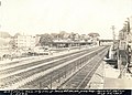
 General southerly view of right of way from Crescent Avenue, July 1927.jpg 4,747 × 3,492; 2.58 MB
-
 Looking northerly in Shawmut station, August 1928.jpg 4,726 × 3,456; 2.58 MB
-
 Looking westerly toward Fields Corner station, July 1927.jpg 4,680 × 3,425; 2.42 MB
-
 Moving Crescent station, October 1926.jpg 3,376 × 2,519; 636 KB
-
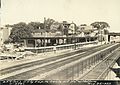
 Northwesterly exposure to Savin Hill station, September 1927.jpg 4,880 × 3,517; 1.9 MB
-
 Southeasterly exposure to Savin Hill station and platform, August 1927.jpg 4,833 × 3,410; 2.53 MB
-
 Southerly view of easterly side of Columbia Station, August 1927.jpg 4,793 × 3,523; 2.55 MB
-
 Southerly view, Rockdale Street, December 1925.jpg 4,787 × 3,456; 2.21 MB


