Category:Cornbury and Wychwood
Jump to navigation
Jump to search
English: Cornbury and Wychwood is a civil parish in West Oxfordshire. It includes the country estate of Cornbury Park (Ordnance Survey grid reference SP350181) and the ancient former Royal Forest of Wychwood, which covers several square miles between Cornbury Park, the village of Leafield (OS grid ref. SP3215) and the hamlet of Mount Skippett (SP352159).
civil parish in West Oxfordshire, England | |||||
| Upload media | |||||
| Instance of | |||||
|---|---|---|---|---|---|
| Location | West Oxfordshire, Oxfordshire, South East England, England | ||||
| Population |
| ||||
 | |||||
Subcategories
This category has the following 2 subcategories, out of 2 total.
C
W
- Wychwood Forest (19 F)
Media in category "Cornbury and Wychwood"
The following 40 files are in this category, out of 40 total.
-
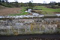
 Benchmark on bridge over River Evenlode - geograph.org.uk - 4249071.jpg 683 × 1,024; 285 KB
-
 Christmas Day walk near Charlbury - geograph.org.uk - 4297638.jpg 3,648 × 2,736; 2.44 MB
-
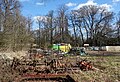
 Cornbury Park - geograph.org.uk - 4297652.jpg 3,648 × 2,736; 3.43 MB
-
 Drive to High Lodge with cattle grid - geograph.org.uk - 6699167.jpg 1,024 × 768; 327 KB
-
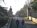
 Entrance to Cornbury Estate - geograph.org.uk - 6371332.jpg 1,024 × 778; 405 KB
-
 Fiveash Bottom - geograph.org.uk - 2566143.jpg 2,560 × 1,920; 2.47 MB
-
 Fiveash Bottom from Hatchings Lane - geograph.org.uk - 2566156.jpg 2,560 × 1,920; 2.35 MB
-
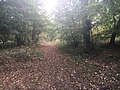
 Footpath near Cornbury Park - geograph.org.uk - 4579919.jpg 3,000 × 4,000; 3.8 MB
-
 Gorse by the Fence - geograph.org.uk - 6136176.jpg 5,139 × 3,648; 5.22 MB
-
 Hatching Lane - geograph.org.uk - 5651228.jpg 640 × 480; 110 KB
-
 Hatching Lane heading north - geograph.org.uk - 6699155.jpg 1,024 × 768; 444 KB
-
 Hatchings Lane - geograph.org.uk - 1096153.jpg 640 × 427; 94 KB
-
 Junction on B4437 - geograph.org.uk - 6699236.jpg 1,024 × 768; 379 KB
-
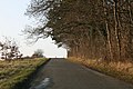
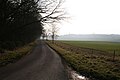
 Lane towards Leafield - geograph.org.uk - 6699188.jpg 1,024 × 768; 506 KB
-
 Leafield Road - geograph.org.uk - 6392675.jpg 800 × 450; 120 KB
-
 Logs in Shocks Copse - geograph.org.uk - 6103977.jpg 4,962 × 3,648; 4.34 MB
-
 Looking South along Hatchings Lane - geograph.org.uk - 1096211.jpg 640 × 427; 60 KB
-
 Northern part of Wychwood Forest - geograph.org.uk - 3985804.jpg 640 × 480; 93 KB
-
 Not the Saw Mill any more - geograph.org.uk - 6101963.jpg 4,560 × 3,100; 2.99 MB
-
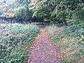
 Path heading towards Vista Gate - geograph.org.uk - 5651216.jpg 640 × 480; 116 KB
-
 Path nearing Hatching Lane - geograph.org.uk - 5651243.jpg 640 × 480; 149 KB
-
 Path nearing Vista Gate - geograph.org.uk - 5651207.jpg 640 × 480; 100 KB
-
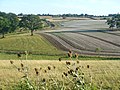
 Rape field, Cornbury Park estate - geograph.org.uk - 6699179.jpg 1,024 × 768; 387 KB
-
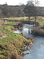 River Evenlode - geograph.org.uk - 4297624.jpg 2,736 × 3,648; 3.82 MB
-
-

-
 River Evenlode near Charlbury - geograph.org.uk - 4579910.jpg 4,000 × 3,000; 3.62 MB
-

-
 Road curving around Wychwood Forest - geograph.org.uk - 6371287.jpg 1,024 × 595; 170 KB
-
 Rocks at the Saw Mill - geograph.org.uk - 6101964.jpg 4,558 × 3,642; 3.54 MB
-
 Sore Leap, according to the map - geograph.org.uk - 6103779.jpg 4,433 × 3,364; 3.26 MB
-
 Track to High Lodge - geograph.org.uk - 1096165.jpg 640 × 427; 59 KB
-
 View over the valley of the Evenlode - geograph.org.uk - 6699232.jpg 1,024 × 768; 458 KB
-
 View towards High Lodge - geograph.org.uk - 6699160.jpg 1,024 × 768; 368 KB
-
 Waterman's Lodge Farm - geograph.org.uk - 6103989.jpg 4,668 × 3,343; 3.02 MB
-
 Woods by Leafield Road - geograph.org.uk - 6286089.jpg 1,878 × 1,214; 1.88 MB
-
 Woods by Leafield Road - geograph.org.uk - 6286091.jpg 1,872 × 1,204; 1.23 MB
-
 Woods by Leafield Road - geograph.org.uk - 6286092.jpg 1,920 × 1,280; 1.41 MB
-
 Junction on Hatchings Lane - geograph.org.uk - 1096195.jpg 640 × 427; 105 KB
-
 Wychwood Way at Five Ash Bottom - geograph.org.uk - 6323350.jpg 5,472 × 3,648; 3.29 MB


