Category:Corrour Estate
Jump to navigation
Jump to search

Estate in Highland, Scotland, UK | |||||
| Upload media | |||||
| Instance of | |||||
|---|---|---|---|---|---|
| Location | Highland, Scottish Highlands, Scotland | ||||
| Connects with |
| ||||
| Has part(s) |
| ||||
| Different from | |||||
| official website | |||||
 | |||||
Corrour Estate, Rannoch Moor, Highland, Scotland.
Note: Category:Corrour Bothy is not related and is in a different part of Scotland.
Subcategories
This category has the following 3 subcategories, out of 3 total.
Media in category "Corrour Estate"
The following 80 files are in this category, out of 80 total.
-
 A clear felled area in Corrour Forest - geograph.org.uk - 1831693.jpg 640 × 427; 280 KB
-
 A wet track in Corrour Forest - geograph.org.uk - 1841049.jpg 640 × 480; 419 KB
-

-
 An old fence in Corrour Forest - geograph.org.uk - 1831730.jpg 640 × 480; 91 KB
-
 An old sign in Corrour Forest - geograph.org.uk - 1828543.jpg 640 × 427; 298 KB
-

-

-
 Bogs, Corrour - geograph.org.uk - 1332067.jpg 640 × 480; 85 KB
-
 Bridge Closed To Walkers - geograph.org.uk - 265393.jpg 640 × 480; 147 KB
-

-
 Corrour Lodge (geograph 2394278).jpg 800 × 530; 179 KB
-
 Corrour Old Lodge (geograph 2167696).jpg 640 × 427; 109 KB
-
 Corrour Old Lodge (ruins), looking west - panoramio.jpg 3,264 × 2,448; 2.34 MB
-
-
 Corrour railway station map 2017 v1.jpg 757 × 505; 163 KB
-
 Corrour, Scottish Gardens.jpg 517 × 381; 70 KB
-
 Gate and cattle grid, Corrour Forest - geograph.org.uk - 2389479.jpg 640 × 424; 101 KB
-
 Gloury path - geograph.org.uk - 899093.jpg 480 × 640; 92 KB
-
 Junction in Corrour Forest - geograph.org.uk - 1831704.jpg 640 × 427; 316 KB
-
 Junction in Corrour Forest - geograph.org.uk - 1831782.jpg 640 × 480; 372 KB
-
 Kaim, Rannoch Moor - geograph.org.uk - 899099.jpg 640 × 359; 54 KB
-
 Lily pond and Loch Ossian from Corrour Lodge (geograph 2391228).jpg 800 × 530; 153 KB
-
 Line of an old fence in Corrour Forest - geograph.org.uk - 1841031.jpg 480 × 640; 383 KB
-
 Loch Ossian - geograph.org.uk - 1194276.jpg 640 × 399; 49 KB
-

-

-
 Loch Ossian.jpg 4,272 × 2,840; 3.26 MB
-
 Locked gate on the road to Corrour - geograph.org.uk - 1831792.jpg 640 × 480; 78 KB
-
 Log piles in Corrour Forest - geograph.org.uk - 1833359.jpg 640 × 427; 345 KB
-
 Looking across Coire Odhar - geograph.org.uk - 911077.jpg 640 × 480; 73 KB
-
 Lot 3, Corrour Forest - geograph.org.uk - 1828541.jpg 640 × 427; 435 KB
-
 Lubnaclach (geograph 3883819).jpg 640 × 480; 458 KB
-
 Lubnaclach in splendid isolation. - geograph.org.uk - 911269.jpg 640 × 480; 94 KB
-
 Lubnaclach ruin - geograph.org.uk - 167172.jpg 640 × 480; 76 KB
-
 Lubnaclach ruins - geograph.org.uk - 1095299.jpg 640 × 480; 76 KB
-
 Memorial near Corrour shooting lodge - geograph.org.uk - 801961.jpg 640 × 427; 78 KB
-
 Moorland, Corrour - geograph.org.uk - 1599964.jpg 640 × 480; 400 KB
-
 Newly replanted area on Corrour Estate - geograph.org.uk - 2391253.jpg 800 × 530; 177 KB
-
 Northern slopes of Meall Natrach Beag - geograph.org.uk - 1016331.jpg 640 × 480; 102 KB
-
 Notice on Corrour Estate gate - geograph.org.uk - 1831800.jpg 640 × 480; 79 KB
-
 Old Corrour Lodge - geograph.org.uk - 1130156.jpg 640 × 464; 73 KB
-
 On the road from Corrour - geograph.org.uk - 1833400.jpg 640 × 427; 260 KB
-
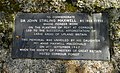 Plaque - Loch Ossian - geograph.org.uk - 2610268.jpg 1,000 × 609; 254 KB
-

-
 Road in Corrour Forest - geograph.org.uk - 1831757.jpg 640 × 427; 301 KB
-

-
 Road junction, Corrour Forest - geograph.org.uk - 2389456.jpg 800 × 530; 176 KB
-
 Road through Corrour Forest - geograph.org.uk - 1831717.jpg 640 × 480; 98 KB
-
-
 Shallow Valley of Allt Ruigh an Ime - geograph.org.uk - 1014147.jpg 640 × 480; 64 KB
-
 Sign at entrance to Corrour Forest - geograph.org.uk - 1828533.jpg 640 × 427; 338 KB
-
 South western slopes of Beinn na Lap - geograph.org.uk - 1640268.jpg 640 × 430; 55 KB
-
 Southern entrance to Corrour Forest - geograph.org.uk - 1833373.jpg 640 × 427; 304 KB
-
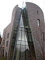
 The Chapel, Corrour Estate - geograph.org.uk - 2168838.jpg 800 × 600; 185 KB
-
 The estate road to Corrour - geograph.org.uk - 2393940.jpg 800 × 530; 156 KB
-

-
 The track to Corrour - geograph.org.uk - 1723797.jpg 640 × 480; 75 KB
-
 Track along the river Ossian - geograph.org.uk - 801946.jpg 640 × 427; 33 KB
-
 Track by Loch Ossian - geograph.org.uk - 1654358.jpg 640 × 480; 52 KB
-

-
 Track in Corrour Forest - geograph.org.uk - 1841042.jpg 640 × 480; 397 KB
-
 Track in Corrour Forest - geograph.org.uk - 1841061.jpg 640 × 471; 437 KB
-
 Windows, Old Corrour Lodge - geograph.org.uk - 1350347.jpg 640 × 480; 139 KB
-
 At the top of Sron na Lagain Ghairbh - geograph.org.uk - 193340.jpg 640 × 480; 92 KB
-
 Bridge over River Ossian - geograph.org.uk - 265381.jpg 640 × 480; 191 KB
-
 Corrour Lodge - geograph.org.uk - 359086.jpg 640 × 480; 106 KB
-
 Corrour Lodge jetty and boat house - geograph.org.uk - 729420.jpg 640 × 480; 86 KB
-
 Corrour Old Lodge Rannoch Moor - geograph.org.uk - 286007.jpg 640 × 389; 57 KB
-
 Corrour road, Druim an Diabhail - geograph.org.uk - 262758.jpg 640 × 480; 90 KB
-
 Corrour Shooting Lodge - geograph.org.uk - 113785.jpg 640 × 480; 97 KB
-
 Corrour Shooting Lodge - geograph.org.uk - 729414.jpg 480 × 640; 64 KB
-
 Gate and stile beside Loch Ossian - geograph.org.uk - 265370.jpg 640 × 480; 221 KB
-
-
 Stalkers' Path up Bealach Cumhann - geograph.org.uk - 142900.jpg 640 × 480; 60 KB
-
 The road to Corrour - geograph.org.uk - 655376.jpg 640 × 480; 55 KB
-

-
 Track from Loch Ossian to Corrour Station - geograph.org.uk - 265348.jpg 1,024 × 768; 541 KB
-
 Track from Loch Ossian to Corrour Station - geograph.org.uk - 265353.jpg 640 × 480; 148 KB
-
 Track through the Corrour Estate - geograph.org.uk - 265384.jpg 640 × 480; 253 KB
-
 Uisge Labhair and Loch Ossian - geograph.org.uk - 263424.jpg 1,024 × 768; 261 KB


.jpg)
.jpg)
,_looking_west_-_panoramio.jpg)


.jpg)


.jpg)


_-_geograph.org.uk_-_1266830.jpg)