Category:Cosby, Leicestershire
Jump to navigation
Jump to search
English: Cosby is a village in the English county of Leicestershire. Cosby is located in the south-west of the county near the larger villages and towns of Whetstone, Blaby and Wigston. Its proximity to the city of Leicester means it is part of the Leicester Urban Area.
village and civil parish in Leicestershire, United Kingdom | |||||
| Upload media | |||||
| Instance of | |||||
|---|---|---|---|---|---|
| Location | Blaby, Leicestershire, East Midlands, England | ||||
| Different from | |||||
 | |||||
Subcategories
This category has the following 3 subcategories, out of 3 total.
C
- Cosby Victory Show (220 F)
Media in category "Cosby, Leicestershire"
The following 160 files are in this category, out of 160 total.
-
 A field of maize - geograph.org.uk - 3671984.jpg 4,000 × 3,000; 3.48 MB
-
 A field of sheep near Cosby Spinneys - geograph.org.uk - 3926145.jpg 1,600 × 1,200; 821 KB
-
 Ash Tree Road, Cosby - geograph.org.uk - 5697065.jpg 640 × 640; 92 KB
-
 B4114 Coventry Road - geograph.org.uk - 3268449.jpg 2,690 × 1,979; 1.45 MB
-
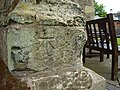 Benchmark on Cosby church tower - geograph.org.uk - 4501622.jpg 2,560 × 1,920; 1.05 MB
-
 Bridge identifier - geograph.org.uk - 2790823.jpg 631 × 640; 130 KB
-
 Bridleway to Cosby - geograph.org.uk - 191333.jpg 640 × 480; 95 KB
-
 Broughton Road - geograph.org.uk - 3157142.jpg 640 × 480; 74 KB
-
 Cambridge Road - geograph.org.uk - 3157171.jpg 640 × 480; 68 KB
-
 Car park along Croft Road - geograph.org.uk - 4163815.jpg 1,600 × 1,080; 491 KB
-
 Chiltern Avenue in Cosby - geograph.org.uk - 5427146.jpg 800 × 460; 70 KB
-
 Christmas lights in Cosby - geograph.org.uk - 5621389.jpg 633 × 800; 170 KB
-
 Church View Cottage in Cosby - geograph.org.uk - 5602301.jpg 800 × 531; 114 KB
-
 Co-op on Cosby Main Street - geograph.org.uk - 6425426.jpg 800 × 462; 81 KB
-
 Cosby - geograph.org.uk - 60872.jpg 640 × 480; 135 KB
-
 Cosby Brook at the Nook in Cosby - geograph.org.uk - 5617862.jpg 800 × 384; 99 KB
-
 Cosby Brook in Cosby - geograph.org.uk - 5283940.jpg 800 × 611; 183 KB
-
 Cosby Brook in Cosby - geograph.org.uk - 5602315.jpg 800 × 468; 158 KB
-
 Cosby Brook in Cosby - geograph.org.uk - 5602316.jpg 800 × 587; 235 KB
-
 Cosby Brook in Cosby - geograph.org.uk - 5602319.jpg 800 × 474; 169 KB
-
 Cosby Brook in Cosby - geograph.org.uk - 5615548.jpg 756 × 800; 234 KB
-
 Cosby Church - geograph.org.uk - 2433781.jpg 480 × 640; 44 KB
-
 Cosby cows - geograph.org.uk - 509662.jpg 640 × 444; 128 KB
-
 Cosby Footpath - geograph.org.uk - 2431579.jpg 640 × 480; 130 KB
-
 Cosby Footpath - geograph.org.uk - 2433552.jpg 640 × 480; 63 KB
-
 Cosby Ford - geograph.org.uk - 3264124.jpg 3,872 × 2,592; 2.33 MB
-
 Cosby Hill - M1 Motorway - geograph.org.uk - 2296826.jpg 640 × 527; 67 KB
-
 Cosby Hill Bridge - geograph.org.uk - 2293440.jpg 640 × 480; 147 KB
-
 Cosby Huntsman - geograph.org.uk - 2846943.jpg 640 × 480; 121 KB
-
 Cosby Lane Bridge - geograph.org.uk - 2437675.jpg 640 × 480; 83 KB
-
 Cosby Lane-Great Central Railway - geograph.org.uk - 2437656.jpg 640 × 480; 117 KB
-
 Cosby Library - geograph.org.uk - 3157161.jpg 1,600 × 957; 382 KB
-

-
 Cosby Post Office - geograph.org.uk - 2434559.jpg 640 × 480; 63 KB
-
 Cosby Post Office - geograph.org.uk - 509665.jpg 640 × 535; 126 KB
-
 Cosby Road near Littlethorpe - geograph.org.uk - 2678499.jpg 3,264 × 2,448; 2.1 MB
-
 Cosby Spinneys - geograph.org.uk - 2431997.jpg 640 × 480; 60 KB
-
 Cosby Spinneys Farm - geograph.org.uk - 3926141.jpg 1,600 × 1,270; 633 KB
-
 Cosby village centre.jpg 750 × 562; 95 KB
-
 Cosby village sign - geograph.org.uk - 5614750.jpg 737 × 800; 122 KB
-
 Cosby, barn in village centre.jpg 2,048 × 1,536; 776 KB
-
 Cosby-Bangla Lodge - geograph.org.uk - 2433777.jpg 640 × 517; 55 KB
-
 Cosby-Bramble Walk - geograph.org.uk - 2433545.jpg 480 × 640; 115 KB
-
 Cosby-Bramble Walk - geograph.org.uk - 2434490.jpg 640 × 480; 90 KB
-
 Cosby-Bramble Walk - geograph.org.uk - 2451534.jpg 640 × 480; 125 KB
-
 Cosby-Cambridge Road - geograph.org.uk - 2432318.jpg 640 × 480; 84 KB
-
 Cosby-Croft Road - geograph.org.uk - 2433794.jpg 640 × 480; 62 KB
-
 Cosby-Great Central Railway - geograph.org.uk - 2431542.jpg 640 × 480; 118 KB
-
 Cosby-Great Central Railway - geograph.org.uk - 2434439.jpg 640 × 480; 126 KB
-
 Cosby-Great Central Railway - geograph.org.uk - 2434455.jpg 640 × 480; 123 KB
-
 Cosby-Main Street - geograph.org.uk - 2434521.jpg 640 × 480; 61 KB
-
 Cosby-The Bunning Hall - geograph.org.uk - 2434550.jpg 640 × 480; 50 KB
-
 Cosby-The Cranny in the Nook - geograph.org.uk - 2431624.jpg 640 × 480; 55 KB
-
 Cosby-The Old Barn - geograph.org.uk - 2432303.jpg 640 × 480; 85 KB
-
 Cosby-Whetstone Golf Club - geograph.org.uk - 1276234.jpg 640 × 480; 114 KB
-
 Coventry Road (B4114) - geograph.org.uk - 5224339.jpg 640 × 480; 56 KB
-
 Coventry Road (B4114) - geograph.org.uk - 5224367.jpg 640 × 480; 63 KB
-
 Croft Road - geograph.org.uk - 5835539.jpg 4,000 × 3,000; 2.98 MB
-
 Croft Road at Foxlands Farm - geograph.org.uk - 3926127.jpg 1,600 × 1,196; 427 KB
-
 Croft Road heading towards Croft Hill - geograph.org.uk - 3926147.jpg 1,600 × 1,200; 488 KB
-
 Croft Road in Cosby - geograph.org.uk - 5617835.jpg 681 × 800; 187 KB
-
 Croft Road near Cosby Spinneys - geograph.org.uk - 3926143.jpg 1,600 × 1,200; 704 KB
-
 Croft Road on the edge of Cosby - geograph.org.uk - 5588039.jpg 800 × 581; 113 KB
-
 Croft Road towards the B4114 Coventry Road - geograph.org.uk - 3927390.jpg 1,600 × 1,131; 447 KB
-

-
 Daffodils along Cosby Brook - geograph.org.uk - 6421903.jpg 800 × 492; 134 KB
-
 Farmland near Cosby - geograph.org.uk - 2678529.jpg 2,582 × 2,084; 1.86 MB
-
 Farmland near Flash Farm - geograph.org.uk - 4449095.jpg 640 × 426; 40 KB
-
 Farmland near Lodge Farm - geograph.org.uk - 4449088.jpg 640 × 426; 43 KB
-
 Farmland near Thorne Hill Farm - geograph.org.uk - 3157126.jpg 640 × 480; 77 KB
-
 Farmland off Broughton Road - geograph.org.uk - 3157135.jpg 640 × 480; 76 KB
-
 Field along Narborough Road in Cosby - geograph.org.uk - 4163939.jpg 1,600 × 1,200; 634 KB
-

-
 Field near Cosby - geograph.org.uk - 2678513.jpg 1,820 × 1,407; 693 KB
-
 Flooded fields near the River Soar - geograph.org.uk - 4329363.jpg 1,600 × 1,259; 708 KB
-
 Footbridge across Cosby Brook, Cosby - geograph.org.uk - 5283929.jpg 800 × 616; 198 KB
-
 Footbridge across Cosby Brook, Cosby - geograph.org.uk - 5621388.jpg 800 × 518; 161 KB
-
 Footpath from Cosby to Croft - geograph.org.uk - 5835522.jpg 4,000 × 3,000; 3.47 MB
-
 Footpath from Cosby to Croft - geograph.org.uk - 5835528.jpg 4,000 × 3,000; 3.43 MB
-
 Footpath from Cosby to Croft - geograph.org.uk - 5835537.jpg 4,000 × 3,000; 3.75 MB
-
 Footpath through a field of maize - geograph.org.uk - 3671989.jpg 4,000 × 3,000; 5.19 MB
-
 Footpath to Cosby crosses the Midland Counties Railway - geograph.org.uk - 5918159.jpg 4,000 × 3,000; 4.24 MB
-
 Footpath to Littlethorpe - geograph.org.uk - 5224340.jpg 480 × 640; 70 KB
-
 Footpath to Littlethorpe - geograph.org.uk - 5224342.jpg 640 × 480; 66 KB
-

-

-
 FV-433 Abbot self propelled gun - geograph.org.uk - 4163927.jpg 1,600 × 1,131; 398 KB
-
 Grazing off Coventry Road (B4114) - geograph.org.uk - 5224343.jpg 640 × 480; 59 KB
-
 Greenspace on Brooklands Road in Cosby - geograph.org.uk - 5588034.jpg 800 × 427; 138 KB
-
 Hedgerow and field - geograph.org.uk - 3157124.jpg 640 × 480; 64 KB
-
 Houses on Brooklands Road in Cosby - geograph.org.uk - 5338154.jpg 800 × 552; 171 KB
-
 Hurricane and Spitfire - geograph.org.uk - 4163956.jpg 1,600 × 1,237; 170 KB
-
 Looking to Leicester - geograph.org.uk - 2173323.jpg 800 × 531; 101 KB
-
 M1 Motorway bridge - geograph.org.uk - 509652.jpg 623 × 640; 134 KB
-
 Narborough Road in Cosby - geograph.org.uk - 5602295.jpg 800 × 441; 104 KB
-
 Narborough Road, Cosby - geograph.org.uk - 509648.jpg 640 × 496; 120 KB
-
 Outside the co-operative store - geograph.org.uk - 5614745.jpg 800 × 471; 70 KB
-

-
 Park Road, Cosby - geograph.org.uk - 3157165.jpg 640 × 480; 63 KB
-
 Path and allotments at Cosby - geograph.org.uk - 5617808.jpg 800 × 418; 108 KB
-
 Public footpath along Croft Road - geograph.org.uk - 3926132.jpg 1,600 × 1,420; 584 KB
-
 Railways Crossing - geograph.org.uk - 2432557.jpg 640 × 480; 111 KB
-
 Rugby-Leicester Line - geograph.org.uk - 2432518.jpg 640 × 480; 95 KB
-
 Rugby-Leicester Line - geograph.org.uk - 2432535.jpg 480 × 640; 103 KB
-
 Rugby-Leicester Line - geograph.org.uk - 2434506.jpg 640 × 480; 107 KB
-
 Saint Michael and All Angels church - geograph.org.uk - 5835520.jpg 3,791 × 2,843; 1.94 MB
-

-

-

-
 South Leicestershire Railway - geograph.org.uk - 5781564.jpg 3,794 × 2,842; 2.51 MB
-
 Spectators for the Cosby Victory Show - geograph.org.uk - 2678442.jpg 2,755 × 2,052; 1.51 MB
-
 Sports field, Cosby - geograph.org.uk - 3157168.jpg 640 × 480; 51 KB
-
 Stream beside Main Street, Cosby - geograph.org.uk - 3157157.jpg 640 × 480; 122 KB
-
 Stubbly field near Cosby - geograph.org.uk - 2678524.jpg 2,078 × 1,435; 965 KB
-
 Temporary Shelter - geograph.org.uk - 2432548.jpg 640 × 480; 143 KB
-
 The Blacksmiths Arms - geograph.org.uk - 509657.jpg 640 × 513; 117 KB
-
 The Cemetery Chapel, Cosby - geograph.org.uk - 509647.jpg 640 × 427; 125 KB
-
 The Main Street in Cosby - geograph.org.uk - 5614091.jpg 800 × 722; 168 KB
-
 The Old Barn in Cosby - geograph.org.uk - 5251733.jpg 800 × 552; 116 KB
-
 Thornhill Farm - geograph.org.uk - 3157139.jpg 640 × 480; 61 KB
-
 Thornhill Farm - geograph.org.uk - 509669.jpg 640 × 537; 102 KB
-
 Three routes - geograph.org.uk - 5918158.jpg 4,000 × 3,000; 3.7 MB
-
 Approaching Cosby - geograph.org.uk - 509645.jpg 640 × 397; 118 KB
-
 Approaching Cosby - geograph.org.uk - 509664.jpg 640 × 469; 123 KB
-
 Broughton Road towards Cosby - geograph.org.uk - 509670.jpg 640 × 480; 111 KB
-
 Cambridge Road towards Whetstone - geograph.org.uk - 509651.jpg 640 × 499; 114 KB
-
 Cambridge Road, Cosby - geograph.org.uk - 509653.jpg 640 × 502; 109 KB
-
 Cosby Golf Course - geograph.org.uk - 164635.jpg 640 × 427; 144 KB
-
 Cosby Golf Course - geograph.org.uk - 509667.jpg 640 × 480; 125 KB
-
 Cosby Spinneys from Croft Road - geograph.org.uk - 229249.jpg 640 × 427; 110 KB
-
 Cottage Lane near Cosby Lodge - geograph.org.uk - 726440.jpg 640 × 468; 71 KB
-
 Countesthorpe Road, Cosby - geograph.org.uk - 509661.jpg 640 × 527; 110 KB
-
 Croft Road, Leicestershire - geograph.org.uk - 511811.jpg 640 × 475; 89 KB
-
 Croft Road, Leicestershire - geograph.org.uk - 511827.jpg 640 × 627; 105 KB
-
 Farmland at Whetstone Gorse - geograph.org.uk - 164691.jpg 640 × 427; 123 KB
-
 Farmland near Cosby, Leicestershire - geograph.org.uk - 229261.jpg 640 × 427; 116 KB
-
 Farmland near Cosby, Leicestershire - geograph.org.uk - 229280.jpg 640 × 427; 113 KB
-

-
 Farmland off Willoughby Lane - geograph.org.uk - 164770.jpg 640 × 427; 115 KB
-
 Farmland on Shuttleworth Lane near Cosby - geograph.org.uk - 164644.jpg 640 × 427; 144 KB
-
 Farmland on Shuttleworth Lane near Cosby - geograph.org.uk - 164647.jpg 640 × 427; 133 KB
-
 Junction in Cosby, Leicestershire - geograph.org.uk - 509649.jpg 640 × 463; 129 KB
-
 Lane near Willoughby Waterleys - geograph.org.uk - 169194.jpg 640 × 480; 97 KB
-
 Looking towards Cosby Spinneys - geograph.org.uk - 511820.jpg 551 × 640; 121 KB
-
 Main Street, Cosby - geograph.org.uk - 509655.jpg 640 × 554; 136 KB
-
 Narborough Road, Cosby, Leicestershire - geograph.org.uk - 164602.jpg 640 × 427; 122 KB
-
 Narborough Road, Cosby, Leicestershire - geograph.org.uk - 164610.jpg 640 × 427; 122 KB
-
 Old barn on Croft Road, Cosby - geograph.org.uk - 164614.jpg 640 × 427; 121 KB
-
 Pond near Cosby Hill - geograph.org.uk - 169190.jpg 640 × 480; 132 KB
-
 Shuttleworth Lane near Cosby - geograph.org.uk - 164631.jpg 640 × 427; 194 KB
-
 Shuttleworth Lane near Cosby - geograph.org.uk - 509666.jpg 640 × 473; 126 KB
-
 Shuttleworth Lane south of Cosby - geograph.org.uk - 509668.jpg 472 × 640; 116 KB
-
 Springwell Lane, Whetstone near Leicester - geograph.org.uk - 164919.jpg 640 × 427; 152 KB
-
 The Nook, Cosby, Leicestershire - geograph.org.uk - 164608.jpg 640 × 427; 147 KB
-
 ZTS Martin T-55 Main Battle Tank - geograph.org.uk - 4163844.jpg 1,600 × 1,131; 451 KB
-

-

-

-
 Willoughby Road - geograph.org.uk - 164768.jpg 640 × 480; 159 KB
-


_-_geograph.org.uk_-_5224339.jpg)
_-_geograph.org.uk_-_5224367.jpg)


_-_geograph.org.uk_-_5223031.jpg)


_-_geograph.org.uk_-_5224343.jpg)


