Category:County Trunk Highway K (Dane County, Wisconsin)
Jump to navigation
Jump to search

English: County Trunk Highway K runs from Wisconsin Highway 19 east of Marxville in the town of Berry to County Trunk Highway M in the town of Westport.
Media in category "County Trunk Highway K (Dane County, Wisconsin)"
The following 16 files are in this category, out of 16 total.
-
 Ashton Wisconsin - panoramio (1).jpg 4,896 × 3,672; 5.34 MB
-
 Ashton Wisconsin - panoramio (2).jpg 4,896 × 3,672; 5.81 MB
-
 Ashton Wisconsin - panoramio.jpg 4,896 × 3,672; 6.59 MB
-
 Ashton, Wisconsin - panoramio.jpg 3,072 × 2,304; 1.45 MB
-
 County Trunk Highway K - panoramio (1).jpg 4,877 × 3,325; 5.33 MB
-
 County Trunk Highway K - panoramio (2).jpg 4,887 × 3,101; 5.63 MB
-
 County Trunk Highway K - panoramio (3).jpg 4,896 × 3,391; 4.03 MB
-
 County Trunk Highway K - panoramio.jpg 4,608 × 3,456; 6.65 MB
-
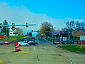
 County Trunk Highway P at County Trunk Highway K - panoramio.jpg 4,896 × 3,672; 5.28 MB
-
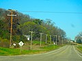
 Farm on County Highway K - panoramio.jpg 4,608 × 3,456; 5.51 MB
-
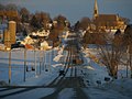
 Historic St Peter's Catholic Church - panoramio.jpg 4,608 × 3,456; 5.56 MB
-
 St. Peter's Steeple - panoramio.jpg 4,896 × 3,672; 4.99 MB
-
 Statue of St. Peter - panoramio.jpg 4,608 × 3,456; 7.28 MB
-
 US Highway 12 ^ County Hwy K - panoramio.jpg 4,879 × 2,941; 4.07 MB
-
 US Highway 12 ^ County Trunk Highway K - panoramio.jpg 4,896 × 3,672; 4.91 MB
-
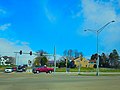 US Highway 12 ^ Hwy K - panoramio.jpg 4,896 × 3,672; 4.87 MB
.jpg)
.jpg)


.jpg)
.jpg)
.jpg)


