Category:County maps of England by John Speed
Jump to navigation
Jump to search
Media in category "County maps of England by John Speed"
The following 48 files are in this category, out of 48 total.
-
 John Speed - Map of the Isle of Wight - 1610 - 001.jpg 3,500 × 2,622; 3.56 MB
-
 17th Century map of Cheshire.JPG 3,456 × 2,592; 5.39 MB
-
 17th Century map of County Durham.JPG 2,048 × 1,536; 1.01 MB
-
 17th Century map of Rutlandshire.jpg 3,456 × 2,592; 5.32 MB
-
 17th Century map of Shropshire.jpg 3,456 × 2,592; 5.18 MB
-
 17th Century map of Staffordshire.jpg 3,456 × 2,592; 4.96 MB
-
 17th Century map of Warwickshire.jpg 3,456 × 2,592; 5.83 MB
-
 17th Century map of Westmorland and Cumberland.jpg 3,456 × 2,592; 4.95 MB
-
 17th Century map of Worcestershire.jpg 3,456 × 2,592; 4.94 MB
-
 17the Century map of Linster.jpg 3,456 × 2,592; 7.43 MB
-
 17the Century map of Montgomeryshire and Merioniothshire.jpg 3,456 × 2,592; 6.61 MB
-
 17the Century map of Mounmouthshire.jpg 3,456 × 2,592; 5.24 MB
-
 17the Century map of Nottinghamshire.jpg 3,456 × 2,592; 5.82 MB
-
 Antigua Inglaterra.jpg 1,300 × 936; 345 KB
-
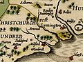 Arnwood on a 1611 map of Hampshire by John Speed.jpg 800 × 600; 184 KB
-
 Cambridgshire described with the devision of the hundreds.jpg 6,376 × 4,770; 6.09 MB
-
 John Speed - Map of Cumberland - 1610 - 001.jpg 2,992 × 2,268; 3.29 MB
-
 Durham - John Speed Map.jpg 6,497 × 5,015; 5.08 MB
-
 John Speed - Berkshire - 1610 - 001.jpg 3,000 × 2,252; 3.23 MB
-
 John Speed - Map of Cambridgeshire - 1610 - 001.jpg 3,000 × 2,291; 3.46 MB
-
 John Speed - Map of Cheshire - 1610 - 001.jpg 3,000 × 2,246; 2.99 MB
-
 John Speed - Map of Cornwall - 1614 - 001.jpg 2,972 × 2,240; 3.49 MB
-
 John Speed - Map of Derbyshire - 1610 - 001.jpg 3,000 × 2,269; 3.34 MB
-
 John Speed - Map of Devonshire - 1610 - 001.jpg 3,000 × 2,272; 2.85 MB
-
 John Speed - Map of Dorsetshire - 1610 - 001.jpg 3,000 × 2,247; 3.17 MB
-
 John Speed - Map of Durham - 001.jpg 3,000 × 2,236; 2.62 MB
-
 John Speed - Map of Essex - 1610 - 001.jpg 3,500 × 2,632; 3.44 MB
-
 John Speed - Map of Gloucestershire - 1610 - 001.jpg 3,500 × 2,618; 3.19 MB
-
 John Speed - Map of Hampshire - 1610 - 001.jpg 3,500 × 2,611; 3.07 MB
-
 John Speed - Map of Hampshire.jpg 3,125 × 2,358; 1.69 MB
-
 John Speed - Map of Herefordshire - 1610 - 001.jpg 3,500 × 2,636; 3.75 MB
-
 John Speed - Map of Hertfordshire - 1610 - 001.jpg 3,500 × 2,623; 3.37 MB
-
 John Speed - Map of Huntingdonshire - 1610 - 001.jpg 3,500 × 2,655; 3.8 MB
-
 John Speed - Maps of Buckinghamshire - 1610 - 001.jpg 3,000 × 2,279; 2.61 MB
-
 John Speed Wiltshire.jpg 1,754 × 1,350; 3.85 MB
-
 Lancashire 1610 Speed Hondius - Restoration.jpg 2,610 × 2,000; 7.34 MB
-
 Lancashire 1610 Speed Hondius - Restoration.png 2,610 × 2,000; 11.37 MB
-
 Lancashire 1610 Speed Hondius.jpg 6,456 × 4,971; 9.9 MB
-
 Lancashire 1610 Speed Hondius.png 6,456 × 4,971; 55.97 MB
-
 North.Lancashire.1610.jpg 1,800 × 1,197; 308 KB
-
 Old Map of Cornwall c.1610.jpg 1,410 × 1,068; 2.24 MB
-
 Old Maps - Bedfordshire.jpg 700 × 529; 104 KB
-
 Southwest.Lancashire.1610.jpg 1,265 × 1,800; 276 KB
-
 Speed Northampton.jpg 6,240 × 4,680; 24.29 MB
-
 Speed's Map of Surrey 1610 colour full.jpg 1,573 × 1,200; 2.58 MB
-
 Staffordshire - John Speed map 1610.jpg 6,586 × 5,001; 4.71 MB
-
 Warwickshire - John Speed Map 1610.jpg 6,591 × 5,033; 5.28 MB
-
 Wiltshire – John Speed map, 1611.jpg 1,600 × 1,215; 714 KB


