Category:County maps of UK parliamentary constituencies 1983
Jump to navigation
Jump to search
County maps of UK parliamentary constituencies created by the Third Periodic Review of Parliamentary constituencies
Media in category "County maps of UK parliamentary constituencies 1983"
The following 16 files are in this category, out of 16 total.
-
 Bedfordshire1983.svg 39 × 57; 11 KB
-
 Berkshire1983.svg 73 × 28; 14 KB
-
 Buckinghamshire1983.svg 474 × 776; 418 KB
-
 Buckinghamshire1992.svg 480 × 797; 422 KB
-
 Cambridgeshire1983.svg 69 × 81; 14 KB
-
 Cheshire1983.svg 2,161 × 1,528; 1.12 MB
-
 Cleveland1983.svg 713 × 500; 1,018 KB
-
 Durham1983.svg 824 × 621; 1.33 MB
-
 Essex1983.svg 89 × 71; 31 KB
-
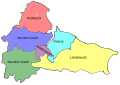
 Hertfordshire1983.svg 64 × 54; 23 KB
-
 Norfolk1983.svg 106 × 68; 19 KB
-
 Northumberland1983.svg 201 × 295; 41 KB
-
 Oxfordshire1983.svg 58 × 78; 14 KB
-
 Oxfordshire1983revised.svg 58 × 78; 14 KB
-
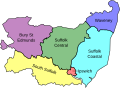 Suffolk1983.svg 94 × 69; 12 KB
-
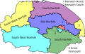
 TyneandWear1983.svg 1,051 × 744; 1.37 MB


