Category:Coventry, Rhode Island
Jump to navigation
Jump to search
town in Kent County, Rhode Island, United States   | |||||
| Upload media | |||||
| Instance of | |||||
|---|---|---|---|---|---|
| Named after | |||||
| Location | Kent County, Rhode Island | ||||
| Has part(s) |
| ||||
| Population |
| ||||
| Area |
| ||||
| Elevation above sea level |
| ||||
| official website | |||||
 | |||||
Subcategories
This category has the following 11 subcategories, out of 11 total.
A
- Arkwright Bridge (4 F)
H
- Harris Mill, Coventry (3 F)
- Harris, Rhode Island (1 F)
P
- Parker Woodland (7 F)
Q
- Quidnick, Rhode Island (3 F)
R
- Rice City Historic District (2 F)
Media in category "Coventry, Rhode Island"
The following 40 files are in this category, out of 40 total.
-
 Anthony Mill, Coventry, RI.jpg 5,728 × 3,824; 3.5 MB
-
 Applebee's (Coventry, Rhode Island) (28006352099).jpg 5,152 × 3,864; 7.66 MB
-
 Arkwright (51956).jpg 3,998 × 2,776; 8.21 MB
-
 BJ's Cracker Barrel (Coventry, Rhode Island) (27989311559).jpg 5,152 × 3,864; 7.41 MB
-
 Closeup of Read School sign.JPG 3,264 × 2,448; 2.53 MB
-
 Coventry RI highlight.png 397 × 584; 15 KB
-
 Coventry RI lg.PNG 527 × 811; 24 KB
-
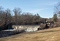
 CoventryRI InterlakenMillBridge.jpg 1,024 × 680; 300 KB
-
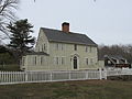
 CoventryRI IsaacBowenHouse.jpg 1,024 × 680; 288 KB
-
 CoventryRI JosephBriggsHouseTownFarm.jpg 1,024 × 680; 308 KB
-
 CoventryRI PaineHouse.jpg 1,024 × 680; 251 KB
-
 CoventryRI WatermanTavern.jpg 1,024 × 680; 229 KB
-
 CoventryRI WilliamWatermanHouse.jpg 1,024 × 680; 259 KB
-

-
 Female red crossbill (40766).jpg 1,684 × 1,274; 1.79 MB
-
 Female red crossbill (40805).jpg 1,367 × 1,027; 1.73 MB
-
 Former Summit station, September 2018.JPG 3,636 × 2,943; 2.07 MB
-
 Greene Public Library in Greene Rhode Island in Coventry RI.jpg 2,560 × 1,920; 2.59 MB
-
 Greene Rhode Island village in Coventry RI Greene Community Church and House.jpg 2,560 × 1,920; 2.43 MB
-
 Greene station 1908 postcard.jpg 1,498 × 967; 313 KB
-
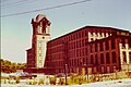
 Harris Mill (51961).jpg 4,558 × 2,236; 5.94 MB
-
 Harris Mill (51965).jpg 4,448 × 2,356; 7.04 MB
-
 Harris Mill (51968).jpg 3,786 × 2,745; 6.08 MB
-
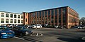
 Harris Mill 2008.jpg 3,300 × 2,208; 1.99 MB
-

-
 Interlaken Mill Bridge.jpg 5,184 × 3,456; 14.69 MB
-
-
 Old Coventry station, Coventry, Rhode Island.JPG 4,320 × 3,240; 2.34 MB
-
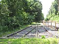 Old rails, Washington Secondary Trail, Coventry, Rhode Island.JPG 4,320 × 3,240; 5.18 MB
-
 Pawtuxet Harris.jpg 600 × 402; 172 KB
-
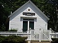 Read School - front view.JPG 3,264 × 2,448; 2.21 MB
-
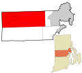
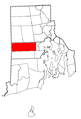 Rhode Island Municipalities Coventry Highlighted.png 396 × 584; 33 KB
-
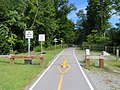 Trestle Trail at Summit, September 2018.JPG 5,184 × 3,888; 5.04 MB
-
 Trestle Trail construction, September 2018.JPG 5,184 × 3,888; 5.66 MB
-
 Trestle Trail west of the Moosup River, September 2018.JPG 5,184 × 3,888; 6.37 MB
-

-

-
 Washington Secondary Trail, Conventry, Rhode Island.JPG 4,320 × 3,240; 4.7 MB
-
 West end of paved section of the Trestle Trail, September 2018.JPG 5,184 × 3,888; 7.47 MB
-
 Wilson Winslow House, Coventry RI.JPG 3,264 × 2,448; 2.19 MB

_(28006352099).jpg)
.jpg)
_(27989311559).jpg)


.jpg)
.jpg)


.jpg)
.jpg)
.jpg)


