Category:Craigengar
Jump to navigation
Jump to search
hill in the United Kingdom  | |||||
| Upload media | |||||
| Instance of | |||||
|---|---|---|---|---|---|
| Location |
| ||||
| Mountain range | |||||
| Elevation above sea level |
| ||||
 | |||||
Media in category "Craigengar"
The following 21 files are in this category, out of 21 total.
-
 Burn above Raven's Cleuch - geograph.org.uk - 174090.jpg 640 × 480; 93 KB
-
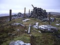
 Cairn on Craigengar Hill - geograph.org.uk - 1558513.jpg 640 × 427; 83 KB
-
 Craigengar - geograph.org.uk - 1691824.jpg 640 × 480; 105 KB
-
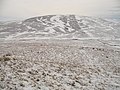
 Craigengar - geograph.org.uk - 32128.jpg 640 × 252; 36 KB
-
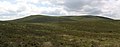
 Craigengar, west ridge - geograph.org.uk - 75284.jpg 640 × 480; 133 KB
-
 Crosswood Burn - geograph.org.uk - 1691829.jpg 640 × 359; 78 KB
-
 Crosswood Burn - geograph.org.uk - 1713117.jpg 640 × 480; 100 KB
-
 Gas pipeline north of Craigengar - geograph.org.uk - 1558465.jpg 427 × 640; 92 KB
-
 Mealowther from Craigengar - geograph.org.uk - 75287.jpg 640 × 480; 105 KB
-
 One of many cairns on Craigengar - geograph.org.uk - 1558523.jpg 640 × 427; 75 KB
-
 Path on Craigengar - geograph.org.uk - 75293.jpg 640 × 480; 143 KB
-
 Raven's Cleuch - geograph.org.uk - 174103.jpg 640 × 480; 116 KB
-
 Rock art on Craigengar - geograph.org.uk - 1558542.jpg 640 × 427; 115 KB
-
 Rock carving on Craigengar - geograph.org.uk - 1558528.jpg 640 × 427; 123 KB
-
 Rock engraving on Craigengar - geograph.org.uk - 1558558.jpg 640 × 427; 116 KB
-
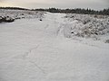 Snow drift, Birny Knowe - geograph.org.uk - 1704103.jpg 640 × 480; 61 KB
-
 Summit fence on Craigengar - geograph.org.uk - 1558567.jpg 640 × 427; 107 KB
-
 Summit of Craigengar - geograph.org.uk - 75298.jpg 640 × 480; 135 KB
-
 Summit of Mealowther - geograph.org.uk - 1691810.jpg 640 × 359; 69 KB
-
 Summit, Craigengar - geograph.org.uk - 1713136.jpg 640 × 359; 60 KB
-
 White Craig and Darlees Rig - geograph.org.uk - 1713149.jpg 640 × 290; 61 KB


