Category:Creggan, County Armagh
Jump to navigation
Jump to search
village in County Armagh, Northern Ireland, UK | |||||
| Upload media | |||||
| Instance of | |||||
|---|---|---|---|---|---|
| Location | County Armagh, Northern Ireland | ||||
 | |||||
English: Creggan is a small village in County Armagh, Northern Ireland, just outside Crossmaglen. In the 2001 Census it had a population of 246 people. It lies within the Newry and Mourne District Council area.
Media in category "Creggan, County Armagh"
The following 83 files are in this category, out of 83 total.
-
 A formidable list of Dos and Don'ts on the Poet's Glen Path - geograph.org.uk - 5921009.jpg 3,385 × 2,637; 7.42 MB
-
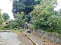
 Access lane off Cregganbane Road - geograph.org.uk - 4304592.jpg 1,600 × 1,200; 786 KB
-
 Access lane off the Newry Road at Creggan - geograph.org.uk - 4296299.jpg 1,600 × 1,298; 307 KB
-
 An oak tree in the Poet's Glen at Creggan - geograph.org.uk - 5921035.jpg 4,000 × 3,000; 2.88 MB
-
 Children's play area at Creggan - geograph.org.uk - 4225642.jpg 1,600 × 1,169; 437 KB
-
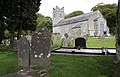
 Creggan Church of Ireland grave yard - geograph.org.uk - 547093.jpg 640 × 480; 124 KB
-
 Creggan Church of Ireland grave yard 2 - geograph.org.uk - 547105.jpg 640 × 480; 138 KB
-

-

-

-
 Creggan Church of Ireland Parish Hall - geograph.org.uk - 4192481.jpg 1,024 × 757; 208 KB
-
 Creggan Church of Ireland. - geograph.org.uk - 507822.jpg 640 × 410; 134 KB
-
 Creggan Church of Ireland. - geograph.org.uk - 547077.jpg 640 × 480; 93 KB
-
 Creggan Church of Ireland. - geograph.org.uk - 547082.jpg 480 × 640; 75 KB
-
 Creggan Graveyard - geograph.org.uk - 4225460.jpg 1,600 × 995; 392 KB
-
 Creggan River above the Liscalgot Road bridge - geograph.org.uk - 5920147.jpg 4,000 × 3,000; 2.85 MB
-
 Creggan Transport Depot from the car park of the Poet's Glen - geograph.org.uk - 5920073.jpg 3,106 × 2,028; 3.96 MB
-
 Cregganbane Road - geograph.org.uk - 4304607.jpg 1,600 × 1,200; 648 KB
-
-

-
 Disused farmstead on the Liscalgot Road - geograph.org.uk - 5920170.jpg 3,230 × 2,310; 6.21 MB
-
 Donaldson Road at its junction with the B30 (Newry Road) - geograph.org.uk - 5920002.jpg 1,779 × 1,334; 1.74 MB
-

-
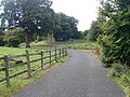
 Farm access lane leading off the B30 west of Creggan - geograph.org.uk - 4296344.jpg 1,600 × 1,157; 299 KB
-
 Farmland on the Cregganbane Road - geograph.org.uk - 4304610.jpg 1,600 × 1,200; 466 KB
-
 Father McFadden Terrace, Creggan - geograph.org.uk - 4225752.jpg 1,600 × 1,200; 665 KB
-
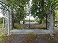 Gate and cattle grid at the B30 entrance to the Poet's Glen - geograph.org.uk - 5920055.jpg 4,000 × 3,000; 2.88 MB
-
 Glasdrumman Road approaching the junction with the B30 - geograph.org.uk - 4225646.jpg 1,600 × 1,197; 347 KB
-
 Glasdrumman Road at its junction with the B30 at Creggan - geograph.org.uk - 4225654.jpg 1,600 × 1,198; 385 KB
-
 Glasdrumman Road exiting Creggan - geograph.org.uk - 4303703.jpg 1,600 × 1,200; 521 KB
-
 Glasdrumman Road, Creggan - geograph.org.uk - 4303708.jpg 1,600 × 888; 280 KB
-
 Grazing land between Liscalgot Road and the River Creggan - geograph.org.uk - 5921056.jpg 3,926 × 2,167; 3.49 MB
-

-
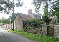
 House alongside Crgganbane Road - geograph.org.uk - 4304602.jpg 1,600 × 1,200; 618 KB
-

-
-
 Junction with farm access road on Cregganbane Road - geograph.org.uk - 4303798.jpg 1,600 × 1,200; 534 KB
-

-

-

-

-
-

-
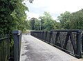 Pedestrian walkway bridge over the Creggan River - geograph.org.uk - 6252508.jpg 3,906 × 2,872; 6.02 MB
-

-
 Removing fallen trees above the Creggan Gorge - geograph.org.uk - 5919618.jpg 2,898 × 2,119; 5.3 MB
-

-
 Rough pasture on the north side of Cregganbane Road - geograph.org.uk - 4303801.jpg 1,600 × 1,200; 475 KB
-
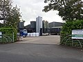 Soláthairtí Feirme an Chreagáin-Creggan Farm Supplies - geograph.org.uk - 6254451.jpg 4,000 × 3,000; 2.65 MB
-
 Soláthairtí Feirme an Chreagáin-Creggan Farm Supplies - geograph.org.uk - 6254483.jpg 3,596 × 2,103; 3.91 MB
-
 Sweeping curve in the Newry Road West of Creggan - geograph.org.uk - 6147144.jpg 2,586 × 1,741; 2.15 MB
-
 Tarred track in Creggan's Poet's Glen - geograph.org.uk - 5920112.jpg 4,000 × 3,000; 2.84 MB
-
 Terraced bungalows in Father McFadden Terrace. - geograph.org.uk - 4225770.jpg 1,600 × 1,200; 558 KB
-
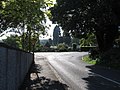
 The B30 (Newry Road) at Creggan - geograph.org.uk - 4168355.jpg 1,024 × 617; 114 KB
-

-
 The B30 (Newry Road) outside Creggan - geograph.org.uk - 4169680.jpg 1,024 × 765; 202 KB
-
 The B30 at Creggan - geograph.org.uk - 4225756.jpg 1,600 × 1,200; 394 KB
-
 The B30 leaving Creggan in the direction of Newry - geograph.org.uk - 4225759.jpg 1,600 × 1,197; 369 KB
-
 The Burns and Moley Memorial in Donaldsons Road, Creggan - geograph.org.uk - 6254504.jpg 3,601 × 2,467; 5.27 MB
-

-
 The Creggan River below the B30 bridge at Creggan - geograph.org.uk - 5919454.jpg 4,000 × 3,000; 2.87 MB
-

-

-
 The Donaldsons Road junction on the B30 at Creggan - geograph.org.uk - 6263634.jpg 1,659 × 1,232; 1.68 MB
-
 The eastern end of Trainor Crescent, Creggan - geograph.org.uk - 4303543.jpg 1,600 × 1,200; 585 KB
-
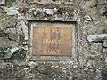
 The Eastwood Family Vault at Creggan Churchyard - geograph.org.uk - 4193172.jpg 1,024 × 765; 229 KB
-
 The gates of Creggan CoI Churchyard - geograph.org.uk - 4224567.jpg 1,600 × 1,198; 380 KB
-

-
 The lower end of Cregganbane Road - geograph.org.uk - 4303533.jpg 1,200 × 1,600; 625 KB
-
 The Murtaugh Family Plot at Creggan Graveyard - geograph.org.uk - 4225470.jpg 1,200 × 1,600; 618 KB
-
 The Newry Road West of the village of Creggan - geograph.org.uk - 6263638.jpg 1,980 × 1,463; 1.85 MB
-
 The O'Callaghan Johnston Plot at Creggan Graveyard - geograph.org.uk - 4225506.jpg 1,600 × 1,200; 666 KB
-

-
 The walled garden at the demolished Creggan CoI Rectory - geograph.org.uk - 5920123.jpg 4,000 × 3,000; 2.89 MB
-
-
 Vehicle exiting the B30 for Glasdrumman Road at Creggan - geograph.org.uk - 4225765.jpg 1,600 × 1,200; 455 KB
-

-

-
 View ENE along the B30 (Newry Road) - geograph.org.uk - 6263645.jpg 2,356 × 1,248; 1.72 MB
-
-
 View south-west along Cregganbane Road - geograph.org.uk - 4303799.jpg 1,600 × 1,200; 601 KB
-
 View west along a narrow section of Cregganbane Road - geograph.org.uk - 4304598.jpg 1,600 × 1,200; 813 KB
-
 View west along the tree lined Cregganbane Road - geograph.org.uk - 4304560.jpg 1,600 × 1,200; 693 KB


_-_geograph.org.uk_-_5920002.jpg)


_-_geograph.org.uk_-_6252503.jpg)


_at_Creggan_-_geograph.org.uk_-_4168355.jpg)
_between_Crossmaglen_and_Creggan_-_geograph.org.uk_-_4169664.jpg)
_outside_Creggan_-_geograph.org.uk_-_4169680.jpg)


.jpg)


_-_geograph.org.uk_-_6263645.jpg)


