Category:Creu de terme de Llorenç
Jump to navigation
Jump to search
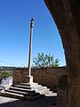
Català: Creu de terme de Llorenç de Rocafort (Sant Martí de Riucorb)
| Object location | | View all coordinates using: OpenStreetMap |
|---|
Media in category "Creu de terme de Llorenç"
The following 4 files are in this category, out of 4 total.
-
 Creu de Llorenç de Vallbona.jpeg 1,556 × 720; 172 KB
-
 CREU DE TERME DE LLORENÇ - IB-642.jpg 1,536 × 2,048; 948 KB
-
 CREU DE TERME DE LLORENÇ - IB-643.jpg 1,536 × 2,048; 1,018 KB
-
 CREU DE TERME DE LLORENÇ - IB-644.jpg 2,048 × 1,536; 962 KB


