Category:Crewe
Jump to navigation
Jump to search
railway town and civil parish in Cheshire East, Cheshire, England   | |||||
| Upload media | |||||
| Instance of |
| ||||
|---|---|---|---|---|---|
| Location | Cheshire East, Cheshire, North West England, England | ||||
| Population |
| ||||
| official website | |||||
 | |||||
Subcategories
This category has the following 10 subcategories, out of 10 total.
Media in category "Crewe"
The following 200 files are in this category, out of 812 total.
(previous page) (next page)-
 A pond at Quaker's Coppice, Crewe - geograph.org.uk - 2911482.jpg 800 × 600; 198 KB
-
 A Tarzie - geograph.org.uk - 2755482.jpg 4,320 × 3,240; 3.12 MB
-

-
 A5020 Crewe Green Link Road - geograph.org.uk - 196988.jpg 640 × 480; 23 KB
-
 A5020 heading north - geograph.org.uk - 3345941.jpg 2,848 × 2,136; 1.45 MB
-
 A5020 looking south - geograph.org.uk - 3101994.jpg 640 × 480; 63 KB
-
 A5020 nears Weston Road roundabout - geograph.org.uk - 3102000.jpg 640 × 481; 62 KB
-
 A5020 westbound - geograph.org.uk - 3505329.jpg 640 × 470; 53 KB
-
 A532 Macon Way, Crewe - geograph.org.uk - 3510794.jpg 640 × 480; 46 KB
-
 A532-A534 directions sign, Crewe - geograph.org.uk - 5954018.jpg 1,024 × 712; 150 KB
-
 Abbeyfield House, Crewe - geograph.org.uk - 5284852.jpg 800 × 456; 86 KB
-
 ABC Modelsport.jpg 492 × 611; 258 KB
-
 Advantage Vehicles, Tommy's Lane, Crewe - geograph.org.uk - 5112506.jpg 800 × 566; 102 KB
-
 Afford Rent-a-Car, Wistaston Road, Crewe - geograph.org.uk - 5290319.jpg 800 × 799; 129 KB
-
 Alchemy Dental Practice, Crewe - geograph.org.uk - 5284645.jpg 800 × 665; 132 KB
-
 Aldi supermarket, Crewe - geograph.org.uk - 5185817.jpg 640 × 480; 62 KB
-
 Alec Ross Carpets shop, Crewe - geograph.org.uk - 5288166.jpg 800 × 641; 103 KB
-
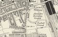 Alexandra Recreation Ground - 1888 OS map detail.png 1,125 × 712; 1.17 MB
-
 Alexandra Veterinary Centre, Crewe - geograph.org.uk - 5283907.jpg 800 × 587; 113 KB
-
 Allotments south of Manor Road - geograph.org.uk - 5180831.jpg 640 × 438; 125 KB
-
 Alton Street - geograph.org.uk - 2862657.jpg 2,000 × 1,498; 518 KB
-
 Always There Homecare office in Crewe - geograph.org.uk - 5289382.jpg 733 × 800; 147 KB
-
 Apartments, Grosvenor Park - geograph.org.uk - 5173370.jpg 640 × 480; 60 KB
-
 Apo's Kebab ^ Pizza, Crewe - geograph.org.uk - 5272850.jpg 800 × 685; 161 KB
-
 Arrival at Crewe - geograph.org.uk - 5561216.jpg 640 × 480; 194 KB
-
 Atkins, Gresty Road, Crewe - geograph.org.uk - 5273598.jpg 613 × 800; 128 KB
-
 Auto Body Shop, Crewe - geograph.org.uk - 5290308.jpg 800 × 524; 74 KB
-
 Autumn tints on Vernon Way - geograph.org.uk - 1546475.jpg 640 × 480; 204 KB
-
 Backs of houses on Bray Close, from the railway, Crewe - geograph.org.uk - 4982637.jpg 1,564 × 1,118; 265 KB
-
 Bannatyne's Health Club, Crewe - geograph.org.uk - 2911415.jpg 800 × 600; 133 KB
-
 Bar 7, Nantwich Road, Crewe - geograph.org.uk - 5273014.jpg 800 × 600; 113 KB
-
 Bargain Booze Plus, Crewe - geograph.org.uk - 5273596.jpg 800 × 594; 104 KB
-
 Bargain Booze, Crewe - geograph.org.uk - 5173362.jpg 640 × 480; 72 KB
-
 Bargain Busters on a Crewe corner - geograph.org.uk - 5289279.jpg 800 × 586; 96 KB
-
 Barn, Bolton Farm - geograph.org.uk - 3829918.jpg 640 × 430; 51 KB
-
 Barrows Green - geograph.org.uk - 4959377.jpg 640 × 426; 64 KB
-
 Basford Hall Sidings - geograph.org.uk - 3834809.jpg 573 × 640; 78 KB
-

-
 Bashall Yard Sidings - geograph.org.uk - 4967486.jpg 640 × 426; 67 KB
-
 Bench mark on Chester Bridge - geograph.org.uk - 1547586.jpg 480 × 640; 191 KB
-
 Bench mark on Earle Street bridge - geograph.org.uk - 1545848.jpg 480 × 640; 140 KB
-
 Best Western Crewe Arms Hotel, Crewe - geograph.org.uk - 5111689.jpg 800 × 731; 168 KB
-
 Beswick Drive, Crewe, Cheshire - geograph.org.uk - 5121761.jpg 1,024 × 675; 164 KB
-

-
-
 Blue signpost, Herdman Street, Crewe - geograph.org.uk - 5284868.jpg 787 × 800; 163 KB
-

-

-

-
 Bombay in Crewe - geograph.org.uk - 5288143.jpg 800 × 751; 135 KB
-
 Bradfield Road (B5076) - geograph.org.uk - 5173596.jpg 640 × 480; 55 KB
-

-
 Bridge over Valley Brook - geograph.org.uk - 5323810.jpg 1,280 × 960; 740 KB
-
 Bridle Road houses, Crewe - geograph.org.uk - 5290407.jpg 800 × 407; 97 KB
-
 Bristol Street Motors, Crewe - geograph.org.uk - 5112073.jpg 800 × 512; 102 KB
-
 Bristol Street Motors, Macon Way - geograph.org.uk - 2861657.jpg 2,000 × 1,452; 408 KB
-

-
-
-
 Brook House Drive - geograph.org.uk - 5180832.jpg 640 × 441; 67 KB
-

-
 Brooklyn Street, Crewe - geograph.org.uk - 5284267.jpg 800 × 537; 84 KB
-
 Browning Street Free Car Park, Crewe - geograph.org.uk - 5291353.jpg 800 × 637; 103 KB
-

-
 BT phonebox on a Crewe corner - geograph.org.uk - 5288024.jpg 800 × 718; 124 KB
-

-

-
 Bus stop on Capesthorne Road - geograph.org.uk - 5185803.jpg 640 × 480; 53 KB
-
 Bus stop on Minshill New Road - geograph.org.uk - 5173381.jpg 640 × 480; 84 KB
-
 Bus stop on West Street, Crewe - geograph.org.uk - 5173360.jpg 640 × 480; 54 KB
-
 C H K Factory Bentley Motors is to the far left - geograph.org.uk - 2755714.jpg 4,320 × 3,240; 3.06 MB
-
 Camm Street Centre, Crewe - geograph.org.uk - 5288176.jpg 800 × 582; 96 KB
-
 Camm Street, Crewe - geograph.org.uk - 5288183.jpg 800 × 588; 106 KB
-

-
 Car park, Market St - geograph.org.uk - 4959408.jpg 640 × 426; 82 KB
-
 Carillion, Crewe - geograph.org.uk - 5296158.jpg 800 × 585; 100 KB
-
 Carpet and wallpaper centre, Mill Street, Crewe - geograph.org.uk - 4982631.jpg 1,024 × 768; 127 KB
-
 Carpet Clearance Centre in Crewe - geograph.org.uk - 5289274.jpg 771 × 800; 131 KB
-
 Cast iron railings on Chester Bridge - geograph.org.uk - 1549007.jpg 640 × 480; 123 KB
-
 Cathay Princess in Crewe - geograph.org.uk - 5283914.jpg 738 × 800; 150 KB
-
 Catherine Street, Crewe - geograph.org.uk - 5273645.jpg 800 × 694; 97 KB
-

-
 Centenary poppy in Memorial Square - geograph.org.uk - 4915386.jpg 1,600 × 1,200; 675 KB
-
 Centre of Crewe. From the library - geograph.org.uk - 2753080.jpg 720 × 482; 132 KB
-
 Centre of the Caledonian Sleeper at Crewe - geograph.org.uk - 6221878.jpg 1,024 × 768; 188 KB
-

-
 CES UK Exhausts ^ Car Parts, Crewe - geograph.org.uk - 5288223.jpg 800 × 545; 96 KB
-
 Cherry blossom at Coppenhall Cemetery - geograph.org.uk - 2874440.jpg 800 × 514; 241 KB
-
 Chester Bridge and a bench mark - geograph.org.uk - 1547594.jpg 640 × 480; 153 KB
-
 Chester Bridge and Market Street - geograph.org.uk - 1548999.jpg 640 × 480; 108 KB
-
 Chester Bridge, Crewe - geograph.org.uk - 1549043.jpg 640 × 480; 138 KB
-

-
 Chester Street, Crewe - geograph.org.uk - 5294577.jpg 800 × 618; 104 KB
-
 Chiangmai in Crewe - geograph.org.uk - 5283861.jpg 800 × 513; 102 KB
-
 Children's play ground - geograph.org.uk - 4489513.jpg 1,200 × 675; 329 KB
-

-
 Christadelphian Hall, Crewe - geograph.org.uk - 5286023.jpg 800 × 724; 165 KB
-
 Claughton Avenue, Crewe - geograph.org.uk - 5296075.jpg 800 × 527; 83 KB
-
 Clearing waste ground near Crewe - geograph.org.uk - 3345907.jpg 1,024 × 492; 71 KB
-

-
 Close up, Elizabeth II postbox on Gresty Road, Crewe - geograph.org.uk - 5193320.jpg 1,064 × 2,090; 502 KB
-
-
 Co-operative food store, Crewe - geograph.org.uk - 5173358.jpg 640 × 447; 55 KB
-

-
 College construction site - geograph.org.uk - 1234403.jpg 640 × 480; 72 KB
-
 Coppenhall - geograph.org.uk - 5517005.jpg 4,963 × 3,034; 1.97 MB
-
 Coppenhall Post Office - geograph.org.uk - 5174838.jpg 640 × 480; 61 KB
-
 Coppenhall W.M.C. - geograph.org.uk - 5173603.jpg 640 × 480; 56 KB
-
 Coral on a town centre corner, Crewe - geograph.org.uk - 5285797.jpg 800 × 693; 147 KB
-
-

-
-
 Cotterill Street, Crewe - geograph.org.uk - 5286511.jpg 738 × 800; 100 KB
-
 Cowley Way, Crewe - geograph.org.uk - 3505345.jpg 640 × 463; 51 KB
-
 Crewe (33916958155).jpg 4,000 × 3,000; 2.34 MB
-
 Crewe - Coppenhall Cemetery - geograph.org.uk - 809405.jpg 640 × 480; 312 KB
-
 Crewe - Coppenhall Moss - geograph.org.uk - 811844.jpg 640 × 480; 281 KB
-
 Crewe - Crewe Town footpath 13 - geograph.org.uk - 809415.jpg 640 × 480; 313 KB
-
 Crewe - Ellis Street - geograph.org.uk - 809396.jpg 640 × 480; 281 KB
-
 Crewe - footpath 13 and Moss Bridge - geograph.org.uk - 811833.jpg 640 × 480; 359 KB
-
 Crewe - geograph.org.uk - 5514994.jpg 5,184 × 2,971; 1.9 MB
-
 Crewe - geograph.org.uk - 5515003.jpg 5,183 × 2,981; 1.96 MB
-
 Crewe - geograph.org.uk - 5517000.jpg 5,050 × 2,961; 1.64 MB
-

-
 Crewe - Municipal Buildings on Earle St - geograph.org.uk - 4754352.jpg 1,024 × 768; 224 KB
-
 Crewe - the railway town - geograph.org.uk - 2107499.jpg 2,048 × 1,536; 1.29 MB
-
 Crewe 1951, trip goods to Works - geograph.org.uk - 4874310.jpg 2,283 × 1,400; 1.32 MB
-
 Crewe Arms Hotel - geograph.org.uk - 4664019.jpg 1,500 × 2,000; 347 KB
-
 Crewe Arms Hotel - geograph.org.uk - 5515001.jpg 5,049 × 2,032; 1.96 MB
-
 Crewe Arms Hotel 1830 - geograph.org.uk - 5463987.jpg 1,280 × 852; 725 KB
-
 Crewe banner.jpg 3,850 × 550; 600 KB
-
 Crewe Business Nature Trail - geograph.org.uk - 2911423.jpg 800 × 600; 132 KB
-

-

-
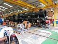 Crewe Diesel Depot open day - geograph.org.uk - 6179523.jpg 5,082 × 3,812; 5.58 MB
-
 Crewe Fire Station - geograph.org.uk - 1392922.jpg 640 × 426; 220 KB
-
 Crewe from the west - geograph.org.uk - 2107505.jpg 2,048 × 1,536; 1.27 MB
-
 Crewe Gateway - geograph.org.uk - 1333774.jpg 640 × 640; 203 KB
-
 Crewe Gateway 2 - geograph.org.uk - 1333780.jpg 640 × 480; 166 KB
-
 Crewe Green Link Road (South), north end - geograph.org.uk - 4414376.jpg 4,176 × 2,784; 4.61 MB
-
 Crewe Heritage Festival, 1987 - geograph.org.uk - 3487558.jpg 1,600 × 1,067; 419 KB
-
 Crewe Junction War Memorial - geograph.org.uk - 3166884.jpg 640 × 429; 60 KB
-
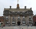 Crewe Municipal Building - geograph.org.uk - 5087173.jpg 2,632 × 2,088; 968 KB
-
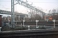 Crewe North Junction - geograph.org.uk - 4570722.jpg 640 × 426; 58 KB
-
 Crewe North Junction - geograph.org.uk - 4967452.jpg 640 × 426; 64 KB
-
 Crewe North Junction Signalbox - geograph.org.uk - 4570690.jpg 640 × 426; 44 KB
-
 Crewe North Junction Signalbox - geograph.org.uk - 4959436.jpg 640 × 426; 74 KB
-
 Crewe North Junction Signalbox - geograph.org.uk - 5341856.jpg 640 × 426; 61 KB
-
 Crewe Rail Junction - geograph.org.uk - 2812367.jpg 640 × 428; 72 KB
-
 Crewe railway exhibition - geograph.org.uk - 2809524.jpg 640 × 531; 129 KB
-
 Crewe Sidings - geograph.org.uk - 4967488.jpg 640 × 426; 65 KB
-
 Crewe Sorting Sidings North Signal Box.jpg 4,254 × 2,798; 4.28 MB
-
 Crewe South Junction Signalbox - geograph.org.uk - 4570747.jpg 640 × 426; 54 KB
-
 Crewe Veterinary Hospital - geograph.org.uk - 4916718.jpg 1,600 × 1,200; 392 KB
-
 Crewe, Crewe Alexandra stadium from the station - geograph.org.uk - 4330840.jpg 2,592 × 1,944; 586 KB
-
 Crewe, Lansdowne Road - geograph.org.uk - 4724154.jpg 3,241 × 2,045; 921 KB
-
 Crewe, seen from over Sandbach - geograph.org.uk - 4677170.jpg 3,264 × 2,448; 4.5 MB
-
 Crewe, station entrance during reconstruction, 1960 - geograph.org.uk - 5425595.jpg 2,357 × 1,358; 1.11 MB
-

-
 Cristini Carpet Centre, Crewe - geograph.org.uk - 5284902.jpg 800 × 653; 113 KB
-
 Crosville Social Club, Crewe - geograph.org.uk - 5294572.jpg 800 × 507; 79 KB
-
 Cruise Bar at The Albion, Crewe - geograph.org.uk - 5288023.jpg 800 × 549; 90 KB
-
-
 Cycle path - geograph.org.uk - 5437663.jpg 2,322 × 4,128; 2.18 MB
-
 Cycle path beside the A5020 - geograph.org.uk - 3346078.jpg 640 × 480; 52 KB
-
 Cycle path beside Weston Road - geograph.org.uk - 3345931.jpg 640 × 480; 93 KB
-

-
 Dane Bank Avenue, Crewe - geograph.org.uk - 5186471.jpg 2,848 × 2,136; 1.11 MB
-
 Del Boy's Diner, Crewe - geograph.org.uk - 5284610.jpg 800 × 676; 136 KB
-
 Delamere Resource Centre, Crewe - geograph.org.uk - 5294550.jpg 800 × 479; 77 KB
-

-
 Delamere Street recycling area, Crewe - geograph.org.uk - 5294538.jpg 800 × 701; 175 KB
-
 Delamere Street, Crewe - geograph.org.uk - 5291288.jpg 800 × 705; 125 KB
-
 Derelict Farm building - geograph.org.uk - 3690960.jpg 640 × 430; 48 KB
-
-

-

-
 Detached house, Maxwell Street, Crewe - geograph.org.uk - 5284496.jpg 800 × 679; 109 KB
-

-

-
 Directions sign, Macon Way, Crewe - geograph.org.uk - 5112375.jpg 800 × 666; 120 KB
-

-

-
 Dishers Pool ^ Snooker Club, Crewe - geograph.org.uk - 5272818.jpg 800 × 726; 102 KB
-
 Distances from Crewe - geograph.org.uk - 5547972.jpg 800 × 746; 148 KB
-
-
 Drinking bowl at Crewe - geograph.org.uk - 5464091.jpg 850 × 1,600; 330 KB
-
 Duke Of Bridgewater name sign, Crewe - geograph.org.uk - 5286055.jpg 766 × 800; 106 KB
-
 Duke Of Bridgewater pub in Crewe - geograph.org.uk - 5286063.jpg 800 × 697; 100 KB
-
 Duke Of Bridgewater, Crewe - geograph.org.uk - 5286051.jpg 800 × 686; 111 KB
-
 Duke Street, Crewe - geograph.org.uk - 5290311.jpg 800 × 621; 129 KB
-
 Dunwoody Way, Crewe - geograph.org.uk - 5286067.jpg 800 × 624; 91 KB
-
 D^G bus, Nantwich Road, Crewe - geograph.org.uk - 5286254.jpg 751 × 800; 116 KB
-
 Earl of Chester in Crewe - geograph.org.uk - 5290367.jpg 758 × 800; 127 KB
-
 Earl of Chester on a Crewe corner - geograph.org.uk - 5290380.jpg 800 × 668; 104 KB
-
 Earle Street bridge and a bench mark - geograph.org.uk - 1545857.jpg 640 × 480; 125 KB
-
 East along Brook Street, Crewe - geograph.org.uk - 5284617.jpg 800 × 549; 93 KB
-
 East along Camm Street, Crewe - geograph.org.uk - 5286502.jpg 800 × 632; 94 KB
-
 East along Delamere Street, Crewe - geograph.org.uk - 5294411.jpg 799 × 800; 143 KB
-
 East side of Betley Street, Crewe - geograph.org.uk - 5294605.jpg 733 × 800; 210 KB


_near_Duchy_Road_-_geograph.org.uk_-_2244926.jpg)


_-_geograph.org.uk_-_5173596.jpg)


.jpg)


,_north_end_-_geograph.org.uk_-_4414376.jpg)


