Category:Cribyn
Jump to navigation
Jump to search
village in United Kingdom  | |||||
| Upload media | |||||
| Instance of | |||||
|---|---|---|---|---|---|
| Location | Ceredigion, Wales | ||||
 | |||||
Cymraeg: Pentref bychan yn ne Ceredigion yw Cribyn, a leolir tua 7 milltir i'r gogledd o Lanbedr Pont Steffan i'r de o bentrefi Troed-y-rhiw, Mydroilyn a Dihewyd.
English: Cribyn is a small village in Ceredigion, Wales, about 7 miles north of Lampeter and with the villages of Troed y Rhiw, Mydroilyn and Dihewyd to the north.
Media in category "Cribyn"
The following 12 files are in this category, out of 12 total.
-
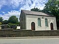 Capel Undodaidd, Cribyn - geograph.org.uk - 6189050.jpg 2,048 × 1,536; 948 KB
-
 Cribyn, Ceredigion.jpg 640 × 480; 118 KB
-
Cy-Cribyn.ogg 1.3 s; 21 KB
-

-
 Hedgebank above sheep enclosure - geograph.org.uk - 1432070.jpg 640 × 480; 98 KB
-
 Nant Mynach - geograph.org.uk - 1090364.jpg 640 × 480; 95 KB
-
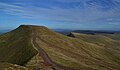 Peny Fan & Cribyn, Brecon Beacons, Wales (33204675492).jpg 7,290 × 4,279; 11.51 MB
-
 Troedrhiwfallen, Cribyn, Lampeter - geograph.org.uk - 54782.jpg 640 × 429; 94 KB
-
 Farm near Capel-y-Groes - geograph.org.uk - 735640.jpg 640 × 410; 54 KB
-
 Farmland north of Troed-y-rhiw - geograph.org.uk - 739335.jpg 640 × 428; 110 KB
-
 Footpath to Blaen-waun-ganol - geograph.org.uk - 1432066.jpg 640 × 480; 89 KB
-
 Lane east of Capel-y-Groes - geograph.org.uk - 502997.jpg 640 × 428; 133 KB


.jpg)