Category:Crinkle Crags
Jump to navigation
Jump to search
fell in the English Lake District in the county of Cumbria  | |||||
| Upload media | |||||
| Instance of |
| ||||
|---|---|---|---|---|---|
| Part of |
| ||||
| Location |
| ||||
| Mountain range | |||||
| Elevation above sea level |
| ||||
| Parent peak | |||||
 | |||||
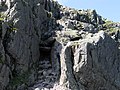
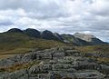
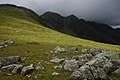
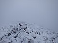
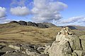
English: Crinkle Crags is a fell in the English Lake District in the county of Cumbria. It forms part of two major rings of mountains, surrounding the valleys of Great Langdale and Upper Eskdale. The name reflects the fell's physical appearance as its summit ridge is a series of five rises and depressions (crinkles) that are very distinctive from the valley floor. In Old English, cringol means twisted or wrinkled.
Media in category "Crinkle Crags"
The following 73 files are in this category, out of 73 total.
-
 Approach to Crinkle Crags - geograph.org.uk - 4254594.jpg 800 × 592; 122 KB
-
 Ascending Crinkle Crags - geograph.org.uk - 1482159.jpg 640 × 480; 71 KB
-
 Bad Step on Crinkle Crags.PNG 600 × 450; 633 KB
-
 Cairn on Crinkle Crags - geograph.org.uk - 506709.jpg 640 × 426; 116 KB
-
 Cairn on the Ist Crinkle - geograph.org.uk - 1367514.jpg 640 × 426; 173 KB
-
 Climb up to Crinkle Crags - geograph.org.uk - 19107.jpg 640 × 480; 70 KB
-
 Crinke Crags.JPG 2,304 × 1,728; 1.06 MB
-
 Crinkle Crags - geograph.org.uk - 1482169.jpg 640 × 480; 82 KB
-
 Crinkle Crags - geograph.org.uk - 19102.jpg 640 × 480; 53 KB
-
 Crinkle Crags - geograph.org.uk - 506716.jpg 640 × 426; 96 KB
-
 Crinkle Crags - geograph.org.uk - 635700.jpg 640 × 429; 59 KB
-
 Crinkle Crags - The Bad Step - geograph.org.uk - 3251428.jpg 1,500 × 1,125; 1.68 MB
-
 Crinkle Crags and Bow Fell - geograph.org.uk - 1040993.jpg 640 × 376; 47 KB
-
 Crinkle Crags and Bow Fell - geograph.org.uk - 945737.jpg 640 × 480; 78 KB
-

-
 Crinkle Crags from Cold Pike.jpg 1,200 × 868; 64 KB
-
 Crinkle Crags from Great Langdale - geograph.org.uk - 572437.jpg 640 × 480; 49 KB
-
 Crinkle Crags from Side Pike - geograph.org.uk - 4676382.jpg 640 × 424; 255 KB
-
 Crinkle Crags from the Band - geograph.org.uk - 635699.jpg 640 × 429; 71 KB
-
 Crinkle Crags from Three Tarns - geograph.org.uk - 2589862.jpg 3,968 × 2,976; 2.92 MB
-
-
 Descending Crinkle Crags - geograph.org.uk - 1004256.jpg 640 × 427; 218 KB
-
 From Crinkle Crags - geograph.org.uk - 377329.jpg 640 × 480; 99 KB
-
 From Crinkle Crags - geograph.org.uk - 379232.jpg 640 × 480; 98 KB
-
 Frozen Tarn Crinkle Crags - geograph.org.uk - 117993.jpg 640 × 424; 61 KB
-
 Frozen tarn, Crinkle Crags - geograph.org.uk - 377357.jpg 640 × 480; 79 KB
-
 Gladstone's Finger, Crinkle Crags - geograph.org.uk - 2203764.jpg 560 × 800; 98 KB
-
 Gunson Knott - geograph.org.uk - 872043.jpg 640 × 480; 120 KB
-
 Looking back towards Crinkle Crags - geograph.org.uk - 993116.jpg 640 × 429; 83 KB
-
 Looking towards Crinkle Crags from The Band - geograph.org.uk - 3787466.jpg 1,024 × 768; 332 KB
-
 Nearing First Crinkle Crags - geograph.org.uk - 2749952.jpg 640 × 480; 95 KB
-
 On Crinkle Crags - geograph.org.uk - 1482175.jpg 640 × 480; 85 KB
-
 On Crinkle Crags - geograph.org.uk - 3064689.jpg 2,560 × 1,920; 649 KB
-
 On Crinkle Crags - geograph.org.uk - 3504390.jpg 2,560 × 1,920; 940 KB
-
 On Crinkle Crags - geograph.org.uk - 4296739.jpg 4,608 × 3,456; 3.38 MB
-
 On Crinkle Crags - geograph.org.uk - 4296741.jpg 4,608 × 3,456; 3.7 MB
-
 On Crinkle Crags - geograph.org.uk - 4296750.jpg 4,608 × 3,456; 3.71 MB
-
 On the First Crinkle - geograph.org.uk - 1482165.jpg 640 × 480; 71 KB
-
 On the first Crinkle Crag - geograph.org.uk - 2331097.jpg 3,872 × 2,592; 5.07 MB
-
 Ordnance Survey Sheet NY 20 Langdale, Published 1960.jpg 5,362 × 5,855; 5.1 MB
-
 Part of the first Crinkle above Oxendale - geograph.org.uk - 2331021.jpg 3,872 × 2,592; 4.56 MB
-
 Path to Crinkle Crags - geograph.org.uk - 1367533.jpg 640 × 426; 211 KB
-
 Path to Crinkle Crags - geograph.org.uk - 2329361.jpg 3,872 × 2,592; 5.07 MB
-
 Path up to Crinkle Crags - geograph.org.uk - 1256524.jpg 640 × 479; 75 KB
-
 Red Tarn and Crinkle Crags - geograph.org.uk - 1041741.jpg 640 × 460; 124 KB
-
 Rocks near Crinkle Crags summit - geograph.org.uk - 506715.jpg 640 × 426; 122 KB
-
 Small Tarn on Crinkle Crags - geograph.org.uk - 1367521.jpg 640 × 426; 221 KB
-
 Summit Cairn, Crinkle Crags - geograph.org.uk - 377363.jpg 640 × 480; 107 KB
-
 Summit Cairn, Crinkle Crags - geograph.org.uk - 377369.jpg 640 × 480; 102 KB
-
 Summit Crinkle Crags - geograph.org.uk - 90977.jpg 640 × 480; 56 KB
-
 Summit of Cold Pike Looking toward the path to Crinkle Crags - geograph.org.uk - 2832227.jpg 2,592 × 1,728; 3.32 MB
-
 Summit of Crinkle Crags, view towards Coniston Fells - geograph.org.uk - 2887489.jpg 1,600 × 1,067; 394 KB
-
 Summit of Second Crinkle Crag - geograph.org.uk - 2749984.jpg 640 × 480; 116 KB
-
 The Bad Step - geograph.org.uk - 1004209.jpg 640 × 426; 265 KB
-
 The Bad Step - geograph.org.uk - 1004214.jpg 427 × 640; 265 KB
-
 The Bad Step - geograph.org.uk - 2930569.jpg 1,024 × 768; 628 KB
-
 The Bad Step - geograph.org.uk - 871996.jpg 480 × 640; 137 KB
-
 The bad step draws a crowd - geograph.org.uk - 2242610.jpg 640 × 480; 98 KB
-
 The Bad Step on Crinkle Crags - geograph.org.uk - 3945604.jpg 1,024 × 890; 246 KB
-
 The Big Step - Crinkle crags - geograph.org.uk - 1256538.jpg 640 × 479; 131 KB
-
 The cairn on the first Crinkle - geograph.org.uk - 871982.jpg 640 × 480; 111 KB
-
 The Crinkle Crags - geograph.org.uk - 871931.jpg 640 × 480; 99 KB
-
 The Crinkle Crags Ridge - geograph.org.uk - 1940833.jpg 640 × 480; 85 KB
-
 The Crinkle Crags Ridge - geograph.org.uk - 1940834.jpg 640 × 480; 84 KB
-
 The first Crinkle - geograph.org.uk - 871943.jpg 640 × 480; 124 KB
-
 The first Crinkle Crag - geograph.org.uk - 1256553.jpg 640 × 479; 88 KB
-

-

-

-
 The second and third Crinkle - geograph.org.uk - 871962.jpg 640 × 480; 118 KB
-
 The top of the first Crinkle Crag - geograph.org.uk - 2331057.jpg 3,872 × 2,592; 6.04 MB
-
 The top of the second Crinkle Crag - geograph.org.uk - 2331111.jpg 3,872 × 2,592; 4.59 MB
-
 View to Crinkle Crags - geograph.org.uk - 69986.jpg 640 × 480; 99 KB


