Category:Crowley Historic District
Jump to navigation
Jump to search
Main Wikipedia article: Crowley Historic District.
| Object location | | View all coordinates using: OpenStreetMap |
|---|
|
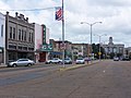
This is a category about a place or building that is listed on the National Register of Historic Places in the United States of America. Its reference number is 82002751. |
park in Acadia Parish, Louisiana, United States of America  | |||||
| Upload media | |||||
| Instance of | |||||
|---|---|---|---|---|---|
| Location |
| ||||
| Heritage designation |
| ||||
| Inception |
| ||||
| Area |
| ||||
 | |||||
Subcategories
This category has the following 2 subcategories, out of 2 total.
G
- Grand Opera House of the South (14 F)
R
Media in category "Crowley Historic District"
The following 4 files are in this category, out of 4 total.
-
 ChrisLitherlandCrowley.jpg 1,280 × 857; 1.12 MB
-
 Crowley1913.jpg 1,121 × 683; 201 KB
-
 DowntownCrowley.jpg 2,304 × 1,728; 614 KB
-
 First Acadia Parish Courthouse.jpg 3,236 × 4,197; 8.28 MB


