Category:Croxteth Bridge
Jump to navigation
Jump to search
| Object location | | View all coordinates using: OpenStreetMap |
|---|
Bridge over Croxteth Brook carrying the A580 East Lancashire Road and roughly marking the boundary between Liverpool and Knowsley. Possibly dating to 1934 when the A580 was made the major route it is today.
Media in category "Croxteth Bridge"
The following 7 files are in this category, out of 7 total.
-
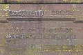
 Benchmark on Croxteth Bridge.jpg 3,462 × 5,198; 25.9 MB
-
 Croxteth Bridge 1.jpg 4,093 × 2,226; 10.95 MB
-
 Croxteth Bridge 2.jpg 4,293 × 2,657; 13.35 MB
-
 Croxteth Bridge 3.jpg 4,630 × 3,089; 14.5 MB
-
 Croxteth Bridge 4.jpg 4,316 × 1,689; 10.27 MB
-
 Croxteth Bridge 5.jpg 5,049 × 2,932; 16.3 MB
-
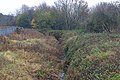 Croxteth Brook flowing towards Croxteth Bridge.jpg 5,198 × 3,462; 27.13 MB


