Category:Culverthorpe and Kelby
Jump to navigation
Jump to search
English: Culverthorpe and Kelby is a civil parish in the North Kesteven district, in the county of Lincolnshire, England.
civil parish in North Kesteven, Lincolnshire, England | |||||
| Upload media | |||||
| Instance of | |||||
|---|---|---|---|---|---|
| Location | North Kesteven, Lincolnshire, East Midlands, England | ||||
 | |||||
Subcategories
This category has the following 2 subcategories, out of 2 total.
C
K
Media in category "Culverthorpe and Kelby"
The following 37 files are in this category, out of 37 total.
-
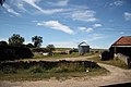 Church Farm yard - geograph.org.uk - 1986399.jpg 640 × 426; 76 KB
-
 Cut Mark, Kelby, St Andrews Church - geograph.org.uk - 5939983.jpg 1,280 × 960; 2.18 MB
-
 Defibrillator box - geograph.org.uk - 6067844.jpg 5,842 × 3,786; 7.34 MB
-
 Driveway and gates, Culverthorpe - geograph.org.uk - 6311402.jpg 1,024 × 768; 364 KB
-
 Fire Hydrant - geograph.org.uk - 6067873.jpg 6,032 × 4,014; 5.94 MB
-
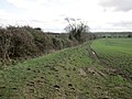
 Footpath across the fields - geograph.org.uk - 5001294.jpg 4,608 × 3,456; 3.36 MB
-
 Footpath to Kelby - geograph.org.uk - 5302251.jpg 1,024 × 768; 191 KB
-
 Footpath to Northings - geograph.org.uk - 5302254.jpg 1,024 × 768; 214 KB
-
 Gateway to the lake - geograph.org.uk - 3782002.jpg 1,024 × 768; 339 KB
-
 Hydrant sign - geograph.org.uk - 6067869.jpg 3,340 × 4,679; 4.72 MB
-
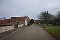 Kelby village street - geograph.org.uk - 6067857.jpg 6,032 × 4,014; 4.65 MB
-
 Kelby village street - geograph.org.uk - 6067858.jpg 6,032 × 4,014; 6.6 MB
-
 Kelby, St Andrews Church - geograph.org.uk - 5939987.jpg 960 × 1,280; 1.52 MB
-
 King George's Letterbox - geograph.org.uk - 6067855.jpg 4,014 × 6,032; 4.65 MB
-
 Lane near North Hill - geograph.org.uk - 5001311.jpg 4,608 × 3,456; 3.38 MB
-
 Lane to Culverthorpe - geograph.org.uk - 3179882.jpg 3,088 × 2,056; 1.56 MB
-
 Last of the Autumn colour - geograph.org.uk - 3782068.jpg 1,024 × 768; 178 KB
-
 Lincoln Reds at Culverthorpe - geograph.org.uk - 6311407.jpg 1,024 × 768; 216 KB
-
 Manor and Church - geograph.org.uk - 6067859.jpg 6,032 × 4,014; 6.45 MB
-
 New post - geograph.org.uk - 5299252.jpg 1,024 × 768; 289 KB
-
 Oasby Road towards Kelby - geograph.org.uk - 6138071.jpg 1,600 × 1,200; 648 KB
-

-
-
 Phone box no longer - geograph.org.uk - 6067848.jpg 2,493 × 3,199; 4.67 MB
-
 Private road to Heydour Farm - geograph.org.uk - 3802669.jpg 3,088 × 2,056; 3.13 MB
-
 Read the signs - geograph.org.uk - 6221142.jpg 4,608 × 3,456; 4.98 MB
-
 Small sluice gate - geograph.org.uk - 3781995.jpg 1,024 × 768; 287 KB
-
 Street Furniture - geograph.org.uk - 6067861.jpg 6,032 × 4,014; 7.37 MB
-
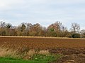
 Stubble field at Kelby - geograph.org.uk - 6311454.jpg 1,024 × 768; 213 KB
-
 Stubble field near Kelby - geograph.org.uk - 6311450.jpg 1,024 × 768; 181 KB
-
 The Dam at Culverthorpe - geograph.org.uk - 6311420.jpg 1,024 × 768; 251 KB
-
 Track up to North Hill - geograph.org.uk - 5001316.jpg 4,608 × 3,456; 3.42 MB
-
 View from near Mulberry House - geograph.org.uk - 5001296.jpg 4,608 × 3,456; 3.35 MB
-
 View towards Kelby Plantation - geograph.org.uk - 5304455.jpg 1,024 × 768; 152 KB
-
 Village phone box - geograph.org.uk - 6067842.jpg 6,032 × 4,014; 7.75 MB
-
 Wilsford Warren - geograph.org.uk - 2664285.jpg 640 × 427; 93 KB
-
 Wilsford Warren - geograph.org.uk - 2664508.jpg 640 × 427; 88 KB


