Category:Cumberland Crossing (Natural section)
Jump to navigation
Jump to search
The YMCA Pond is 810 feet (250 m) above sea level, while the surrounding walks and pavement is 820 feet (250 m) above sea level. The north 2/3rds of the pond is on 'Y' property. The southern third is part of the Urschel Development Corp. property.
| Object location | | View all coordinates using: OpenStreetMap |
|---|
Subcategories
This category has the following 16 subcategories, out of 16 total.
- Summer at Cumberland Crossing (33 F)
- Autumn at Cumberland Crossing (13 F)
- Winter at Cumberland Crossing (33 F)
*
A
B
- Beaver (Cumberland Crossing) (10 F)
C
E
- Egrets at Cumberland Crossing (33 F)
G
P
W
Media in category "Cumberland Crossing (Natural section)"
The following 14 files are in this category, out of 14 total.
-
 American robin (Turdus migratorius) 6198.jpg 4,608 × 3,456; 3.09 MB
-
 Bittern - Killeer - Bittern 6183.jpg 4,608 × 3,456; 6.19 MB
-
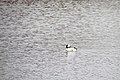 Bufflehead 0533.jpg 4,608 × 3,072; 5.03 MB
-
 Bufflehead and Canada Goose 0538.jpg 4,608 × 3,072; 3.92 MB
-
 Clear water 0988.jpg 4,608 × 3,072; 3.31 MB
-
 Clear water 0991.jpg 4,608 × 3,072; 3.71 MB
-
 Coopers Hawk 8885.jpg 4,608 × 3,456; 5.94 MB
-
 Coopers Hawk 8889.jpg 4,608 × 3,456; 6.23 MB
-
 Panorama Egret & Heron.jpg 12,176 × 3,157; 9.76 MB
-
 Panorama egret 6203.jpg 4,608 × 3,456; 5.77 MB
-
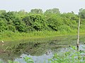
 Pond 4772.jpg 4,543 × 2,962; 2.42 MB
-
 Pond 4792.jpg 4,608 × 3,072; 4.86 MB
-
 Pond 4793.jpg 4,608 × 3,072; 3 MB
-
 Sunday Morning gathering.jpg 7,603 × 2,518; 3.98 MB
_6198.jpg)


