Category:Cumbria photographs taken on 2010-02-02
Jump to navigation
Jump to search
Subcategories
This category has only the following subcategory.
Media in category "Cumbria photographs taken on 2010-02-02"
The following 14 files are in this category, out of 14 total.
-
 Beckside from path to Crook End - geograph.org.uk - 1691389.jpg 640 × 426; 281 KB
-
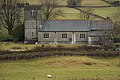
 Church Tower near Crook Hall - geograph.org.uk - 1691373.jpg 426 × 640; 250 KB
-
 Climbing to Lord's Lot - geograph.org.uk - 1691316.jpg 640 × 426; 296 KB
-
 Converted mill at Starnthwaite - geograph.org.uk - 1691280.jpg 640 × 426; 300 KB
-
 Farm track near Starnthwaite - geograph.org.uk - 1691262.jpg 640 × 426; 317 KB
-
 Farm tracks on Birkmoss Plantation - geograph.org.uk - 1691325.jpg 640 × 426; 334 KB
-
 Footpath near Birkmoss Plantation - geograph.org.uk - 1691323.jpg 640 × 426; 264 KB
-
 Footpath on Lord's Lot - geograph.org.uk - 1691311.jpg 640 × 426; 335 KB
-
 Footpath to High Leys - geograph.org.uk - 1691335.jpg 640 × 426; 271 KB
-
 Footpath to Lord's Lot - geograph.org.uk - 1691274.jpg 640 × 426; 344 KB
-
 Footpath to Milldam - geograph.org.uk - 1691295.jpg 640 × 426; 305 KB
-
 Ford on farm track below Lord's Lot - geograph.org.uk - 1691266.jpg 640 × 426; 329 KB
-
 Foxhole Bank - geograph.org.uk - 1691273.jpg 640 × 426; 291 KB
-
 St.Catherines Church Crook - geograph.org.uk - 1691390.jpg 640 × 426; 292 KB


