Category:Cundall
Jump to navigation
Jump to search
village in North Yorkshire, United Kingdom  | |||||
| Upload media | |||||
| Instance of | |||||
|---|---|---|---|---|---|
| Location | Cundall with Leckby, Harrogate, North Yorkshire, Yorkshire and the Humber, England | ||||
 | |||||
English: Cundall is a hamlet in the Harrogate district of North Yorkshire, England. It is one of the Thankful Villages that suffered no fatalities during the Great War of 1914 to 1918.
Media in category "Cundall"
The following 18 files are in this category, out of 18 total.
-
 Bat Bridge Cundall - geograph.org.uk - 320334.jpg 640 × 480; 123 KB
-
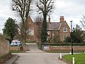
 Crossroads - Cundall village - geograph.org.uk - 320333.jpg 640 × 480; 127 KB
-
 Cundal Lodge Farm viewed from River Swale - geograph.org.uk - 789092.jpg 640 × 425; 107 KB
-
 Access Lane to Studforth Farm - geograph.org.uk - 391853.jpg 640 × 480; 110 KB
-
 Approaching Cundall - geograph.org.uk - 390160.jpg 640 × 480; 90 KB
-

-
 Farm buildings and dead crows. - geograph.org.uk - 545745.jpg 640 × 480; 62 KB
-
 Mucky track to Dent's Wood - geograph.org.uk - 320335.jpg 640 × 480; 139 KB
-
 St Mary and All Saints Church Cundall - geograph.org.uk - 320332.jpg 640 × 480; 89 KB
-
 St Peter's CE Primary School - geograph.org.uk - 357914.jpg 640 × 480; 108 KB
-
 Throstle Nest Farm - geograph.org.uk - 390624.jpg 640 × 480; 78 KB
-
 Track heading for Studforth Farm - geograph.org.uk - 391840.jpg 640 × 480; 82 KB
-
 Windmill Hill Cundall - geograph.org.uk - 320331.jpg 640 × 480; 96 KB
-
 Ewe Hole Lane - geograph.org.uk - 132856.jpg 640 × 425; 78 KB
-
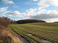
 Open Fields - geograph.org.uk - 132859.jpg 640 × 425; 73 KB
-
 Raskelf Road - geograph.org.uk - 257729.jpg 640 × 400; 67 KB
-
 River Swale from Thornton Bridge. - geograph.org.uk - 545748.jpg 640 × 480; 57 KB
-
 River Swale. - geograph.org.uk - 545749.jpg 640 × 480; 59 KB


