Category:Czorneboh
Jump to navigation
Jump to search
mountain  horská chata na vrcholu | |||||
| Upload media | |||||
| Instance of | |||||
|---|---|---|---|---|---|
| Part of | |||||
| Location | Bautzen District, Saxony, Germany | ||||
| Mountain range | |||||
| Elevation above sea level |
| ||||
| Different from | |||||
 | |||||
Subcategories
This category has the following 4 subcategories, out of 4 total.
C
- Czorneboh in Cunewalde (empty)
- Czorneboh in Hochkirch/Bukecy (31 F)
R
- Remote views of Czorneboh (33 F)
Media in category "Czorneboh"
The following 14 files are in this category, out of 14 total.
-
-
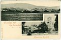
 13701-Großpostwitz-1911-Blick auf Großpostwitz-Brück & Sohn Kunstverlag.jpg 1,484 × 1,000; 683 KB
-
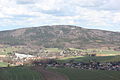
 25830-Czorneboh-1932-Czorneboh vom Mönchswalder Berg aus-Brück & Sohn Kunstverlag.jpg 1,000 × 1,528; 358 KB
-
 Bismarckdenkmal auf dem Czorneboh.png 537 × 748; 465 KB
-
 Běłobóh Čornobóh.JPG 2,100 × 1,400; 1.33 MB
-
 Czorneboh Opferbecken 101.JPG 3,888 × 2,592; 4.47 MB
-
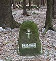 Denkestein.jpg 2,502 × 2,723; 1,002 KB
-
 Ente.jpg 600 × 450; 75 KB
-
 Fotothek df hauptkatalog 0009868 Cunewalde, Am Czorneboh.jpg 1,600 × 1,166; 1.04 MB
-
 Gastwirtschaft auf dem Czorneboh bei Bautzen.png 746 × 535; 435 KB
-
 Jakob-Böhme-Stein.jpg 2,174 × 1,839; 1.86 MB
-
 Reformationsstein.jpg 3,648 × 2,736; 6.13 MB
-

-
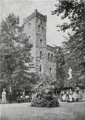 Turm auf dem Czorneboh..png 535 × 753; 433 KB


