Category:Dakota County, Minnesota
Vai alla navigazione
Vai alla ricerca
Counties of Minnesota: Aitkin · Anoka · Becker · Beltrami · Benton · Big Stone · Blue Earth · Brown · Carlton · Carver · Cass · Chippewa · Chisago · Clay · Clearwater · Cook · Cottonwood · Crow Wing · Dakota · Dodge · Douglas · Faribault · Fillmore · Freeborn · Goodhue · Grant · Hennepin · Houston · Hubbard · Isanti · Itasca · Jackson · Kanabec · Kandiyohi · Kittson · Koochiching · Lac qui Parle · Lake · Lake of the Woods · Le Sueur · Lincoln · Lyon · Mahnomen · Marshall · Martin · McLeod · Meeker · Mille Lacs · Morrison · Mower · Murray · Nicollet · Nobles · Norman · Olmsted · Otter Tail · Pennington · Pine · Pipestone · Polk · Pope · Ramsey · Red Lake · Redwood · Renville · Rice · Rock · Roseau · St. Louis · Scott · Sherburne · Sibley · Stearns · Steele · Stevens · Swift · Todd · Traverse · Wabasha · Wadena · Waseca · Washington · Watonwan · Wilkin · Winona · Wright · Yellow Medicine
English: Dakota County is the third most populous county in the U.S. state of Minnesota
contea statunitense del Minnesota   | |||||
| Carica un file multimediale | |||||
| Istanza di | |||||
|---|---|---|---|---|---|
| Prende il nome da | |||||
| Luogo | Minnesota, Stati Uniti d'America | ||||
| Capitale | |||||
| Data di fondazione o creazione |
| ||||
| Popolazione |
| ||||
| Superficie |
| ||||
| Distinto da | |||||
| sito web ufficiale | |||||
 | |||||
Sottocategorie
Questa categoria contiene le 15 sottocategorie indicate di seguito, su un totale di 15.
File nella categoria "Dakota County, Minnesota"
Questa categoria contiene 29 file, indicati di seguito, su un totale di 29.
-
 Antique Sun - panoramio.jpg 2 592 × 1 936; 1,98 MB
-
 Chargepoint Electric Vehicle (EV) Charging Station, Dakota County, Minnesota (41490006075).jpg 6 016 × 4 016; 11,38 MB
-
 Dakota Co Pie Chart No Text Version.pdf 1 650 × 1 275; 23 KB
-
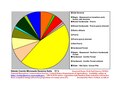 Dakota County Native Vegetation Pie Chart New Wiki Version.pdf 1 650 × 1 275; 24 KB
-
 DakotaCountyMn2022PopPyr.png 1 000 × 1 200; 96 KB
-

-
 Dryad's Saddle Pheasant's Back Mushroom (cerioporus squamosus) (41623969505).jpg 6 016 × 4 016; 10,81 MB
-
 E-85 (85% Ethanol) Gas Station Pump for Flex-Fuel E85 Vehicles (28822296738).jpg 4 032 × 3 024; 6,14 MB
-
 Farming Irrigation Watering System - Minnesota Farm (42696295311).jpg 5 210 × 3 014; 6,67 MB
-
 Goodtemplar.jpg 957 × 1 085; 297 KB
-
 Gyrfalcon (falco rusticolus) in flight.jpg 2 000 × 1 308; 1,04 MB
-
 History of Dakota and Goodhue counties, Minnesota - (IA historyofdakotag11curt).pdf 918 × 1 441, 718 pagine; 45,94 MB
-
 Inver Grove Heights in 1874.jpg 795 × 768; 137 KB
-
 Katadyn BeFree Water Filter Bottle, Hollow Fiber 0.1-micron filter (42646936672).jpg 5 115 × 3 415; 11,52 MB
-
 MeisvilleMNsigns2006.JPG 801 × 802; 353 KB
-

-
 Percheron head in Home Carriage Festival.jpg 3 872 × 2 592; 2,19 MB
-
 Plowing Percheron team.jpg 2 560 × 1 707; 1,13 MB
-
 Spiral Bridge - panoramio.jpg 2 048 × 1 536; 1,14 MB
-
 Spring Lake Park Reserve and Schaar's Bluff, Dakota County, Minnesota (47967382751).jpg 7 005 × 4 651; 40,7 MB
-
 St Joseph Church Miesville MN 1910.jpg 500 × 311; 33 KB
-
 St. Paul Park Refinery on the Mississippi River - Marathon Petro (42253422592).jpg 5 554 × 3 524; 8,01 MB
-
 Taraxacum dandelion seed head in grass (41977925894).jpg 6 016 × 4 016; 9,29 MB
-
 The Builder in 1,000 places (5583828412).jpg 1 024 × 696; 420 KB
-
 U.S. National Grid Emergency Location Sign, 15T VK 9354 4795 (42393097041).jpg 6 016 × 4 016; 11,19 MB
-
 U.S. National Grid Emergency Location Signage on Hike (28652664758).jpg 6 016 × 4 016; 14,87 MB
-
 UPtrain.jpg 1 024 × 693; 533 KB
-
 USA Dakota County, Minnesota age pyramid.svg 520 × 600; 9 KB
-
 Waterford Mill.jpg 800 × 486; 48 KB

_Charging_Station,_Dakota_County,_Minnesota_(41490006075).jpg)

_(14776624422).jpg)
_(41623969505).jpg)
_Gas_Station_Pump_for_Flex-Fuel_E85_Vehicles_(28822296738).jpg)
.jpg)

_in_flight.jpg)

.jpg)

.jpg)


.jpg)

.jpg)
.jpg)
.jpg)
.jpg)
.jpg)


