Category:Stearns County, Minnesota
Jump to navigation
Jump to search
Counties of Minnesota: Aitkin · Anoka · Becker · Beltrami · Benton · Big Stone · Blue Earth · Brown · Carlton · Carver · Cass · Chippewa · Chisago · Clay · Clearwater · Cook · Cottonwood · Crow Wing · Dakota · Dodge · Douglas · Faribault · Fillmore · Freeborn · Goodhue · Grant · Hennepin · Houston · Hubbard · Isanti · Itasca · Jackson · Kanabec · Kandiyohi · Kittson · Koochiching · Lac qui Parle · Lake · Lake of the Woods · Le Sueur · Lincoln · Lyon · Mahnomen · Marshall · Martin · McLeod · Meeker · Mille Lacs · Morrison · Mower · Murray · Nicollet · Nobles · Norman · Olmsted · Otter Tail · Pennington · Pine · Pipestone · Polk · Pope · Ramsey · Red Lake · Redwood · Renville · Rice · Rock · Roseau · St. Louis · Scott · Sherburne · Sibley · Stearns · Steele · Stevens · Swift · Todd · Traverse · Wabasha · Wadena · Waseca · Washington · Watonwan · Wilkin · Winona · Wright · Yellow Medicine
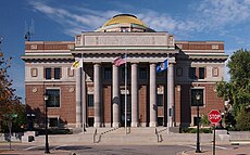
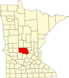
English: Stearns County is a county located in the U.S. state of Minnesota, founded in 1855. As of the 2010 census, the population was 150,642. Its county seat is Saint Cloud. It was named after Charles Thomas Stearns, a local politician.
county in Minnesota, United States | |||||
| Upload media | |||||
| Instance of | |||||
|---|---|---|---|---|---|
| Named after |
| ||||
| Location | Minnesota | ||||
| Capital | |||||
| Inception |
| ||||
| Population |
| ||||
| Area |
| ||||
| official website | |||||
 | |||||
Subcategories
This category has the following 14 subcategories, out of 14 total.
Media in category "Stearns County, Minnesota"
The following 19 files are in this category, out of 19 total.
-
History of Stearns County, Minnesota; volume 1.pdf 983 × 1,841, 928 pages; 23.4 MB
-
History of Stearns County, Minnesota; volume 2.pdf 1,106 × 1,625, 1,108 pages; 31.3 MB
-
MN-23 Exit 164.JPG 960 × 720; 171 KB
-
Roscoe 10-1.jpg 1,376 × 746; 637 KB
-
Sarah york.jpg 512 × 640; 101 KB
-
Steans Hall.jpg 3,024 × 4,032; 2.87 MB
-
Stearns Co Pie Chart No Text Version.pdf 1,650 × 1,275; 6 KB
-
Stearns County Native Vegetation Pie Chart New Wiki Version.pdf 1,650 × 1,275; 25 KB
-
Stearns County Native Vegetation Pie Chart.pdf 1,650 × 1,275; 33 KB
-
Sunset through the trees, July 2010 - panoramio.jpg 640 × 480; 282 KB
-
The field beyond the trees, looking southwest, July 2010 - panoramio.jpg 640 × 480; 308 KB
-
The trail heading east, July 2010 - panoramio.jpg 640 × 480; 273 KB
-
USA Stearns County, Minnesota age pyramid.svg 520 × 600; 9 KB
-
Viking Altar Rock closeup of hole.jpg 448 × 299; 54 KB
-
Week 1 columns.jpg 2,448 × 3,264; 1.42 MB
-
Week 3.jpg 1,632 × 1,224; 736 KB
-
Week 4.jpg 1,512 × 2,016; 1,010 KB
-
Week 5.jpg 1,632 × 1,224; 715 KB


