Category:Dam of Montsalvens
Jump to navigation
Jump to search
| Object location | | View all coordinates using: OpenStreetMap |
|---|
dam in Broc / Châtel-sur-Montsalvens in the Gruyère district in the canton of Fribourg, Switzerland  | |||||
| Upload media | |||||
| Instance of | |||||
|---|---|---|---|---|---|
| Location | Gruyère District, Canton of Fribourg, Switzerland | ||||
| Located in or next to body of water | |||||
| Street address |
| ||||
| Has use | |||||
| Owned by |
| ||||
| Has part(s) |
| ||||
| Date of official opening |
| ||||
| Length |
| ||||
| Height |
| ||||
| Drainage basin | |||||
| Reservoir created | |||||
 | |||||
Media in category "Dam of Montsalvens"
The following 29 files are in this category, out of 29 total.
-
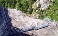
 Barrage Montsalvens 2010-08-21 14 32 16 PICT2813.JPG 2,272 × 1,704; 2.77 MB
-
 Barrage Montsalvens 2010-08-21 14 33 12 PICT2816.JPG 2,272 × 1,704; 2.6 MB
-
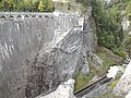
 Barrage Montsalvens 2010-08-21 14 35 39 PICT2818.JPG 2,272 × 1,404; 2.66 MB
-
 Barrage Montsalvens 2010-08-21 14 37 18 PICT2819.JPG 2,272 × 1,704; 2.18 MB
-
 Barrage Montsalvens 2010-08-21 16 16 18 PICT2842.JPG 2,272 × 1,704; 2.74 MB
-
 Barrage Montsalvens-2019-0.jpg 1,944 × 2,592; 1.64 MB
-
 Barrage Montsalvens-2019-1.jpg 2,592 × 1,944; 1.82 MB
-
 Barrage Montsalvens-2019-2.jpg 1,680 × 1,462; 952 KB
-
 Barrage Montsalvens-2019-3.jpg 2,577 × 1,299; 963 KB
-
 Barrage Montsalvens-2019-4.jpg 1,944 × 2,592; 2.2 MB
-
 Barrage Montsalvens-2019-5.jpg 2,592 × 1,944; 2.36 MB
-
 Barrage Montsalvens-2019-6.jpg 1,944 × 2,592; 2.54 MB
-
 Barrage Montsalvens-2019-7.jpg 1,944 × 2,592; 1.82 MB
-
 Barrage Montsalvens-2019-8.jpg 2,189 × 1,327; 988 KB
-
 Barrage Montsalvens-2019-9.jpg 2,592 × 1,944; 2.26 MB
-
 Charmey 07 2008 - panoramio.jpg 1,200 × 797; 809 KB
-
 ETH-BIB-Druckleitung Felsaustritt bei Broc-Dia 247-14066.tif 3,056 × 3,426; 10.13 MB
-
 ETH-BIB-Lac de Montsalvens (Gemeinde Broc), Staumauer-Inlandflüge-LBS MH03-1703.tif 6,208 × 4,379; 77.9 MB
-
 ETH-BIB-Lac de Montsalvens (Gemeinde Broc), Staumauer-Inlandflüge-LBS MH03-1738.tif 6,273 × 4,381; 78.76 MB
-
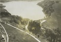
 ETH-BIB-Lac de Montsalvens Staumauer, von Süd-Südwest-Dia 247-14063.tif 3,600 × 2,739; 28.34 MB
-
 ETH-BIB-Lac de Montsalvens, Ausfluss, von Norden-Dia 247-13999.tif 3,668 × 2,854; 30.08 MB
-

-
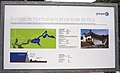
 Karte Lac de la Gruyère.png 885 × 892; 274 KB
-
 L d montsalvens.jpg 1,024 × 768; 137 KB
-
 Lac de Montsalvens Barrage 032.tiff 4,592 × 3,448; 45.31 MB
-
 Lac Montsalvens.jpg 2,272 × 1,704; 1.4 MB
-
 Montsalvens Bogenmauer.jpg 945 × 709; 501 KB
-
 Schwarzsee-Dam.jpg 3,807 × 2,120; 3.02 MB
-
 Vue panoramique du lac de Montsalvens - panoramio.jpg 11,888 × 2,953; 17.26 MB


