Category:De Krim (Overijssel)
Jump to navigation
Jump to search
| Object location | | View all coordinates using: OpenStreetMap |
|---|
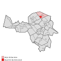
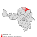
village in the municipality of Hardenberg , province of Overijssel, The Netherlands   | |||||
| Upload media | |||||
| Instance of |
| ||||
|---|---|---|---|---|---|
| Location | Hardenberg, Overijssel, Netherlands | ||||
 | |||||
Subcategories
This category has the following 3 subcategories, out of 3 total.
A
G
O
Media in category "De Krim (Overijssel)"
The following 60 files are in this category, out of 60 total.
-
 Map - NL - Hardenberg - Wijk 07 Slagharen - Buurt 03 De Krim.svg 375 × 375; 63 KB
-

-
 Map - NL - Hardenberg - Wijk 09 De Krim - Buurt 01 De Krim-Zuid.svg 375 × 375; 63 KB
-
-
 Map - NL - Hardenberg - Wijk 09 De Krim.svg 625 × 575; 24 KB
-
 Topografie De Krim 1914.jpg 1,156 × 696; 201 KB
-
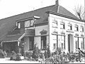
 Achtergevel - De Krim - 20048000 - RCE.jpg 1,200 × 953; 323 KB
-
 Dekrimkerk.jpg 1,600 × 1,200; 378 KB
-
 Huis met classicistische voorgevel - De Krim - 20047999 - RCE.jpg 1,200 × 963; 258 KB
-
 Interieur, aanzicht orgel - De Krim - 20349233 - RCE.jpg 1,191 × 1,200; 192 KB
-
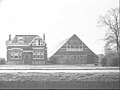
 Landgoed Grote Scheere 19 18 50 685000.jpeg 4,032 × 3,024; 3.5 MB
-
 Landgoed Grote Scheere 19 19 05 743000.jpeg 4,032 × 3,024; 4.1 MB
-
 Landgoed Grote Scheere 19 19 17 087000.jpeg 4,032 × 3,024; 3.85 MB
-
 Landgoed Grote Scheere 19 19 28 269000.jpeg 4,032 × 3,024; 5.45 MB
-
 Landgoed Grote Scheere 19 19 49 359000.jpeg 4,032 × 3,024; 5.64 MB
-
 Landgoed Grote Scheere 19 20 03 395000.jpeg 4,032 × 3,024; 2.72 MB
-
 Landgoed Grote Scheere.jpeg 4,032 × 3,024; 2.66 MB
-
 Molenstomp - De Krim - 20048001 - RCE.jpg 796 × 1,200; 149 KB
-
 Molenstomp - De Krim - 20048002 - RCE.jpg 1,200 × 789; 239 KB
-
 Overzicht noordwestgevel met buurpand - De Krim - 20350827 - RCE.jpg 1,182 × 1,200; 305 KB
-
 Voor- en zijgevel - De Krim - 20476541 - RCE.jpg 1,200 × 900; 167 KB
-
 Voor- en zijgevel - De Krim - 20476544 - RCE.jpg 1,200 × 900; 83 KB
-
 Voor- en zijgevel - De Krim - 20476550 - RCE.jpg 1,200 × 900; 133 KB
-
 Voor- en zijgevel - De Krim - 20476557 - RCE.jpg 1,200 × 900; 82 KB
-
 Voor- en zijgevel - De Krim - 20476563 - RCE.jpg 1,200 × 900; 158 KB
-
 Voor- en zijgevel - De Krim - 20476565 - RCE.jpg 1,200 × 900; 184 KB
-
 Voor- en zijgevel - De Krim - 20476569 - RCE.jpg 1,200 × 900; 131 KB
-
 Voor- en zijgevel - De Krim - 20476572 - RCE.jpg 1,200 × 900; 108 KB
-

-

-

-

-

-

-

-

-

-

-
 Voorgevel - De Krim - 20476538 - RCE.jpg 1,200 × 900; 105 KB
-
-
 Zij- en voorgevel - De Krim - 20476536 - RCE.jpg 1,200 × 900; 149 KB
-
 Zij- en voorgevel - De Krim - 20476546 - RCE.jpg 1,200 × 900; 141 KB
-
 Zij- en voorgevel - De Krim - 20476548 - RCE.jpg 1,200 × 900; 141 KB
-
 Zij- en voorgevel - De Krim - 20476554 - RCE.jpg 1,200 × 900; 126 KB
-
 Zij- en voorgevel - De Krim - 20476555 - RCE.jpg 1,200 × 900; 154 KB
-
 Zij- en voorgevel - De Krim - 20476562 - RCE.jpg 1,200 × 900; 130 KB
-
 Zij- en voorgevel - De Krim - 20476571 - RCE.jpg 1,200 × 900; 144 KB
-
 Zij- en voorgevel - De Krim - 20476577 - RCE.jpg 1,200 × 900; 92 KB
-

-
-

-

-

-

-

-

-

-
 Zij- en voorgevel nr. 2235 - De Krim - 20473920 - RCE.jpg 1,200 × 900; 145 KB
-
 Zij- en voorgevel Repro - De Krim - 20476551 - RCE.jpg 1,200 × 900; 135 KB
-
 Zijgevel - De Krim - 20476560 - RCE.jpg 1,200 × 900; 116 KB


_Lit.-_L._Koeten,_Dus_toch_groningers_%3F,_1984_-_De_Krim_-_20476552_-_RCE.jpg)


