Category:Maps of BAG woonplaatsen
Jump to navigation
Jump to search
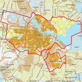
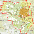
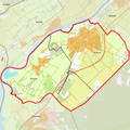
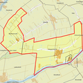
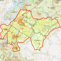
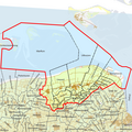
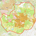
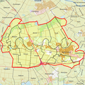
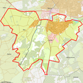
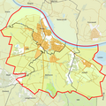
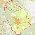
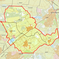
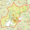
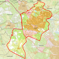
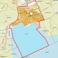
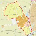
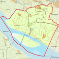
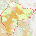
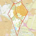
English: Every building (address) in the Netherlands has a registration into the Basisregistratie Adressen en Gebouwen (BAG). This category shows the boundaries of 'BAG woonplaatsen' per municipality (2012). In 2012, there existed 2504 woonplaatsen divided over 415 municipalities
officially designated place ("woonplaats") (city/town/village) in the Netherlands | |||||
| Upload media | |||||
| Subclass of |
| ||||
|---|---|---|---|---|---|
| Part of |
| ||||
| Location |
| ||||
| |||||
Pages in category "Maps of BAG woonplaatsen"
This category contains only the following page.
Media in category "Maps of BAG woonplaatsen"
The following 200 files are in this category, out of 417 total.
(previous page) (next page)-
 BAG woonplaatsen - Gemeente 's-Gravenhage.png 2,419 × 2,419; 1.22 MB
-
 BAG woonplaatsen - Gemeente 's-Hertogenbosch.png 2,419 × 2,419; 951 KB
-
 BAG woonplaatsen - Gemeente Aa en Hunze.png 2,419 × 2,419; 1.29 MB
-
 BAG woonplaatsen - Gemeente Aalburg.png 2,419 × 2,419; 482 KB
-
 BAG woonplaatsen - Gemeente Aalsmeer.png 2,419 × 2,419; 691 KB
-
 BAG woonplaatsen - Gemeente Aalten.png 2,419 × 2,419; 599 KB
-
 BAG woonplaatsen - Gemeente Achtkarspelen.png 2,419 × 2,419; 647 KB
-
 BAG woonplaatsen - Gemeente Alblasserdam.png 2,419 × 2,419; 437 KB
-
 BAG woonplaatsen - Gemeente Albrandswaard.png 2,419 × 2,419; 576 KB
-
 BAG woonplaatsen - Gemeente Alkmaar.png 2,419 × 2,419; 791 KB
-
 BAG woonplaatsen - Gemeente Almelo.png 2,419 × 2,419; 781 KB
-
 BAG woonplaatsen - Gemeente Almere.png 2,419 × 2,419; 876 KB
-
 BAG woonplaatsen - Gemeente Alphen aan den Rijn.png 2,419 × 2,419; 527 KB
-
 BAG woonplaatsen - Gemeente Alphen-Chaam.png 2,419 × 2,419; 859 KB
-
 BAG woonplaatsen - Gemeente Ameland.png 2,419 × 2,419; 571 KB
-
 BAG woonplaatsen - Gemeente Amersfoort.png 2,419 × 2,419; 797 KB
-
 BAG woonplaatsen - Gemeente Amstelveen.png 2,419 × 2,419; 699 KB
-
 BAG woonplaatsen - Gemeente Amsterdam.png 2,419 × 2,419; 1.43 MB
-
 BAG woonplaatsen - Gemeente Apeldoorn.png 2,419 × 2,419; 1 MB
-
 BAG woonplaatsen - Gemeente Appingedam.png 2,419 × 2,419; 286 KB
-
 BAG woonplaatsen - Gemeente Arnhem.png 2,419 × 2,419; 913 KB
-
 BAG woonplaatsen - Gemeente Assen.png 2,419 × 2,419; 870 KB
-
 BAG woonplaatsen - Gemeente Asten.png 2,419 × 2,419; 652 KB
-
 BAG woonplaatsen - Gemeente Baarle-Nassau.png 2,419 × 2,419; 596 KB
-
 BAG woonplaatsen - Gemeente Baarn.png 2,419 × 2,419; 573 KB
-
 BAG woonplaatsen - Gemeente Barendrecht.png 2,419 × 2,419; 492 KB
-
 BAG woonplaatsen - Gemeente Barneveld.png 2,419 × 2,419; 1.02 MB
-
 BAG woonplaatsen - Gemeente Bedum.png 2,419 × 2,419; 386 KB
-
 BAG woonplaatsen - Gemeente Beek.png 2,419 × 2,419; 552 KB
-
 BAG woonplaatsen - Gemeente Beemster.png 2,419 × 2,419; 548 KB
-
 BAG woonplaatsen - Gemeente Beesel.png 2,419 × 2,419; 461 KB
-
 BAG woonplaatsen - Gemeente Bellingwedde.png 2,419 × 2,419; 549 KB
-
 BAG woonplaatsen - Gemeente Bergambacht.png 2,419 × 2,419; 472 KB
-
 BAG woonplaatsen - Gemeente Bergeijk.png 2,419 × 2,419; 774 KB
-
 BAG woonplaatsen - Gemeente Bergen NH.png 1,890 × 1,890; 633 KB
-
 BAG woonplaatsen - Gemeente Bergen op Zoom.png 2,419 × 2,419; 676 KB
-
 BAG woonplaatsen - Gemeente Bergen.png 2,419 × 2,419; 925 KB
-
 BAG woonplaatsen - Gemeente Berkelland.png 2,419 × 2,419; 1.13 MB
-
 BAG woonplaatsen - Gemeente Bernheze.png 2,419 × 2,419; 726 KB
-
 BAG woonplaatsen - Gemeente Bernisse.png 2,419 × 2,419; 555 KB
-
 BAG woonplaatsen - Gemeente Best.png 2,419 × 2,419; 604 KB
-
 BAG woonplaatsen - Gemeente Beuningen.png 2,419 × 2,419; 640 KB
-
 BAG woonplaatsen - Gemeente Beverwijk.png 2,419 × 2,419; 689 KB
-
 BAG woonplaatsen - Gemeente Binnenmaas.png 2,419 × 2,419; 584 KB
-
 BAG woonplaatsen - Gemeente Bladel.png 2,419 × 2,419; 809 KB
-
 BAG woonplaatsen - Gemeente Blaricum.png 2,419 × 2,419; 505 KB
-
 BAG woonplaatsen - Gemeente Bloemendaal.png 2,419 × 2,419; 886 KB
-
 BAG woonplaatsen - Gemeente Boarnsterhim.png 2,419 × 2,419; 778 KB
-
 BAG woonplaatsen - Gemeente Bodegraven-Reeuwijk.png 2,419 × 2,419; 752 KB
-
 BAG woonplaatsen - Gemeente Boekel.png 2,419 × 2,419; 399 KB
-
 BAG woonplaatsen - Gemeente Borger-Odoorn.png 2,419 × 2,419; 980 KB
-
 BAG woonplaatsen - Gemeente Borne.png 2,419 × 2,419; 628 KB
-
 BAG woonplaatsen - Gemeente Borsele.png 2,419 × 2,419; 644 KB
-
 BAG woonplaatsen - Gemeente Boskoop.png 2,419 × 2,419; 301 KB
-
 BAG woonplaatsen - Gemeente Boxmeer.png 2,419 × 2,419; 1.03 MB
-
 BAG woonplaatsen - Gemeente Boxtel.png 2,419 × 2,419; 680 KB
-
 BAG woonplaatsen - Gemeente Breda.png 2,419 × 2,419; 1.01 MB
-
 BAG woonplaatsen - Gemeente Brielle.png 2,419 × 2,419; 654 KB
-
 BAG woonplaatsen - Gemeente Bronckhorst.png 2,419 × 2,419; 1.28 MB
-
 BAG woonplaatsen - Gemeente Brummen.png 2,419 × 2,419; 825 KB
-
 BAG woonplaatsen - Gemeente Brunssum.png 2,419 × 2,419; 482 KB
-
 BAG woonplaatsen - Gemeente Bunnik.png 2,419 × 2,419; 663 KB
-
 BAG woonplaatsen - Gemeente Bunschoten.png 2,419 × 2,419; 326 KB
-
 BAG woonplaatsen - Gemeente Buren.png 2,419 × 2,419; 1.25 MB
-
 BAG woonplaatsen - Gemeente Bussum.png 2,419 × 2,419; 426 KB
-
 BAG woonplaatsen - Gemeente Capelle aan den IJssel.png 2,419 × 2,419; 769 KB
-
 BAG woonplaatsen - Gemeente Castricum.png 2,419 × 2,419; 721 KB
-
 BAG woonplaatsen - Gemeente Coevorden.png 2,419 × 2,419; 1.28 MB
-
 BAG woonplaatsen - Gemeente Cranendonck.png 2,419 × 2,419; 758 KB
-
 BAG woonplaatsen - Gemeente Cromstrijen.png 2,419 × 2,419; 327 KB
-
 BAG woonplaatsen - Gemeente Cuijk.png 2,419 × 2,419; 680 KB
-
 BAG woonplaatsen - Gemeente Culemborg.png 2,419 × 2,419; 468 KB
-
 BAG woonplaatsen - Gemeente Dalfsen.png 2,419 × 2,419; 707 KB
-
 BAG woonplaatsen - Gemeente Dantumadiel.png 2,419 × 2,419; 641 KB
-
 BAG woonplaatsen - Gemeente De Bilt.png 2,419 × 2,419; 983 KB
-
 BAG woonplaatsen - Gemeente De Marne.png 2,419 × 2,419; 772 KB
-
 BAG woonplaatsen - Gemeente De Ronde Venen.png 2,419 × 2,419; 865 KB
-
 BAG woonplaatsen - Gemeente De Wolden.png 2,419 × 2,419; 868 KB
-
 BAG woonplaatsen - Gemeente Delft.png 2,419 × 2,419; 725 KB
-
 BAG woonplaatsen - Gemeente Delfzijl.png 2,419 × 2,419; 697 KB
-
 BAG woonplaatsen - Gemeente Den Helder.png 2,419 × 2,419; 468 KB
-
 BAG woonplaatsen - Gemeente Deurne.png 2,419 × 2,419; 862 KB
-
 BAG woonplaatsen - Gemeente Deventer.png 2,419 × 2,419; 1,023 KB
-
 BAG woonplaatsen - Gemeente Diemen.png 2,419 × 2,419; 618 KB
-
 BAG woonplaatsen - Gemeente Dinkelland.png 2,419 × 2,419; 1.2 MB
-
 BAG woonplaatsen - Gemeente Dirksland.png 2,419 × 2,419; 377 KB
-
 BAG woonplaatsen - Gemeente Doesburg.png 2,419 × 2,419; 351 KB
-
 BAG woonplaatsen - Gemeente Doetinchem.png 2,419 × 2,419; 1,020 KB
-
 BAG woonplaatsen - Gemeente Dongen.png 2,419 × 2,419; 375 KB
-
 BAG woonplaatsen - Gemeente Dongeradeel.png 2,419 × 2,419; 759 KB
-
 BAG woonplaatsen - Gemeente Dordrecht.png 2,419 × 2,419; 994 KB
-
 BAG woonplaatsen - Gemeente Drechterland.png 2,419 × 2,419; 415 KB
-
 BAG woonplaatsen - Gemeente Drimmelen.png 2,419 × 2,419; 706 KB
-
 BAG woonplaatsen - Gemeente Dronten.png 2,419 × 2,419; 924 KB
-
 BAG woonplaatsen - Gemeente Druten.png 2,419 × 2,419; 552 KB
-
 BAG woonplaatsen - Gemeente Duiven.png 2,419 × 2,419; 539 KB
-
 BAG woonplaatsen - Gemeente Echt-Susteren.png 2,419 × 2,419; 854 KB
-
 BAG woonplaatsen - Gemeente Edam-Volendam.png 2,419 × 2,419; 311 KB
-
 BAG woonplaatsen - Gemeente Ede.png 2,419 × 2,419; 1.27 MB
-
 BAG woonplaatsen - Gemeente Eemnes.png 2,419 × 2,419; 415 KB
-
 BAG woonplaatsen - Gemeente Eemsmond.png 2,419 × 2,419; 818 KB
-
 BAG woonplaatsen - Gemeente Eersel.png 2,419 × 2,419; 986 KB
-
 BAG woonplaatsen - Gemeente Eijsden-Margraten.png 2,419 × 2,419; 700 KB
-
 BAG woonplaatsen - Gemeente Eindhoven.png 2,419 × 2,419; 1,006 KB
-
 BAG woonplaatsen - Gemeente Elburg.png 2,419 × 2,419; 666 KB
-
 BAG woonplaatsen - Gemeente Emmen.png 2,419 × 2,419; 922 KB
-
 BAG woonplaatsen - Gemeente Enkhuizen.png 2,419 × 2,419; 291 KB
-
 BAG woonplaatsen - Gemeente Enschede.png 2,419 × 2,419; 1.02 MB
-
 BAG woonplaatsen - Gemeente Epe.png 2,419 × 2,419; 760 KB
-
 BAG woonplaatsen - Gemeente Ermelo.png 2,419 × 2,419; 713 KB
-
 BAG woonplaatsen - Gemeente Etten-Leur.png 2,419 × 2,419; 695 KB
-
 BAG woonplaatsen - Gemeente Ferweradiel.png 2,419 × 2,419; 513 KB
-
 BAG woonplaatsen - Gemeente Franekeradeel.png 2,419 × 2,419; 623 KB
-
 BAG woonplaatsen - Gemeente Gaasterlân-Sleat.png 2,419 × 2,419; 476 KB
-
 BAG woonplaatsen - Gemeente Geertruidenberg.png 2,419 × 2,419; 427 KB
-
 BAG woonplaatsen - Gemeente Geldermalsen.png 2,419 × 2,419; 781 KB
-
 BAG woonplaatsen - Gemeente Geldrop-Mierlo.png 2,419 × 2,419; 621 KB
-
 BAG woonplaatsen - Gemeente Gemert-Bakel.png 2,419 × 2,419; 682 KB
-
 BAG woonplaatsen - Gemeente Gennep.png 2,419 × 2,419; 658 KB
-
 BAG woonplaatsen - Gemeente Giessenlanden.png 2,419 × 2,419; 580 KB
-
 BAG woonplaatsen - Gemeente Gilze en Rijen.png 2,419 × 2,419; 653 KB
-
 BAG woonplaatsen - Gemeente Goedereede.png 2,419 × 2,419; 419 KB
-
 BAG woonplaatsen - Gemeente Goes.png 2,419 × 2,419; 701 KB
-
 BAG woonplaatsen - Gemeente Goirle.png 2,419 × 2,419; 537 KB
-
 BAG woonplaatsen - Gemeente Gorinchem.png 2,419 × 2,419; 501 KB
-
 BAG woonplaatsen - Gemeente Gouda.png 2,419 × 2,419; 532 KB
-
 BAG woonplaatsen - Gemeente Graafstroom.png 2,419 × 2,419; 766 KB
-
 BAG woonplaatsen - Gemeente Graft-De Rijp.png 2,419 × 2,419; 322 KB
-
 BAG woonplaatsen - Gemeente Grave.png 2,419 × 2,419; 497 KB
-
 BAG woonplaatsen - Gemeente Groesbeek.png 2,419 × 2,419; 597 KB
-
 BAG woonplaatsen - Gemeente Groningen.png 2,419 × 2,419; 770 KB
-
 BAG woonplaatsen - Gemeente Grootegast.png 2,419 × 2,419; 589 KB
-
 BAG woonplaatsen - Gemeente Gulpen-Wittem.png 2,419 × 2,419; 591 KB
-
 BAG woonplaatsen - Gemeente Haaksbergen.png 2,419 × 2,419; 986 KB
-
 BAG woonplaatsen - Gemeente Haaren.png 2,419 × 2,419; 705 KB
-
 BAG woonplaatsen - Gemeente Haarlem.png 2,419 × 2,419; 851 KB
-
 BAG woonplaatsen - Gemeente Haarlemmerliede c.a..png 2,419 × 2,419; 459 KB
-
 BAG woonplaatsen - Gemeente Haarlemmermeer.png 2,419 × 2,419; 1.22 MB
-
 BAG woonplaatsen - Gemeente Halderberge.png 2,419 × 2,419; 636 KB
-
 BAG woonplaatsen - Gemeente Hardenberg.png 2,419 × 2,419; 1.32 MB
-
 BAG woonplaatsen - Gemeente Harderwijk.png 2,419 × 2,419; 541 KB
-
 BAG woonplaatsen - Gemeente Hardinxveld-Giessendam.png 2,419 × 2,419; 393 KB
-
 BAG woonplaatsen - Gemeente Haren.png 2,419 × 2,419; 664 KB
-
 BAG woonplaatsen - Gemeente Harenkarspel.png 2,419 × 2,419; 513 KB
-
 BAG woonplaatsen - Gemeente Harlingen.png 2,419 × 2,419; 563 KB
-
 BAG woonplaatsen - Gemeente Hattem.png 2,419 × 2,419; 503 KB
-
 BAG woonplaatsen - Gemeente Heemskerk.png 2,419 × 2,419; 611 KB
-
 BAG woonplaatsen - Gemeente Heemstede.png 2,419 × 2,419; 474 KB
-
 BAG woonplaatsen - Gemeente Heerde.png 2,419 × 2,419; 646 KB
-
 BAG woonplaatsen - Gemeente Heerenveen.png 2,419 × 2,419; 1.09 MB
-
 BAG woonplaatsen - Gemeente Heerhugowaard.png 2,419 × 2,419; 655 KB
-
 BAG woonplaatsen - Gemeente Heerlen.png 2,419 × 2,419; 924 KB
-
 BAG woonplaatsen - Gemeente Heeze-Leende.png 2,419 × 2,419; 792 KB
-
 BAG woonplaatsen - Gemeente Heiloo.png 2,419 × 2,419; 436 KB
-
 BAG woonplaatsen - Gemeente Hellendoorn.png 2,419 × 2,419; 803 KB
-
 BAG woonplaatsen - Gemeente Hellevoetsluis.png 2,419 × 2,419; 510 KB
-
 BAG woonplaatsen - Gemeente Helmond.png 2,419 × 2,419; 757 KB
-
 BAG woonplaatsen - Gemeente Hendrik-Ido-Ambacht.png 2,419 × 2,419; 544 KB
-
 BAG woonplaatsen - Gemeente Hengelo.png 2,419 × 2,419; 1.01 MB
-
 BAG woonplaatsen - Gemeente het Bildt.png 2,419 × 2,419; 456 KB
-
 BAG woonplaatsen - Gemeente Heumen.png 2,419 × 2,419; 830 KB
-
 BAG woonplaatsen - Gemeente Heusden.png 2,419 × 2,419; 604 KB
-
 BAG woonplaatsen - Gemeente Hillegom.png 2,419 × 2,419; 424 KB
-
 BAG woonplaatsen - Gemeente Hilvarenbeek.png 2,419 × 2,419; 730 KB
-
 BAG woonplaatsen - Gemeente Hilversum.png 2,419 × 2,419; 1,018 KB
-
 BAG woonplaatsen - Gemeente Hof van Twente.png 2,419 × 2,419; 1.12 MB
-
 BAG woonplaatsen - Gemeente Hollands Kroon.png 2,419 × 2,419; 921 KB
-
 BAG woonplaatsen - Gemeente Hoogeveen.png 2,419 × 2,419; 734 KB
-
 BAG woonplaatsen - Gemeente Hoogezand-Sappemeer.png 2,419 × 2,419; 783 KB
-
 BAG woonplaatsen - Gemeente Hoorn.png 2,419 × 2,419; 512 KB
-
 BAG woonplaatsen - Gemeente Horst aan de Maas.png 2,419 × 2,419; 1.13 MB
-
 BAG woonplaatsen - Gemeente Houten.png 2,419 × 2,419; 621 KB
-
 BAG woonplaatsen - Gemeente Huizen.png 2,419 × 2,419; 508 KB
-
 BAG woonplaatsen - Gemeente Hulst.png 2,419 × 2,419; 600 KB
-
 BAG woonplaatsen - Gemeente IJsselstein.png 2,419 × 2,419; 402 KB
-
 BAG woonplaatsen - Gemeente Kaag en Braassem.png 2,419 × 2,419; 664 KB
-
 BAG woonplaatsen - Gemeente Kampen.png 2,419 × 2,419; 563 KB
-
 BAG woonplaatsen - Gemeente Kapelle.png 2,419 × 2,419; 530 KB
-
 BAG woonplaatsen - Gemeente Katwijk.png 2,419 × 2,419; 529 KB
-
 BAG woonplaatsen - Gemeente Kerkrade.png 2,419 × 2,419; 532 KB
-
 BAG woonplaatsen - Gemeente Koggenland.png 2,419 × 2,419; 577 KB
-
 BAG woonplaatsen - Gemeente Kollumerland c.a..png 2,419 × 2,419; 752 KB
-
 BAG woonplaatsen - Gemeente Korendijk.png 2,419 × 2,419; 426 KB
-
 BAG woonplaatsen - Gemeente Krimpen aan den IJssel.png 2,419 × 2,419; 736 KB
-
 BAG woonplaatsen - Gemeente Laarbeek.png 2,419 × 2,419; 612 KB
-
 BAG woonplaatsen - Gemeente Landerd.png 2,419 × 2,419; 802 KB
-
 BAG woonplaatsen - Gemeente Landgraaf.png 2,419 × 2,419; 532 KB
-
 BAG woonplaatsen - Gemeente Landsmeer.png 2,419 × 2,419; 517 KB
-
 BAG woonplaatsen - Gemeente Langedijk.png 2,419 × 2,419; 618 KB
-
 BAG woonplaatsen - Gemeente Lansingerland.png 2,419 × 2,419; 796 KB
-
 BAG woonplaatsen - Gemeente Laren.png 2,419 × 2,419; 536 KB
-
 BAG woonplaatsen - Gemeente Leek.png 2,419 × 2,419; 655 KB
-
 BAG woonplaatsen - Gemeente Leerdam.png 2,419 × 2,419; 454 KB
-
 BAG woonplaatsen - Gemeente Leeuwarden.png 2,419 × 2,419; 643 KB
-
 BAG woonplaatsen - Gemeente Leeuwarderadeel.png 2,419 × 2,419; 310 KB
-
 BAG woonplaatsen - Gemeente Leiden.png 2,419 × 2,419; 732 KB
-
 BAG woonplaatsen - Gemeente Leiderdorp.png 2,419 × 2,419; 501 KB
-
 BAG woonplaatsen - Gemeente Leidschendam-Voorburg.png 2,419 × 2,419; 969 KB
-
 BAG woonplaatsen - Gemeente Lelystad.png 2,419 × 2,419; 650 KB
-
 BAG woonplaatsen - Gemeente Lemsterland.png 2,419 × 2,419; 850 KB


