Category:De Arcade (Drunen)
Jump to navigation
Jump to search
| Camera location | | View all coordinates using: OpenStreetMap |
|---|
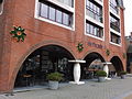
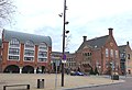
Nederlands: Afbeeldingen van De Arcade (Drunen) een bebouwing met onder andere diverse woningen, winkels en restaurants nabij het Raadhuisplein in het centrum van Drunen in de provincie Noord-Brabant in het zuiden van Nederland
Media in category "De Arcade (Drunen)"
The following 9 files are in this category, out of 9 total.
-
 Drunen - Raadhuisplein.jpg 2,528 × 1,850; 2.62 MB
-
 Drunen DSCF3316.JPG 2,511 × 1,851; 2.12 MB
-
 Drunen DSCF3317.JPG 2,816 × 2,112; 2.69 MB
-
 Drunen DSCF3321.JPG 2,816 × 2,112; 2.64 MB
-
 Drunen DSCF3323.JPG 2,816 × 2,112; 2.65 MB
-
 Drunen DSCF3325.JPG 2,816 × 2,112; 2.65 MB
-
 Drunen DSCF3326.JPG 2,816 × 2,112; 2.78 MB
-
 Drunen DSCF3335.JPG 2,816 × 2,112; 2.88 MB
-
 Drunen DSCF3338.JPG 2,569 × 1,750; 2.15 MB


