Category:De Blauwe Reiger
Jump to navigation
Jump to search
| Object location | | View all coordinates using: OpenStreetMap |
|---|
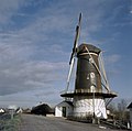
windmill in Haaften, Netherlands  | |||||
| Upload media | |||||
| Instance of | |||||
|---|---|---|---|---|---|
| Location | Haaften, Haaften | ||||
| Street address |
| ||||
| Located on street |
| ||||
| Has use | |||||
| Heritage designation |
| ||||
| Source of energy | |||||
 | |||||
|
This is a category about rijksmonument number 30346
|
| Address |
|
Media in category "De Blauwe Reiger"
The following 28 files are in this category, out of 28 total.
-
 Exterieur OVERZICHT - Haaften - 20287548 - RCE.jpg 1,193 × 1,200; 303 KB
-
 Exterieur OVERZICHT - Haaften - 20287549 - RCE.jpg 1,200 × 1,192; 331 KB
-
 Exterieur OVERZICHT ACHTERZIJDE - Haaften - 20287551 - RCE.jpg 1,200 × 1,172; 333 KB
-
 Exterieur OVERZICHT VOORZIJDE - Haaften - 20287550 - RCE.jpg 1,191 × 1,200; 322 KB
-
 Gevel - Haaften - 20095084 - RCE.jpg 1,186 × 1,200; 310 KB
-
 Haaften - molen De Blauwe Reiger.jpg 1,001 × 1,500; 852 KB
-
 Haaften De Blauwe Reiger.jpg 2,562 × 3,207; 2.94 MB
-
 Interieur nieuw bovenwiel korenmolen De Blauwe Reiger. - Haaften - 20095114 - RCE.jpg 1,188 × 1,200; 299 KB
-
 Korenmolen "De Blauwe Reiger" - Haaften - 20095115 - RCE.jpg 1,200 × 1,165; 251 KB
-
 Korenmolen "De Blauwe Reiger" - Haaften - 20095116 - RCE.jpg 1,200 × 1,176; 267 KB
-
 Korenmolen "De Blauwe Reiger" - Haaften - 20095117 - RCE.jpg 1,200 × 1,188; 231 KB
-
 Korenmolen "De Blauwe Reiger", interieur nieuw bovenwiel. - Haaften - 20095118 - RCE.jpg 1,200 × 1,200; 230 KB
-
 Korenmolen "De Blauwe Reiger", overzicht - Haaften - 20095113 - RCE.jpg 1,200 × 1,183; 272 KB
-
 Korenmolen - Haaften - 20095111 - RCE.jpg 1,200 × 1,195; 276 KB
-
 Korenmolen - Haaften - 20095112 - RCE.jpg 1,192 × 1,200; 236 KB
-
 Korenmolen aan de Waaldijk - Haaften - 20095108 - RCE.jpg 898 × 1,200; 183 KB
-
 Korenmolen De Blauwe Reiger, aanzicht - Haaften - 20095109 - RCE.jpg 1,200 × 1,186; 183 KB
-
 Korenmolen De Blauwe Reiger, aanzicht - Haaften - 20095110 - RCE.jpg 1,200 × 1,173; 198 KB
-
 Korenmolen, doorkijkje op stelling - Haaften - 20095107 - RCE.jpg 1,190 × 1,200; 269 KB
-
 Overzicht - Haaften - 20095044 - RCE.jpg 1,188 × 1,200; 337 KB
-
 Overzicht - Haaften - 20363217 - RCE.jpg 1,200 × 1,194; 177 KB
-

-

-

-

-

-

-
 Woonhuis bij ronde stenen stellingmolen - AMR Molenfoto - 20538737 - RCE.jpg 1,200 × 900; 147 KB


