Category:De Dageraad (Gouda)
Jump to navigation
Jump to search
| Object location | | View all coordinates using: OpenStreetMap |
|---|
Nederlands: De Dageraad (Gouda)
| Address |
|
 | |||||
| Upload media | |||||
| Instance of | |||||
|---|---|---|---|---|---|
| Location | Gouda, South Holland, Netherlands | ||||
| Inception |
| ||||
| Date of official opening |
| ||||
 | |||||
Media in category "De Dageraad (Gouda)"
The following 5 files are in this category, out of 5 total.
-
 20160207 De Dageraad binnenzijde Gouda.jpg 2,448 × 1,836; 1.56 MB
-
 20160207 De Dageraad buitenzijde Gouda.jpg 4,896 × 2,598; 2.02 MB
-
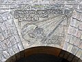
 20160207 De Dageraad toegangspoort Gouda.jpg 3,672 × 4,896; 3.31 MB
-
 20160207 Sluitsteen1 De Dageraad Gouda.jpg 4,896 × 3,672; 3.62 MB
-
 20160207 Sluitsteen2 De Dageraad Gouda.jpg 4,896 × 3,672; 3.23 MB


