Category:De Dog
Jump to navigation
Jump to search
| Object location | | View all coordinates using: OpenStreetMap |
|---|
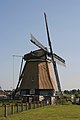
windmill in Uitgeest, Netherlands  | |||||
| Upload media | |||||
| Instance of |
| ||||
|---|---|---|---|---|---|
| Location | Uitgeest, North Holland, Netherlands | ||||
| Street address |
| ||||
| Located on street |
| ||||
| Has use |
| ||||
| Heritage designation |
| ||||
| Source of energy | |||||
 | |||||
|
This is a category about rijksmonument number 35854
|
| Address |
|
Media in category "De Dog"
The following 34 files are in this category, out of 34 total.
-

-

-
 De D.JPG 3,648 × 2,736; 1.43 MB
-

-

-
 De Dog te Uitgeest van opzij gefotografeerd - AMR Molenfoto - 20538961 - RCE.jpg 1,200 × 900; 103 KB
-
 De Dog te Uitgeest van opzij gefotografeerd - AMR Molenfoto - 20538964 - RCE.jpg 1,200 × 900; 164 KB
-
 De Dog te Uitgeest van opzij gefotografeerd - AMR Molenfoto - 20538965 - RCE.jpg 900 × 1,200; 180 KB
-

-
 Dutch traditional windmill with a typical Dutch sky - panoramio.jpg 4,928 × 3,264; 4.21 MB
-
 Exterieur OVERZICHT - Uitgeest - 20284863 - RCE.jpg 1,186 × 1,200; 219 KB
-
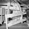
 Interieur van achtkante grondzeiler - AMR Molenfoto - 20538969 - RCE.jpg 900 × 1,200; 184 KB
-
 Interieur van achtkante grondzeiler - AMR Molenfoto - 20538970 - RCE.jpg 1,200 × 900; 186 KB
-
 Interieur van De Dog te Uitgeest - AMR Molenfoto - 20538971 - RCE.jpg 900 × 1,200; 171 KB
-
 Interieur van De Dog te Uitgeest - AMR Molenfoto - 20538972 - RCE.jpg 1,200 × 900; 191 KB
-
 Interieur van De Dog te Uitgeest - AMR Molenfoto - 20538973 - RCE.jpg 1,200 × 900; 197 KB
-
 INTERIEUR, AFSCHEIDING VAN HET BOVENWIEL - Uitgeest - 20283832 - RCE.jpg 1,190 × 1,200; 264 KB
-
 INTERIEUR, KAST ROND DE ONDERBONKELAAR - Uitgeest - 20283833 - RCE.jpg 1,193 × 1,200; 259 KB
-
 INTERIEUR, SCHERMHEK ROND DE BOVENBONKELAAR - Uitgeest - 20283834 - RCE.jpg 1,195 × 1,200; 294 KB
-
 Molen "De Dog" in Uitgeest.jpg 4,770 × 3,177; 4.24 MB
-
 Molen de Dog - panoramio.jpg 3,456 × 4,608; 5.38 MB
-
 Molen de dog in uitgeest tijdelijk zonder wieken.JPG 3,648 × 2,736; 1.45 MB
-
 Molens 'De Kat' en "De Dog" samen in Beeld in Uitgeest..jpg 4,770 × 3,177; 3.9 MB
-
 Overzicht - Uitgeest - 20364342 - RCE.jpg 1,193 × 1,200; 233 KB
-
 Uitgeest molen De Dog.jpg 1,400 × 2,100; 1.46 MB
-
 Watermolen "de Dog" in restauratie - Uitgeest - 20211117 - RCE.jpg 1,200 × 1,147; 186 KB
-
 Watermolen "de Dog" van de Castricummerpolder - Uitgeest - 20211114 - RCE.jpg 780 × 1,200; 107 KB
-
 Watermolen "de Dog" van de Castricummerpolder - Uitgeest - 20211115 - RCE.jpg 772 × 1,200; 115 KB
-

-
 Watermolen "De Dog", exterieur - Uitgeest - 20211127 - RCE.jpg 1,195 × 1,200; 201 KB
-
 Watermolen "De Dog", overzicht - Uitgeest - 20211138 - RCE.jpg 1,200 × 1,197; 214 KB
-

-

-
 Woonhuis bij De Dog te Uitgeest - AMR Molenfoto - 20538966 - RCE.jpg 1,200 × 900; 111 KB


