Category:De Eendragt, Weesp
Jump to navigation
Jump to search
| Object location | | View all coordinates using: OpenStreetMap |
|---|
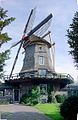
windmill in Weesp, Netherlands  | |||||
| Upload media | |||||
| Instance of | |||||
|---|---|---|---|---|---|
| Location | Weesp, Amsterdam, North Holland, Netherlands | ||||
| Street address |
| ||||
| Located on street |
| ||||
| Heritage designation |
| ||||
| Source of energy | |||||
 | |||||
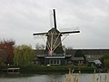
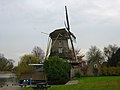
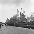
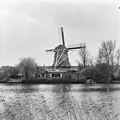
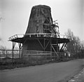
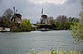
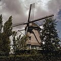
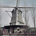
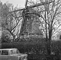
Nederlands: De Eendragt is een in 1691 als moutmolen gebouwde windmolen aan de Utrechtseweg 13, langs de Utrechtse Vecht in de Nederlandse gemeente Weesp.
|
This is a category about rijksmonument number 38659
|
| Address |
|
Media in category "De Eendragt, Weesp"
The following 41 files are in this category, out of 41 total.
-

-

-
-
-
-

-

-
 Houtzaagmolen "De Eendracht", aanzicht - Weesp - 20252699 - RCE.jpg 801 × 1,200; 262 KB
-

-
 Houtzaagmolen "De Eendracht", verbouwd tot woning - Weesp - 20252694 - RCE.jpg 1,200 × 954; 165 KB
-
 Houtzaagmolen "De Eendracht", verbouwd tot woning - Weesp - 20252695 - RCE.jpg 942 × 1,200; 166 KB
-
 Houtzaagmolen - Weesp - 20252692 - RCE.jpg 817 × 1,200; 134 KB
-

-
 Korenmolen De Eendracht - Weesp - 20252649 - RCE.jpg 1,200 × 1,200; 270 KB
-
 Korenmolen De Eendracht - Weesp - 20252650 - RCE.jpg 1,197 × 1,200; 306 KB
-
 Korenmolen, overzicht - Weesp - 20252662 - RCE.jpg 1,200 × 1,181; 187 KB
-
 Korenmolen, overzicht - Weesp - 20252663 - RCE.jpg 1,200 × 1,174; 192 KB
-
 Langs de Vecht - panoramio (1).jpg 4,928 × 3,264; 13.65 MB
-
 Langs de Vecht - panoramio (2).jpg 4,928 × 3,264; 22.14 MB
-
 Molen De Eendragt - panoramio.jpg 3,456 × 4,608; 5.57 MB
-
 Onderbouw van achtkante stellingmolen - AMR Molenfoto - 20539190 - RCE.jpg 1,200 × 900; 157 KB
-
 Onderbouw van achtkante stellingmolen - AMR Molenfoto - 20539191 - RCE.jpg 1,200 × 900; 196 KB
-
 Onderbouw van achtkante stellingmolen - AMR Molenfoto - 20539194 - RCE.jpg 1,200 × 900; 181 KB
-
 Onderbouw van achtkante stellingmolen - AMR Molenfoto - 20539195 - RCE.jpg 1,200 × 900; 154 KB
-
 Onderbouw van achtkante stellingmolen - AMR Molenfoto - 20539197 - RCE.jpg 1,200 × 900; 209 KB
-
 Onderbouw van achtkante stellingmolen - AMR Molenfoto - 20539198 - RCE.jpg 1,200 × 900; 210 KB
-
 Overzicht - Weesp - 20365747 - RCE.jpg 1,200 × 1,197; 457 KB
-
 Overzicht - Weesp - 20365755 - RCE.jpg 1,200 × 1,197; 333 KB
-
 Overzicht van de molen in verval - Weesp - 20369819 - RCE.jpg 1,200 × 1,200; 269 KB
-

-
 Voormalige Houtzaagmalen "De Eendracht" - Weesp - 20252651 - RCE.jpg 1,200 × 1,177; 374 KB
-
 Voormalige houtzaagmolen "De Eendracht" - Weesp - 20252701 - RCE.jpg 1,200 × 1,186; 323 KB
-
 Voormalige Houtzaagmolen "De Eendracht", aanzicht - Weesp - 20252696 - RCE.jpg 1,200 × 1,181; 236 KB
-
 Voormalige Houtzaagmolen "De Eendracht", aanzicht - Weesp - 20252697 - RCE.jpg 1,200 × 1,197; 362 KB
-
 Voormalige Houtzaagmolen De Eendracht - Weesp - 20252653 - RCE.jpg 1,200 × 1,181; 481 KB
-
 Weesp - Molen de Eendragt RM38659.JPG 3,456 × 4,150; 1.06 MB
-
 Weesp and Amsterdam (Netherland, June 2020) - 23 (50550749852).jpg 5,472 × 3,648; 20.84 MB
-
 Weesp molen De Eendragt.jpg 1,001 × 1,500; 805 KB
-
 Weesp, Netherlands - panoramio - Hermanus Es.jpg 732 × 1,125; 256 KB
-
 Weesp6019.jpg 500 × 365; 28 KB
-


.jpg)
.jpg)


_-_23_(50550749852).jpg)


