Category:De Geefhuisjes
Jump to navigation
Jump to search
| Object location | | View all coordinates using: OpenStreetMap |
|---|
hofje in The Hague .jpg) | |||||
| Upload media | |||||
| Instance of | |||||
|---|---|---|---|---|---|
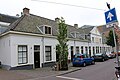
| Location | Centrum, The Hague, South Holland, Netherlands | ||||
| Street address |
| ||||
| Located on street |
| ||||
| Owned by | |||||
| Heritage designation |
| ||||
| Inception |
| ||||
| official website | |||||
 | |||||
|
This is a category about rijksmonument number 17537
|
| Address |
|
Media in category "De Geefhuisjes"
The following 5 files are in this category, out of 5 total.
-
 De Geefhuisjes 2012-09-15 12-29-08.jpg 2,310 × 442; 716 KB
-
 Geefhuisjes (1).jpg 5,184 × 3,456; 5.86 MB
-
 Geefhuisjes (2).jpg 5,184 × 3,456; 6.07 MB
-
 Geefhuisjes (3).jpg 5,184 × 3,456; 4.74 MB
-
 WLM - roel1943 - Heilige drievuldigheid of Geefhuisjes.jpg 1,280 × 960; 331 KB
.jpg)
.jpg)
