Category:De Hoop, Rha
Jump to navigation
Jump to search
| Object location | | View all coordinates using: OpenStreetMap |
|---|
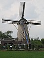
windmill in Rha, Netherlands  | |||||
| Upload media | |||||
| Instance of | |||||
|---|---|---|---|---|---|
| Location | Rha, Bronckhorst, Gelderland, Netherlands | ||||
| Street address |
| ||||
| Located on street |
| ||||
| Has use | |||||
| Heritage designation |
| ||||
| Source of energy | |||||
 | |||||
|
This is a category about rijksmonument number 34570
|
| Address |
|
Media in category "De Hoop, Rha"
The following 20 files are in this category, out of 20 total.
-
 De Hoop in Rha.jpg 1,536 × 2,048; 1.26 MB
-
 Interieur korte spruit met voegbouten - Rha - 20185747 - RCE.jpg 1,200 × 1,200; 306 KB
-
 Interieur kruivloer korenmolen "De Hoop" - Rha - 20185749 - RCE.jpg 1,188 × 1,200; 217 KB
-

-
 Interieur windpeluw, korenmolen De Hoop - Rha - 20185748 - RCE.jpg 1,200 × 1,198; 238 KB
-
 Korenmolen "De Hoop", exterieur gedeelte - Rha - 20185744 - RCE.jpg 1,200 × 1,200; 175 KB
-
 Korenmolen "De Hoop", exterieur overzicht - Rha - 20185743 - RCE.jpg 1,200 × 1,188; 209 KB
-
 Korenmolen "De Hoop", interieur korte spruit met voegbouten - Rha - 20185746 - RCE.jpg 1,200 × 1,200; 317 KB
-

-
 Korenmolen "De Hoop", interieur onderzijde kapzolder - Rha - 20185751 - RCE.jpg 1,200 × 1,200; 157 KB
-
 Korenmolen "De Hoop", overzicht, in verval. - Rha - 20185752 - RCE.jpg 1,200 × 1,200; 292 KB
-
 Korenmolen "De Hoop", overzicht, in verval. - Rha - 20185753 - RCE.jpg 1,200 × 1,200; 245 KB
-
 Korenmolen "De Hoop", overzicht, in verval. - Rha - 20185754 - RCE.jpg 1,200 × 1,200; 254 KB
-
 Korenmolen, overzicht - Rha - 20185742 - RCE.jpg 1,200 × 807; 153 KB
-
 Molen - Rha - 20185739 - RCE.jpg 782 × 1,200; 182 KB
-
 Molen - Rha - 20185740 - RCE.jpg 787 × 1,200; 130 KB
-
 Molen - Rha - 20185741 - RCE.jpg 797 × 1,200; 163 KB
-
 Molen te Rha "de Hoop" - Steenderen - 20205270 - RCE.jpg 801 × 1,200; 138 KB
-
 Overzicht - Rha - 20369823 - RCE.jpg 1,200 × 1,200; 169 KB
-
 Rha, beltmolen de Hoop foto1 2011-02-17 11.15.jpg 4,365 × 3,274; 7.38 MB


