Category:De Luynhorst, Greffelkamp
Jump to navigation
Jump to search
| Object location | | View all coordinates using: OpenStreetMap |
|---|
.JPG) | |||||
| Upload media | |||||
| Instance of | |||||
|---|---|---|---|---|---|
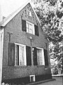
| Location | Didam, Montferland, Gelderland, Netherlands | ||||
| Street address |
| ||||
| Heritage designation |
| ||||
 | |||||
|
This is a category about rijksmonument number 12871
|
| Address |
|
Media in category "De Luynhorst, Greffelkamp"
The following 20 files are in this category, out of 20 total.
-
 Didam, De Luynhorst (1).JPG 3,072 × 2,304; 2.73 MB
-
 Didam, De Luynhorst (2).JPG 3,072 × 2,304; 2.59 MB
-
 Gevelsteen - Greffelkamp - 20494407 - RCE.jpg 639 × 900; 111 KB
-
 Luynhorsterweg 9, Greffelkamp, aanzicht - Didam - 20056872 - RCE.jpg 802 × 1,200; 198 KB
-
 Luynhorsterweg 9, Greffelkamp, aanzicht - Didam - 20056873 - RCE.jpg 1,200 × 800; 218 KB
-
 Luynhorststr. 9, aanzicht - Didam - 20056863 - RCE.jpg 1,200 × 1,179; 422 KB
-
 Luynhorststr. 9, aanzicht - Didam - 20056864 - RCE.jpg 1,200 × 1,191; 399 KB
-
 Luynhorststr. 9, aanzicht - Didam - 20056865 - RCE.jpg 1,200 × 1,175; 352 KB
-
 Luynhorststr. 9, exterieur aanzicht - Didam - 20056866 - RCE.jpg 1,200 × 1,188; 257 KB
-
 Topgevel woongedeelte - Greffelkamp - 20494415 - RCE.jpg 1,200 × 900; 246 KB
-
 Voor- en zijgevel dia 2053 - Greffelkamp - 20494409 - RCE.jpg 1,200 × 900; 182 KB
-
 Voorgevel - Greffelkamp - 20494413 - RCE.jpg 1,200 × 900; 228 KB
-
 Achter- en zijgevel - Greffelkamp - 20494406 - RCE.jpg 1,200 × 900; 176 KB
-
 Zij- en achtergevel - Greffelkamp - 20494410 - RCE.jpg 1,200 × 900; 185 KB
-
 Zij- en voorgevel - Greffelkamp - 20494411 - RCE.jpg 1,200 × 900; 226 KB
-
 Zijgevel - Greffelkamp - 20494405 - RCE.jpg 1,200 × 953; 142 KB
-
 Zijgevel - Greffelkamp - 20494412 - RCE.jpg 695 × 890; 104 KB
-
 Zijgevel - Greffelkamp - 20494414 - RCE.jpg 631 × 890; 118 KB
-
 Zijgevel woongedeelte - Greffelkamp - 20494404 - RCE.jpg 660 × 890; 121 KB
-
 Zijgevel woongedeelte - Greffelkamp - 20494408 - RCE.jpg 644 × 895; 143 KB
.JPG)


