Category:De Olifant, Burdaard
Jump to navigation
Jump to search
| Object location | | View all coordinates using: OpenStreetMap |
|---|
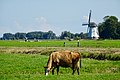
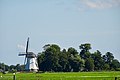
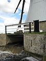
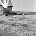
windmill in Birdaard, Netherlands  | |||||
| Upload media | |||||
| Instance of | |||||
|---|---|---|---|---|---|
| Location | Burdaard, Noardeast-Fryslân, Friesland, Netherlands | ||||
| Street address |
| ||||
| Located on street |
| ||||
| Has use |
| ||||
| Heritage designation |
| ||||
| Source of energy | |||||
 | |||||
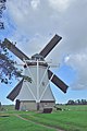
English: De Olifant (The Elephant), Burdaard, Friesland, the Netherlands
Frysk: De Oaljefant, Burdaard
Nederlands: De Olifant, Burdaard (Birdaard), Friesland
|
This is a category about rijksmonument number 11677
|
| Address |
|
Media in category "De Olifant, Burdaard"
The following 92 files are in this category, out of 92 total.
-
 20200902 molen de olifant1 Burdaard.jpg 5,184 × 3,456; 3.94 MB
-
 20200902 molen de olifant2 Burdaard.jpg 5,184 × 3,456; 2.98 MB
-
 20200902 molen de olifant3 Burdaard.jpg 5,184 × 3,456; 2.79 MB
-
 20200902 molen de olifant4 Burdaard.jpg 4,985 × 3,325; 2.89 MB
-
 Burdaard, De Oaljefant.jpg 2,670 × 1,777; 2.3 MB
-
 De Oaljefant, Burdaard.jpg 2,000 × 1,335; 1.39 MB
-
 De olifant engine mount.JPG 2,304 × 3,072; 3.28 MB
-
 De olifant ground floor.JPG 3,072 × 2,304; 4.37 MB
-
 De olifant inlet screw.JPG 3,072 × 2,304; 3.51 MB
-
 De olifant outlet.JPG 2,304 × 3,072; 3.06 MB
-
 De olifant spurwheel.JPG 2,304 × 3,072; 3.03 MB
-
 De olifant turning landscape.JPG 3,072 × 2,304; 3.24 MB
-
 De olifant turning portrait1.JPG 2,304 × 3,072; 3.05 MB
-
 De olifant turning portrait2.jpg 2,185 × 2,986; 655 KB
-
 Exterieur BEIDE VIJZELS MET KROOSHEKKEN - Birdaard - 20296513 - RCE.jpg 1,193 × 1,200; 301 KB
-
 Exterieur IN HET MIDDEN, UITSTROOM TWEE VIJZELS - Birdaard - 20296511 - RCE.jpg 1,200 × 1,200; 282 KB
-
 Exterieur OVERZICHT - Birdaard - 20296512 - RCE.jpg 1,200 × 1,188; 263 KB
-
 Exterieur OVERZICHT - Birdaard - 20296514 - RCE.jpg 1,200 × 1,191; 390 KB
-
 Interieur van poldermolen - AMR Molenfoto - 20538158 - RCE.jpg 1,200 × 900; 156 KB
-
 Interieur van poldermolen - AMR Molenfoto - 20538159 - RCE.jpg 1,200 × 900; 144 KB
-
 Interieur van poldermolen - AMR Molenfoto - 20538160 - RCE.jpg 1,200 × 900; 153 KB
-
 Interieur van poldermolen - AMR Molenfoto - 20538161 - RCE.jpg 1,200 × 900; 159 KB
-
 Molen "De Olifant", exterieur - Burdaard - 20035255 - RCE.jpg 1,193 × 1,200; 286 KB
-
 Molen "De Olifant", exterieur - Burdaard - 20035256 - RCE.jpg 1,184 × 1,200; 256 KB
-
 Molen "De Olifant", exterieur - Burdaard - 20035259 - RCE.jpg 1,188 × 1,200; 260 KB
-
 Molen de Olifant, Burdaard (1).jpg 3,438 × 5,152; 3.62 MB
-
 Molen de Olifant, Burdaard (2).jpg 3,796 × 5,789; 4.77 MB
-
 Molen de Olifant, Burdaard (3).jpg 3,930 × 5,888; 3.92 MB
-
 Molen de Olifant, Burdaard (4).jpg 4,175 × 6,256; 3.46 MB
-
 Molen de Olifant, Burdaard (5).jpg 6,256 × 4,175; 3.89 MB
-
 Molen de Olifant, Burdaard (6).jpg 6,624 × 4,421; 3.39 MB
-
 Molen de Olifant, Burdaard, aandrijving inmaalvijzel (1).jpg 5,568 × 3,728; 3.9 MB
-
 Molen de Olifant, Burdaard, aandrijving inmaalvijzel (4).jpg 5,152 × 3,438; 3.55 MB
-
 Molen de Olifant, Burdaard, aandrijving inmaalvijzel (5).jpg 4,416 × 2,947; 3.65 MB
-
 Molen de Olifant, Burdaard, aandrijving inmaalvijzel inmalen (1).jpg 4,784 × 3,193; 3.36 MB
-
 Molen de Olifant, Burdaard, aandrijving inmaalvijzel inmalen (2).jpg 4,784 × 3,193; 3.25 MB
-
 Molen de Olifant, Burdaard, aandrijving uitmaalvijzel (1).jpg 3,684 × 5,520; 3.88 MB
-
 Molen de Olifant, Burdaard, aandrijving uitmaalvijzel (10).jpg 5,651 × 3,681; 3.85 MB
-
 Molen de Olifant, Burdaard, aandrijving uitmaalvijzel (11).jpg 4,416 × 2,947; 3.65 MB
-
 Molen de Olifant, Burdaard, aandrijving uitmaalvijzel (12).jpg 4,416 × 2,947; 3.72 MB
-
 Molen de Olifant, Burdaard, aandrijving uitmaalvijzel (14).jpg 5,721 × 3,705; 3.94 MB
-
 Molen de Olifant, Burdaard, aandrijving uitmaalvijzel (16).jpg 5,152 × 3,438; 3.59 MB
-
 Molen de Olifant, Burdaard, aandrijving uitmaalvijzel (17).jpg 5,064 × 3,357; 3.79 MB
-
 Molen de Olifant, Burdaard, aandrijving uitmaalvijzel (2).jpg 3,857 × 5,755; 3.3 MB
-
 Molen de Olifant, Burdaard, aandrijving uitmaalvijzel (3).jpg 4,416 × 2,947; 4.14 MB
-
 Molen de Olifant, Burdaard, aandrijving uitmaalvijzel (4).jpg 4,416 × 2,947; 3.83 MB
-
 Molen de Olifant, Burdaard, aandrijving uitmaalvijzel (5).jpg 5,152 × 3,438; 3.63 MB
-
 Molen de Olifant, Burdaard, aandrijving uitmaalvijzel (6).jpg 5,152 × 3,438; 3.72 MB
-
 Molen de Olifant, Burdaard, aandrijving uitmaalvijzel (7).jpg 5,152 × 3,438; 3.33 MB
-
 Molen de Olifant, Burdaard, aandrijving uitmaalvijzel (8).jpg 2,947 × 4,416; 3.3 MB
-
 Molen de Olifant, Burdaard, aandrijving uitmaalvijzel (9).jpg 4,784 × 3,193; 3.7 MB
-
 Molen de Olifant, Burdaard, achtkant (1).jpg 4,048 × 2,702; 3.8 MB
-
 Molen de Olifant, Burdaard, achtkant (2).jpg 2,702 × 4,048; 3.82 MB
-
 Molen de Olifant, Burdaard, achtkant (3).jpg 2,947 × 4,416; 3.5 MB
-
 Molen de Olifant, Burdaard, bovenas bonkelaar.jpg 4,416 × 2,947; 3.76 MB
-
 Molen de Olifant, Burdaard, bovenas halslager (1).jpg 4,416 × 2,947; 3.92 MB
-
 Molen de Olifant, Burdaard, bovenas halslager (2).jpg 2,702 × 4,048; 3.6 MB
-
 Molen de Olifant, Burdaard, bovenas halslager (3).jpg 4,048 × 2,702; 3.55 MB
-
 Molen de Olifant, Burdaard, bovenas penlager.jpg 4,416 × 2,947; 3.92 MB
-
 Molen de Olifant, Burdaard, bovenwiel (1).jpg 4,416 × 2,947; 3.78 MB
-
 Molen de Olifant, Burdaard, bovenwiel (3).jpg 4,416 × 2,947; 3.64 MB
-
 Molen de Olifant, Burdaard, bovenwiel (4).jpg 4,416 × 2,947; 3.83 MB
-
 Molen de Olifant, Burdaard, bovenwiel achterkant rust.jpg 2,947 × 4,416; 3.79 MB
-
 Molen de Olifant, Burdaard, bovenwiel lendestut.jpg 2,947 × 4,416; 3.52 MB
-
 Molen de Olifant, Burdaard, bovenwiel pal.jpg 2,947 × 4,416; 3.53 MB
-
 Molen de Olifant, Burdaard, koningsspil.jpg 3,089 × 4,680; 3.65 MB
-
 Molen de Olifant, Burdaard, kruilier (1).jpg 5,641 × 3,673; 3.4 MB
-
 Molen de Olifant, Burdaard, kruilier (2).jpg 3,440 × 5,358; 3.82 MB
-
 Molen de Olifant, Burdaard, kruiwerk (1).jpg 4,048 × 2,702; 3.6 MB
-
 Molen de Olifant, Burdaard, kruiwerk (2).jpg 4,416 × 2,947; 3.36 MB
-
 Molen de Olifant, Burdaard, vang rust (1).jpg 2,947 × 4,416; 3.53 MB
-
 Molen de Olifant, Burdaard, vang rust rijklamp (1).jpg 2,947 × 4,416; 3.86 MB
-
 Molen de Olifant, Burdaard, vangbalk (1).jpg 2,947 × 4,416; 3.31 MB
-
 Molen de Olifant, Burdaard, vangbalk (2).jpg 4,416 × 2,947; 3.68 MB
-
 Molen de Olifant, Burdaard, vangbalk (3).jpg 4,416 × 2,947; 3.77 MB
-
 Molen de Olifant, Burdaard, voeghout linker.jpg 2,947 × 4,416; 3.51 MB
-
 Molen de Olifant, Burdaard, voeghout rechter (1).jpg 4,416 × 2,947; 3.82 MB
-
 Molen de Olifant, Burdaard, voeghout rechter (2).jpg 4,416 × 2,947; 3.63 MB
-
 Molen de Olifant, Burdaard, voorwaterloop.jpg 5,520 × 3,684; 3.49 MB
-
 Molendeolifant.jpg 1,944 × 2,592; 1.89 MB
-
 Onderzijde van poldermolen - AMR Molenfoto - 20538155 - RCE.jpg 1,200 × 900; 231 KB
-

-
 Poldermolen - AMR Molenfoto - 20538157 - RCE.jpg 900 × 1,200; 241 KB
-
 Poldermolen tekening A. Sipman 1949 - Roodkerk - 20190618 - RCE.jpg 1,200 × 848; 201 KB
-
 Poldermolen van achteren gefotografeerd - AMR Molenfoto - 20538156 - RCE.jpg 1,200 × 900; 233 KB
-
 Poldermolen van opzij gefotografeerd - AMR Molenfoto - 20538153 - RCE.jpg 1,200 × 900; 148 KB
-
 Poldermolen van opzij gefotografeerd - AMR Molenfoto - 20538154 - RCE.jpg 1,200 × 900; 186 KB
-
 Poldermolen van voren gefotografeerd - AMR Molenfoto - 20538152 - RCE.jpg 1,200 × 900; 119 KB
-
 Watermolen "De Olifant", aanzicht - Birdaard - 20035251 - RCE.jpg 788 × 1,200; 186 KB
-
 Watermolen "De Olifant", aanzicht - Birdaard - 20035252 - RCE.jpg 788 × 1,200; 172 KB
-
 Watermolen "De Olifant", interieur - Birdaard - 20035254 - RCE.jpg 1,200 × 787; 221 KB
-


.jpg)
.jpg)
.jpg)
.jpg)
.jpg)
.jpg)
.jpg)
.jpg)
.jpg)
.jpg)
.jpg)
.jpg)
.jpg)
.jpg)
.jpg)
.jpg)
.jpg)
.jpg)
.jpg)
.jpg)
.jpg)
.jpg)
.jpg)
.jpg)
.jpg)
.jpg)
.jpg)
.jpg)
.jpg)

.jpg)
.jpg)
.jpg)

.jpg)
.jpg)
.jpg)


.jpg)
.jpg)
.jpg)
.jpg)
.jpg)
.jpg)
.jpg)
.jpg)
.jpg)

.jpg)
.jpg)


