Category:De Os
Jump to navigation
Jump to search
| Object location | | View all coordinates using: OpenStreetMap |
|---|
windmill in Zaandam, Netherlands  | |||||
| Upload media | |||||
| Instance of | |||||
|---|---|---|---|---|---|
| Location | Zaandam, Zaanstad, North Holland, Netherlands | ||||
| Street address |
| ||||
| Located on street |
| ||||
| Has use | |||||
| Heritage designation |
| ||||
| Source of energy | |||||
 | |||||
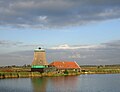
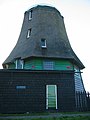
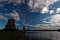
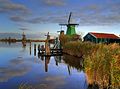
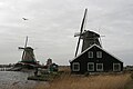
English: De Os was the oil windmill. The mill is in the Zaanse Schans, city Zaanstad. Actually the mill does not work.
Nederlands: De Os is een voormalige oliemolen aan de Kalverringdijk op de Zaanse Schans in de gemeente Zaanstad.
|
This is a category about rijksmonument number 40048
|
| Address |
|
Media in category "De Os"
The following 35 files are in this category, out of 35 total.
-
 Drie molens aan de Zaanse Schans - AMR Molenfoto - 20539390 - RCE.jpg 1,200 × 900; 177 KB
-
 Drie windmolens aan de Zaanse Schans - AMR Molenfoto - 20539391 - RCE.jpg 1,200 × 900; 121 KB
-
 Edam to Haarlem 4-22 (17398893879).jpg 5,472 × 3,648; 3.78 MB
-

-
 Molen "De Os", aanzicht - Zaandam - 20219060 - RCE.jpg 1,200 × 961; 169 KB
-
 Molen De Os met schuur aan de Zaanse Schans - Zaandam - 20365709 - RCE.jpg 1,196 × 1,200; 214 KB
-
 Molen de Os.JPG 1,600 × 1,225; 297 KB
-
 Molen Het Jonge Schaap en De Os maart 2011.jpg 2,448 × 3,264; 1.46 MB
-
 Molen Het Jonge Schaap en De Zoeker.jpg 3,214 × 2,387; 1.04 MB
-
 Molens op de Zaanse Schans.jpg 5,056 × 3,370; 3.55 MB
-
 Nizozemí - Zaanse Schans.jpg 1,680 × 1,260; 104 KB
-
 Oliemolen De Os - Zaandam - 20219065 - RCE.jpg 1,200 × 1,181; 253 KB
-
 Romp van achtkante oliemolen - AMR Molenfoto - 20539385 - RCE.jpg 900 × 1,200; 132 KB
-
 Romp van achtkante oliemolen - AMR Molenfoto - 20539386 - RCE.jpg 900 × 1,200; 229 KB
-
 Romp van achtkante oliemolen - AMR Molenfoto - 20539389 - RCE.jpg 900 × 1,200; 239 KB
-
 Romp van achtkante oliemolen met bijgebouw - AMR Molenfoto - 20539383 - RCE.jpg 1,200 × 900; 188 KB
-
 Romp van achtkante oliemolen met bijgebouw - AMR Molenfoto - 20539384 - RCE.jpg 1,200 × 900; 133 KB
-
 Romp van achtkante oliemolen met bijgebouw - AMR Molenfoto - 20539387 - RCE.jpg 900 × 1,200; 139 KB
-

-
 Schuur bij oliemolen - AMR Molenfoto - 20539388 - RCE.jpg 1,200 × 900; 242 KB
-
 Twee oliemolens aan de Zaanse Schans - AMR Molenfoto - 20539382 - RCE.jpg 1,200 × 900; 115 KB
-
 Zaandijk - Zaanse Schans - Kalverringdijk - View NNW on 'De Os' 1693.jpg 3,024 × 2,016; 2.43 MB
-

-
-
 Zaandijk - Zaanse Schans - Kalverringdijk - View SSE on 'De Os'.jpg 3,024 × 2,016; 3.3 MB
-
 Zaandijk - Zaanse Schans - Kalverringdijk - View WSW along 'De Os' towards Zaandijk.jpg 3,024 × 2,016; 2.12 MB
-

-
 Zaanse Schans - Molen De Os vanaf de Zaan 2012-09-30.JPG 1,200 × 800; 598 KB
-
 Zaanse Schans - panoramio - cisko66.jpg 3,645 × 2,701; 908 KB
-
 Zaanse Schans - Windmills 1.jpg 2,268 × 1,257; 456 KB
-
 Zaanse Schans molen De Os.jpg 1,400 × 2,100; 1.68 MB
-
 Zaanse Schans molens Het Jonge Schaap l en De Zoeker r.jpg 1,888 × 1,258; 1.17 MB
-
 Zaanse Schans Windmills.jpg 2,736 × 2,736; 1.86 MB
-

-
 Zaanse-Schans-dike-road-0270.jpg 2,560 × 1,920; 1.55 MB


.jpg)


_IMG_9853_2019-06-17_12.05.jpg)


_met_op_de_achteregrond_houtzaagmolen_Het_Jonge_Schaap,_voormalige_oliemolen_De_Os_en_oliemolen_De_Bonte_Hen_(RM506221)_IMG_9857_2019-06-17_12.22.jpg)
