Category:De Peilmolen, Oud-Alblas
Jump to navigation
Jump to search
| Object location | | View all coordinates using: OpenStreetMap |
|---|
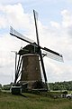
windmill in Oud-Alblas, Netherlands  | |||||
| Upload media | |||||
| Instance of |
| ||||
|---|---|---|---|---|---|
| Location | Oud-Alblas, Molenlanden, South Holland, Netherlands | ||||
| Street address |
| ||||
| Located on street |
| ||||
| Has use |
| ||||
| Heritage designation |
| ||||
| Source of energy | |||||
 | |||||
|
This is a category about rijksmonument number 31902
|
| Address |
|
Media in category "De Peilmolen, Oud-Alblas"
The following 21 files are in this category, out of 21 total.
-

-

-
 Exterieur OVERZICHT - Oud-Alblas - 20264658 - RCE.jpg 757 × 1,200; 145 KB
-
 Exterieur OVERZICHT - Oud-Alblas - 20264659 - RCE.jpg 782 × 1,200; 148 KB
-
 Exterieur STUKGEVROREN MUURWERK - Oud-Alblas - 20299564 - RCE.jpg 1,200 × 1,193; 342 KB
-
 Molen De Hoop, Oud-Alblas rechts, De Peilmolen links 29-09-2012.jpg 3,264 × 2,448; 1.37 MB
-
 Molen De Peilmolen 29-09-2012 (1).jpg 2,368 × 3,201; 1.16 MB
-
 Molen Wingerdse Molen tjasker, De Peilmolen (links), De Hoop (rechts) (1).jpg 2,448 × 3,264; 1.93 MB
-
 Molen Wingerdse Molen tjasker, De Peilmolen (links), De Hoop (rechts).jpg 3,214 × 2,377; 1.52 MB
-
 Oud Alblas - Peilmolen - panoramio - Rokus C (1).jpg 2,256 × 1,500; 262 KB
-
 Oud Alblas - Peilmolen - panoramio - Rokus C.jpg 1,500 × 2,256; 276 KB
-
 Oud Alblas - Peilmolen - panoramio.jpg 2,256 × 1,500; 303 KB
-
 Oud Alblas - peilmolen - panoramio.jpg 1,500 × 2,256; 274 KB
-
 Oud-Alblas - De Peilmolen ijzeren scheprad.jpg 2,100 × 1,400; 1.95 MB
-
 Oud-Alblas - De Peilmolen.jpg 1,401 × 2,100; 1.28 MB
-
 Oud-Alblas Peilmolen.jpg 3,456 × 4,608; 6.24 MB
-
 Overzicht van de molen - Oud-Alblas - 20421108 - RCE.jpg 1,200 × 800; 143 KB
-
 Peilmolen - Oud-Alblas - 20178139 - RCE.jpg 1,200 × 1,167; 280 KB
-

-

-


.jpg)
,_De_Hoop_(rechts)_(1).jpg)
,_De_Hoop_(rechts).jpg)
.jpg)


